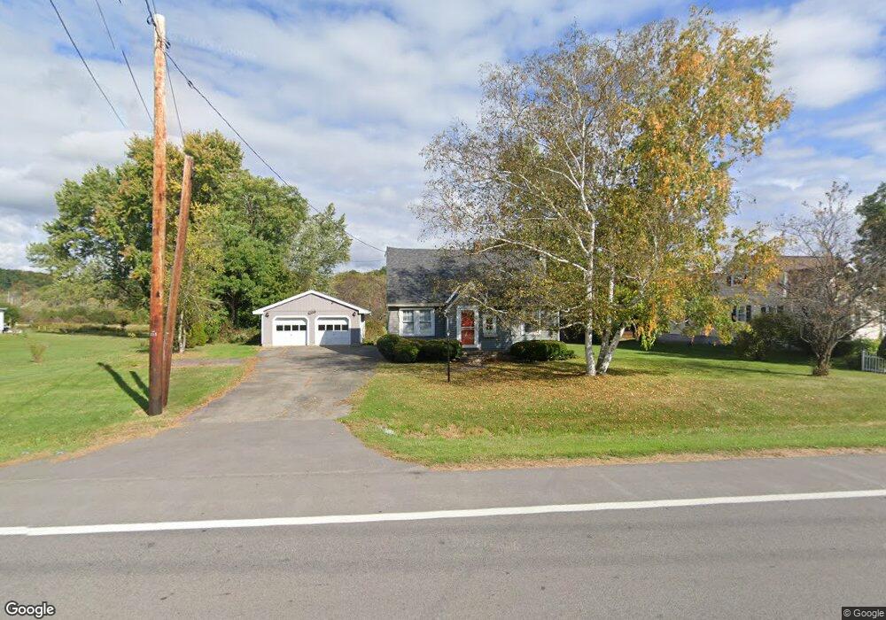
1707 State Highway 67 Johnstown, NY 12095
Estimated Value: $204,000 - $253,000
3
Beds
1
Bath
1,218
Sq Ft
$187/Sq Ft
Est. Value
About This Home
This home is located at 1707 State Highway 67, Johnstown, NY 12095 and is currently estimated at $228,227, approximately $187 per square foot. 1707 State Highway 67 is a home located in Fulton County with nearby schools including Pleasant Avenue School, Warren Street School, and Johnstown Senior High School.
Ownership History
Date
Name
Owned For
Owner Type
Purchase Details
Closed on
Jul 17, 2017
Sold by
Johnson Mark A
Bought by
Wasiczko Robert J
Current Estimated Value
Home Financials for this Owner
Home Financials are based on the most recent Mortgage that was taken out on this home.
Original Mortgage
$60,000
Outstanding Balance
$27,666
Interest Rate
3.91%
Mortgage Type
New Conventional
Estimated Equity
$200,561
Purchase Details
Closed on
Jul 1, 1999
Sold by
Raymond Johnson
Bought by
Marilyn Johnson
Create a Home Valuation Report for This Property
The Home Valuation Report is an in-depth analysis detailing your home's value as well as a comparison with similar homes in the area
Home Values in the Area
Average Home Value in this Area
Purchase History
| Date | Buyer | Sale Price | Title Company |
|---|---|---|---|
| Wasiczko Robert J | $120,000 | Jason A. Brott | |
| Marilyn Johnson | -- | -- |
Source: Public Records
Mortgage History
| Date | Status | Borrower | Loan Amount |
|---|---|---|---|
| Open | Wasiczko Robert J | $60,000 |
Source: Public Records
Tax History
| Year | Tax Paid | Tax Assessment Tax Assessment Total Assessment is a certain percentage of the fair market value that is determined by local assessors to be the total taxable value of land and additions on the property. | Land | Improvement |
|---|---|---|---|---|
| 2025 | $3,486 | $77,000 | $22,800 | $54,200 |
| 2024 | $3,858 | $77,000 | $22,800 | $54,200 |
| 2023 | $3,645 | $77,000 | $22,800 | $54,200 |
| 2022 | $3,674 | $77,000 | $22,800 | $54,200 |
| 2021 | $3,594 | $77,000 | $22,800 | $54,200 |
| 2020 | $3,485 | $77,000 | $22,800 | $54,200 |
| 2019 | $1,386 | $77,000 | $22,800 | $54,200 |
| 2018 | $3,127 | $77,000 | $22,800 | $54,200 |
| 2017 | $2,970 | $77,000 | $22,800 | $54,200 |
| 2016 | $1,418 | $77,000 | $22,800 | $54,200 |
| 2015 | -- | $77,000 | $22,800 | $54,200 |
| 2014 | -- | $77,000 | $22,800 | $54,200 |
Source: Public Records
Map
Nearby Homes
- 2 Killington Ln
- 10 Killington Ln
- 16 Breckenridge Dr
- 307 W Madison Ave Extension
- L18 County Highway 131a
- 400 S Melcher St
- 204 Wells St
- 800 S Melcher St
- 3309 State Highway 29
- 112 S Market St
- 10 Brant Rd
- 26 N Market St
- 312 S Perry St
- 601 S Perry St
- 12 Hoosac St
- L21 S Comrie South Ave
- 206 Glebe St
- 204 Glebe St
- 0 Opportunity Dr Unit LotWP001 20177825
- 0 Opportunity Dr Unit 11272075
- 1709 State Highway 67
- 1699 State Highway 67
- 1715 State Highway 67
- 5 Cutter Dr
- 7 Cutter Dr
- 1695 State Highway 67
- 3 Cutter Dr
- 0 State Highway 67 Unit 201223198
- 0 State Highway 67 Unit 27121879
- 0 State Highway 67
- 0 State Highway 67 Unit Parcel B 201916709
- 0 State Highway 67 Unit Parcel A 201916708
- 0 State Highway 67 Unit Parcel B 201816391
- 0 State Highway 67 Unit Parcel A 201816390
- 9 Cutter Dr
- 1 Cutter Dr
- 1719 State Highway 67
- E State Hwy 67 E
- E State Highway 67 E
- 1725 State Highway 67
Your Personal Tour Guide
Ask me questions while you tour the home.