1708 Neihardt St Branson, MO 65616
North Branson NeighborhoodEstimated Value: $236,000 - $334,000
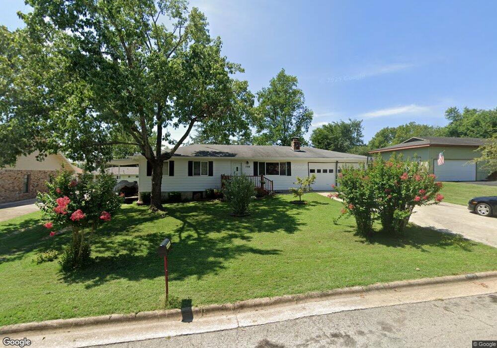
About This Home
This home is located at 1708 Neihardt St, Branson, MO 65616 and is currently estimated at $277,079, approximately $189 per square foot. 1708 Neihardt St is a home located in Taney County with nearby schools including Cedar Ridge Primary, Cedar Ridge Intermediate School, and Cedar Ridge Elementary School.
Ownership History
We collect this data history from publicly available records. To have your information removed, we recommend requesting removal directly through your county’s website.
Purchase Details
Purchase Details
Home Financials for this Owner
Home Financials are based on the most recent Mortgage that was taken out on this home.Home Values in the Area
Average Home Value in this Area
Purchase History
We collect this data history from publicly available records. To have your information removed, we recommend requesting removal directly through your county’s website.
| Date | Buyer | Sale Price | Title Company |
|---|---|---|---|
| -- | None Listed On Document | ||
| -- | Hogan Land Title |
Mortgage History
We collect this data history from publicly available records. To have your information removed, we recommend requesting removal directly through your county’s website.
| Date | Status | Borrower | Loan Amount |
|---|---|---|---|
| Previous Owner | $86,734 |
Tax History
We collect this data history from publicly available records. To have your information removed, we recommend requesting removal directly through your county’s website.
| Year | Tax Paid | Tax Assessment Tax Assessment Total Assessment is a certain percentage of the fair market value that is determined by local assessors to be the total taxable value of land and additions on the property. | Land | Improvement |
|---|---|---|---|---|
| 2025 | $736 | $11,860 | -- | -- |
| 2023 | $736 | $13,760 | $0 | $0 |
| 2022 | $715 | $13,760 | $0 | $0 |
| 2021 | $711 | $13,760 | $0 | $0 |
| 2019 | $668 | $12,390 | $0 | $0 |
| 2018 | $668 | $12,390 | $0 | $0 |
| 2017 | $564 | $10,560 | $0 | $0 |
| 2016 | $563 | $10,560 | $0 | $0 |
| 2015 | $558 | $10,560 | $0 | $0 |
| 2014 | $511 | $10,140 | $0 | $0 |
Map
- 33 Truman Dr
- 1650 Miller Dr
- Lot 22 Rose Oneill Dr
- Tbd Roark Valley Rd
- 1420 W 76 Country Blvd Unit 108
- 1420 W 76 Country Blvd Unit 110
- 1420 W 76 Country Blvd Unit 101
- 1420 W 76 Country Blvd Unit 114
- 1420 W 76 Country Blvd Unit 113
- 1420 W 76 Country Blvd Unit 105
- 1420 W 76 Country Blvd Unit 111
- 1420 W 76 Country Blvd Unit 112
- 1420 W 76 Country Blvd Unit 107
- 1420 W 76 Country Blvd Unit 102
- 1420 W 76 Country Blvd Unit 104
- 1420 W 76 Country Blvd Unit 103
- 1420 W 76 Country Blvd Unit 109
- 000 W St
- 250 Berry Dr Unit A7
- 1211 W 76 Country Blvd
- 1706 Neihardt St
- 1710 Neihardt St
- 1710 Neihardt Ave
- 111 Neihardt Ave
- Tbd Neihardt Ave
- 1709 Colonial Dr
- 1709 Colonial Dr Unit A & B
- 1704 Neihardt Ave
- 1707 Colonial Dr
- 1704 Neihardt St
- 1712 Neihardt St
- 1705 Neihardt Ave
- 1705 Neihardt St
- 1707 Neihardt St
- 1703 Colonial Dr
- 1711 Colonial Dr
- 1709 Neihardt Ave
- 301 Truman Dr
- 1702 Neihardt St
- 1714 Neihardt Ave
Ask me questions while you tour the home.