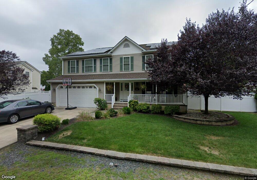
171 Brooklyn Ave Spotswood, NJ 08884
Estimated Value: $770,000 - $883,000
4
Beds
3
Baths
2,500
Sq Ft
$327/Sq Ft
Est. Value
About This Home
This home is located at 171 Brooklyn Ave, Spotswood, NJ 08884 and is currently estimated at $817,640, approximately $327 per square foot. 171 Brooklyn Ave is a home located in Middlesex County with nearby schools including G. Austin Schoenly Elementary School, E. Raymond Appleby Elementary School, and Spotswood Memorial School.
Ownership History
Date
Name
Owned For
Owner Type
Purchase Details
Closed on
Sep 23, 2011
Sold by
Dacosta John B and Dacosta Christina M
Bought by
Korneski Michael D and Korneski Jennifer L
Current Estimated Value
Home Financials for this Owner
Home Financials are based on the most recent Mortgage that was taken out on this home.
Original Mortgage
$280,000
Outstanding Balance
$190,732
Interest Rate
4.15%
Mortgage Type
New Conventional
Estimated Equity
$626,908
Purchase Details
Closed on
Jan 30, 2004
Sold by
Allen Michael T
Bought by
Da Costa John B and Da Costa Christina M
Home Financials for this Owner
Home Financials are based on the most recent Mortgage that was taken out on this home.
Original Mortgage
$245,000
Interest Rate
5.71%
Create a Home Valuation Report for This Property
The Home Valuation Report is an in-depth analysis detailing your home's value as well as a comparison with similar homes in the area
Home Values in the Area
Average Home Value in this Area
Purchase History
| Date | Buyer | Sale Price | Title Company |
|---|---|---|---|
| Korneski Michael D | $410,000 | None Available | |
| Korneski Michael D | $410,000 | None Available | |
| Da Costa John B | $385,000 | -- |
Source: Public Records
Mortgage History
| Date | Status | Borrower | Loan Amount |
|---|---|---|---|
| Open | Korneski Michael D | $280,000 | |
| Previous Owner | Da Costa John B | $245,000 |
Source: Public Records
Tax History
| Year | Tax Paid | Tax Assessment Tax Assessment Total Assessment is a certain percentage of the fair market value that is determined by local assessors to be the total taxable value of land and additions on the property. | Land | Improvement |
|---|---|---|---|---|
| 2025 | $13,268 | $364,400 | $130,000 | $234,400 |
| 2024 | $13,049 | $364,400 | $130,000 | $234,400 |
| 2023 | $13,049 | $364,400 | $130,000 | $234,400 |
| 2022 | $12,783 | $364,400 | $130,000 | $234,400 |
| 2021 | $12,681 | $364,400 | $130,000 | $234,400 |
| 2020 | $12,386 | $364,400 | $130,000 | $234,400 |
| 2019 | $12,102 | $364,400 | $130,000 | $234,400 |
| 2018 | $11,810 | $364,400 | $130,000 | $234,400 |
| 2017 | $11,603 | $364,400 | $130,000 | $234,400 |
| 2016 | $11,293 | $364,400 | $130,000 | $234,400 |
| 2015 | $10,779 | $364,400 | $130,000 | $234,400 |
| 2014 | $10,684 | $364,400 | $130,000 | $234,400 |
Source: Public Records
Map
Nearby Homes
- LOT18 Brooklyn Ave
- Lot19 Brooklyn Ave
- 29 Carol Ln
- 105 Snowhill St
- 4 North St
- 549 Main St
- 9 Parkside Dr
- 58 Manalapan Rd
- 321 Main St
- 290 Brunswick Ave
- 499 Old Stage Rd
- 289 Main St Unit 6E
- 289 Main St Unit 3C
- 289 Main St Unit 10F
- 34 Eisenhower Ave
- 13 Bosko Dr
- 43 John St
- 54 Red Bank Rd
- 2 W End Ave
- 12 Brookside Rd
- 5 New York Ave
- 163 Brooklyn Ave
- 150 Wyoming Ave
- 1 Brooklyn Ave Unit 7
- 0 Brooklyn Ave Unit 14 2205687R
- 6 Brooklyn Ave
- 0 Brooklyn Ave
- 1 Brooklyn Ave
- 176 Brooklyn Ave
- 7 Brooklyn Ave
- 14 Brooklyn Ave
- 68 Brooklyn Ave
- 67 Brooklyn Ave
- 148 Wyoming Ave
- 152 Wyoming Ave
- 170 Brooklyn Ave
- 192 Brooklyn Ave
- 18 New York Ave
- 0 Wyoming Ave
- 146 Wyoming Ave
Your Personal Tour Guide
Ask me questions while you tour the home.