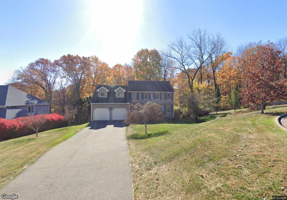
171 Streamside Ln New Britain, CT 06052
Estimated Value: $447,780 - $479,000
About This Home
This home is located at 171 Streamside Ln, New Britain, CT 06052 and is currently estimated at $467,445, approximately $201 per square foot. 171 Streamside Ln is a home located in Hartford County with nearby schools including Lincoln School, Slade Middle School, and Raymond Hill School.
Ownership History
We collect this data history from publicly available records. To have your information removed, we recommend requesting removal directly through your county’s website.
Purchase Details
Purchase Details
Purchase Details
Purchase Details
Purchase Details
Home Values in the Area
Average Home Value in this Area
Purchase History
We collect this data history from publicly available records. To have your information removed, we recommend requesting removal directly through your county’s website.
| Date | Buyer | Sale Price | Title Company |
|---|---|---|---|
| $285,000 | -- | ||
| $267,000 | -- | ||
| $172,000 | -- | ||
| $540,000 | -- | ||
| $225,000 | -- |
Mortgage History
We collect this data history from publicly available records. To have your information removed, we recommend requesting removal directly through your county’s website.
| Date | Status | Borrower | Loan Amount |
|---|---|---|---|
| Closed | $182,000 | ||
| Closed | $15,000 |
Tax History
We collect this data history from publicly available records. To have your information removed, we recommend requesting removal directly through your county’s website.
| Year | Tax Paid | Tax Assessment Tax Assessment Total Assessment is a certain percentage of the fair market value that is determined by local assessors to be the total taxable value of land and additions on the property. | Land | Improvement |
|---|---|---|---|---|
| 2025 | $8,985 | $229,320 | $60,480 | $168,840 |
| 2024 | $9,079 | $229,320 | $60,480 | $168,840 |
| 2023 | $8,778 | $229,320 | $60,480 | $168,840 |
| 2022 | $7,765 | $156,870 | $27,860 | $129,010 |
| 2021 | $7,765 | $156,870 | $27,860 | $129,010 |
| 2020 | $7,922 | $156,870 | $27,860 | $129,010 |
| 2019 | $7,922 | $156,870 | $27,860 | $129,010 |
| 2018 | $7,922 | $156,870 | $27,860 | $129,010 |
| 2017 | $8,477 | $167,860 | $28,350 | $139,510 |
| 2016 | $8,477 | $167,860 | $28,350 | $139,510 |
| 2015 | $8,225 | $167,860 | $28,350 | $139,510 |
| 2014 | $8,225 | $167,860 | $28,350 | $139,510 |
Map
- 58 Cedarwood Dr
- 61 Cedarwood Dr
- 207 Roslyn Dr
- 146 Victoria Rd
- 521 Shuttle Meadow Ave
- 68-70 Pennsylvania Ave
- 40 Ten Acre Rd
- 962 Corbin Ave
- 44 Steele St
- 30 W End Ave
- 510 Corbin Ave
- 156 Black Rock Ave
- 112 Lincoln St
- 16 Ardmore St
- 62 Chatham Rd
- 19 Homestead Ave
- 54 N Mountain Rd Unit 204
- 68 Cornwall Rd
- 7 Ledyard Rd
- 190 Hart St
- 181 Streamside Ln
- 151 Streamside Ln
- 9 Pond View Rd
- 8 Pond View Rd
- 184 Streamside Ln
- 141 Streamside Ln
- 144 Streamside Ln
- 18 Pond View Rd
- 19 Pond View Rd
- 28 Pond View Rd
- 128 Streamside Ln
- 121 Streamside Ln
- 114 Streamside Ln
- 111 Streamside Ln
- 104 Streamside Ln
- 110 Weigands Dr
- 42 Pond View Rd
- 10 Canal St
- 101 Streamside Ln
- 104 Weigands Dr
Ask me questions while you tour the home.