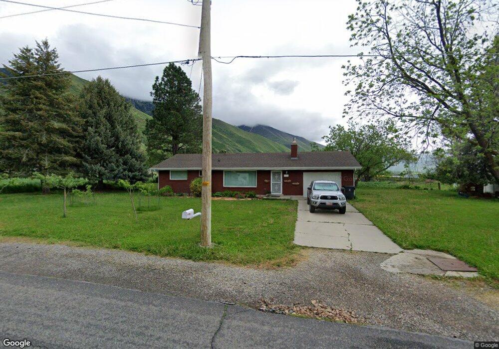
1710 E 400 N Mapleton, UT 84664
Estimated Value: $352,000
3
Beds
1
Bath
1,247
Sq Ft
$282/Sq Ft
Est. Value
About This Home
This home is located at 1710 E 400 N, Mapleton, UT 84664 and is currently priced at $352,000, approximately $282 per square foot. 1710 E 400 N is a home located in Utah County with nearby schools including Mapleton School, Mapleton Junior High School, and Maple Mountain High School.
Ownership History
Date
Name
Owned For
Owner Type
Purchase Details
Closed on
Nov 10, 2008
Sold by
Mitchell Jason J and Mitchell Carianne
Bought by
Hall Jordan M and Hall Julia
Current Estimated Value
Home Financials for this Owner
Home Financials are based on the most recent Mortgage that was taken out on this home.
Original Mortgage
$100,000
Interest Rate
6.07%
Mortgage Type
Purchase Money Mortgage
Purchase Details
Closed on
Sep 11, 2007
Sold by
Mitchell Jason J
Bought by
Mitchell Jason J and Mitchell Carianne
Home Financials for this Owner
Home Financials are based on the most recent Mortgage that was taken out on this home.
Original Mortgage
$198,000
Interest Rate
6.67%
Mortgage Type
Stand Alone Refi Refinance Of Original Loan
Purchase Details
Closed on
Mar 8, 1993
Sold by
Barker Afton S
Bought by
Barker Afton S
Create a Home Valuation Report for This Property
The Home Valuation Report is an in-depth analysis detailing your home's value as well as a comparison with similar homes in the area
Home Values in the Area
Average Home Value in this Area
Purchase History
| Date | Buyer | Sale Price | Title Company |
|---|---|---|---|
| Hall Jordan M | -- | Title West Spanish Fork O | |
| Mitchell Jason J | -- | Beehive Title Insurance Age | |
| Barker Afton S | -- | -- |
Source: Public Records
Mortgage History
| Date | Status | Borrower | Loan Amount |
|---|---|---|---|
| Closed | Hall Jordan M | $100,000 | |
| Previous Owner | Mitchell Jason J | $198,000 |
Source: Public Records
Tax History
| Year | Tax Paid | Tax Assessment Tax Assessment Total Assessment is a certain percentage of the fair market value that is determined by local assessors to be the total taxable value of land and additions on the property. | Land | Improvement |
|---|---|---|---|---|
| 2020 | $0 | $0 | $0 | $0 |
| 2019 | $1,662 | $245,600 | $120,800 | $124,800 |
| 2018 | $1,485 | $208,900 | $99,500 | $109,400 |
| 2017 | $1,356 | $101,255 | $0 | $0 |
| 2016 | $1,259 | $93,445 | $0 | $0 |
| 2015 | $1,124 | $82,885 | $0 | $0 |
| 2014 | $1,144 | $82,885 | $0 | $0 |
Source: Public Records
Map
Nearby Homes
- 630 N 1600 E
- 1515 E Maple St
- 702 N 2000 E Unit 305
- 764 N 2000 E
- 149 S Krissa St Unit 10
- 234 S Krissa St Unit 1
- 266 S Krissa St Unit 2
- 304 S Krissa St Unit 3
- 204 S Troy St
- 310 N 800 E
- 1377 E Maple St
- 162 N 800 E
- 1564 N 1700 East St
- 575 S 1560 E
- 1096 N 1000 E
- 775 N 800 E
- 745 E Maple St
- 1548 N 1350 St E Unit 11
- 1578 N 1350 St E Unit 12
- 4021 S Ironwood Ln Unit 428
Your Personal Tour Guide
Ask me questions while you tour the home.