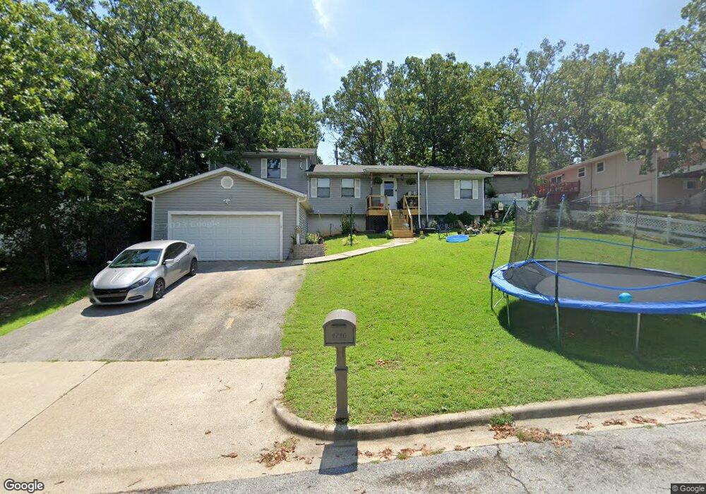
1710 Todd Dr Branson, MO 65616
North Branson NeighborhoodEstimated Value: $252,000 - $356,000
About This Home
This home is located at 1710 Todd Dr, Branson, MO 65616 and is currently estimated at $286,645, approximately $126 per square foot. 1710 Todd Dr is a home located in Taney County with nearby schools including Cedar Ridge Primary, Cedar Ridge Intermediate School, and Cedar Ridge Elementary School.
Ownership History
We collect this data history from publicly available records. To have your information removed, we recommend requesting removal directly through your county’s website.
Purchase Details
Purchase Details
Home Financials for this Owner
Home Financials are based on the most recent Mortgage that was taken out on this home.Home Values in the Area
Average Home Value in this Area
Purchase History
We collect this data history from publicly available records. To have your information removed, we recommend requesting removal directly through your county’s website.
| Date | Buyer | Sale Price | Title Company |
|---|---|---|---|
| -- | None Available | ||
| -- | -- |
Mortgage History
We collect this data history from publicly available records. To have your information removed, we recommend requesting removal directly through your county’s website.
| Date | Status | Borrower | Loan Amount |
|---|---|---|---|
| Previous Owner | $45,000 | ||
| Previous Owner | $100,000 |
Tax History
We collect this data history from publicly available records. To have your information removed, we recommend requesting removal directly through your county’s website.
| Year | Tax Paid | Tax Assessment Tax Assessment Total Assessment is a certain percentage of the fair market value that is determined by local assessors to be the total taxable value of land and additions on the property. | Land | Improvement |
|---|---|---|---|---|
| 2025 | $995 | $16,560 | ||
| 2023 | $995 | $18,610 | $0 | $0 |
| 2022 | $968 | $18,610 | $0 | $0 |
| 2021 | $961 | $18,610 | $0 | $0 |
| 2019 | $896 | $16,620 | $0 | $0 |
| 2018 | $896 | $16,620 | $0 | $0 |
| 2017 | $774 | $14,480 | $0 | $0 |
| 2016 | $772 | $14,480 | $0 | $0 |
| 2015 | $764 | $14,480 | $0 | $0 |
| 2014 | $698 | $13,870 | $0 | $0 |
Map
- 504 Truman Dr
- Tbd Roark Valley Rd
- 000 Roark Valley Rd
- 1650 Miller Dr
- Lot 22 Rose Oneill Dr
- 1704 Neihardt St
- 33 Truman Dr
- 135 Roark Hills Dr
- 000 Forsyth St Roark Valley Rd
- 000 Forsyth St Roark Valley Rd
- 000 W St
- 250 Berry Dr Unit A7
- 105 N Nettie St
- 1420 W 76 Country Blvd Unit 213
- 1420 W 76 Country Blvd Unit 108
- 1420 W 76 Country Blvd Unit 209
- 1420 W 76 Country Blvd Unit 110
- 1420 W 76 Country Blvd Unit 202
- 1420 W 76 Country Blvd Unit 203
- 1420 W 76 Country Blvd Unit 101
Ask me questions while you tour the home.