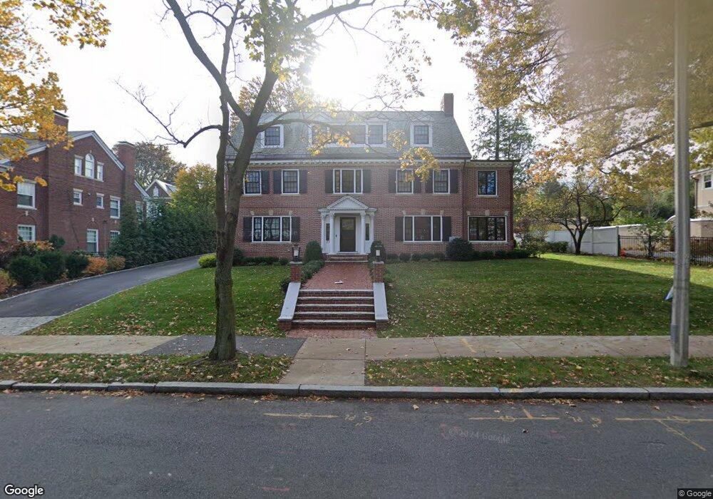
172 Dean Rd Brookline, MA 02445
Cleveland Circle NeighborhoodEstimated Value: $3,697,000 - $4,206,814
About This Home
This home is located at 172 Dean Rd, Brookline, MA 02445 and is currently estimated at $4,010,704, approximately $846 per square foot. 172 Dean Rd is a home located in Norfolk County with nearby schools including John D. Runkle School, Brookline High School, and Torah Academy.
Ownership History
We collect this data history from publicly available records. To have your information removed, we recommend requesting removal directly through your county’s website.
Purchase Details
Purchase Details
Home Financials for this Owner
Home Financials are based on the most recent Mortgage that was taken out on this home.Home Values in the Area
Average Home Value in this Area
Purchase History
We collect this data history from publicly available records. To have your information removed, we recommend requesting removal directly through your county’s website.
| Date | Buyer | Sale Price | Title Company |
|---|---|---|---|
| -- | -- | ||
| $2,300,000 | -- |
Mortgage History
We collect this data history from publicly available records. To have your information removed, we recommend requesting removal directly through your county’s website.
| Date | Status | Borrower | Loan Amount |
|---|---|---|---|
| Previous Owner | $1,840,000 |
Tax History
We collect this data history from publicly available records. To have your information removed, we recommend requesting removal directly through your county’s website.
| Year | Tax Paid | Tax Assessment Tax Assessment Total Assessment is a certain percentage of the fair market value that is determined by local assessors to be the total taxable value of land and additions on the property. | Land | Improvement |
|---|---|---|---|---|
| 2025 | $41,014 | $4,155,400 | $1,649,000 | $2,506,400 |
| 2024 | $39,215 | $4,013,800 | $1,585,500 | $2,428,300 |
| 2023 | $34,556 | $3,466,000 | $1,132,800 | $2,333,200 |
| 2022 | $33,636 | $3,300,900 | $1,078,800 | $2,222,100 |
| 2021 | $31,104 | $3,173,900 | $1,037,300 | $2,136,600 |
| 2020 | $28,862 | $3,054,200 | $943,000 | $2,111,200 |
| 2019 | $27,255 | $2,908,800 | $898,100 | $2,010,700 |
| 2018 | $27,075 | $2,862,100 | $910,900 | $1,951,200 |
| 2017 | $21,548 | $2,181,000 | $859,400 | $1,321,600 |
| 2016 | $21,240 | $2,038,400 | $803,100 | $1,235,300 |
| 2015 | $20,345 | $1,905,000 | $750,600 | $1,154,400 |
| 2014 | $20,508 | $1,800,500 | $682,400 | $1,118,100 |
Map
- 355 Buckminster Rd
- 540 Chestnut Hill Ave
- 55 Penniman Rd
- 278 Clinton Rd
- 33 Ackers Ave Unit 2
- 1895A Beacon St Unit 1895A
- 17 Chesham Rd
- 1896 Beacon St Unit 1
- 1896 Beacon St Unit 3
- 1880 Beacon St Unit 6
- 180 Eliot St
- 2400 Beacon St Unit 102
- 1834 Beacon St Unit 11
- 41 Orkney Rd
- 120 Seaver St Unit B204
- 374 Chestnut Hill Ave Unit 54
- 6 Sutherland Rd Unit 41
- 38 Englewood Ave Unit 1
- 52 Strathmore Rd Unit 44
- 370 Chestnut Hill Ave Unit 3
- 357 Buckminster Rd
- 184 Dean Rd
- 345 Buckminster Rd
- 511 Chestnut Hill Ave
- 511 Chestnut Hill Ave
- 505 Chestnut Hill Ave
- 364 Buckminster Rd
- 164 Dean Rd
- 348 Buckminster Rd
- 2 Willard Rd
- 185 Dean Rd
- 185 Dean Rd Unit 3
- 177 Dean Rd
- 198 Dean Rd
- 337 Buckminster Rd
- 199 Dean Rd
- 200 Fisher Ave
- 156 Dean Rd
- 212 Dean Rd
- 72 Penniman Place
Ask me questions while you tour the home.