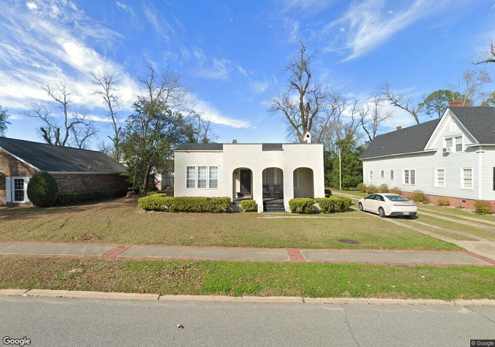
172 E Broad St Camilla, GA 31730
Estimated Value: $179,285 - $235,000
Studio
2
Baths
1,920
Sq Ft
$103/Sq Ft
Est. Value
About This Home
This home is located at 172 E Broad St, Camilla, GA 31730 and is currently estimated at $197,321, approximately $102 per square foot. 172 E Broad St is a home located in Mitchell County with nearby schools including Mitchell County Primary School, Mitchell County Elementary School, and Mitchell County Middle School.
Ownership History
Date
Name
Owned For
Owner Type
Purchase Details
Closed on
Jun 7, 2019
Sold by
Morgan Iii Properties Of Albany Llc
Bought by
Ventures Crenshaw Llc
Current Estimated Value
Purchase Details
Closed on
Feb 20, 2014
Sold by
Thrift Limited Partnership
Bought by
Morgan Iii Properties Of Alban
Create a Home Valuation Report for This Property
The Home Valuation Report is an in-depth analysis detailing your home's value as well as a comparison with similar homes in the area
Home Values in the Area
Average Home Value in this Area
Purchase History
| Date | Buyer | Sale Price | Title Company |
|---|---|---|---|
| Ventures Crenshaw Llc | $65,000 | -- | |
| Morgan Iii Properties Of Alban | $360,000 | -- |
Source: Public Records
Tax History
| Year | Tax Paid | Tax Assessment Tax Assessment Total Assessment is a certain percentage of the fair market value that is determined by local assessors to be the total taxable value of land and additions on the property. | Land | Improvement |
|---|---|---|---|---|
| 2025 | $2,422 | $61,760 | $2,000 | $59,760 |
| 2024 | $2,425 | $61,760 | $2,000 | $59,760 |
| 2023 | $2,596 | $61,760 | $2,000 | $59,760 |
| 2022 | $1,984 | $47,200 | $2,000 | $45,200 |
| 2021 | $1,764 | $41,960 | $2,000 | $39,960 |
| 2020 | $1,764 | $41,960 | $2,000 | $39,960 |
| 2019 | $1,698 | $40,560 | $2,000 | $38,560 |
| 2018 | $1,770 | $40,576 | $2,016 | $38,560 |
| 2017 | $1,849 | $42,783 | $2,016 | $40,767 |
| 2016 | $1,825 | $42,783 | $2,016 | $40,767 |
| 2015 | $1,825 | $42,783 | $2,016 | $40,767 |
| 2014 | $1,825 | $42,783 | $2,016 | $40,767 |
| 2013 | $1,825 | $42,783 | $2,016 | $40,767 |
Source: Public Records
Map
Nearby Homes
- 2 Swindle St
- 162 E Broad St
- 186 E Broad St
- 181 E Broad St
- 7709 Ga Hwy 112n
- 151 Oakland Ave
- 138 E Broad St
- 161 E Broad St Unit D2
- 161 E Broad St Unit B4
- 139 E Oakland Ave
- 135 E Broad St
- 2780 Hwy 37 E Pasture Acreage Only
- 2780 B Hwy 37 E Pasture Acreage Only
- 129 W Oakland Ave
- 119 E Oakland Ave
- 1801 Holt Quarter Rd
- 23 N Ellis St
- 5 U S 19
- 30 Railroad St
- 33 N Ellis St
Your Personal Tour Guide
Ask me questions while you tour the home.