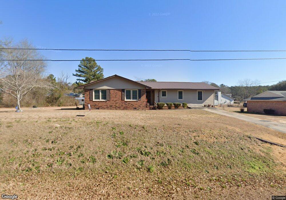
172 Westbrook Rd Gordon, GA 31031
Estimated Value: $194,000 - $288,000
3
Beds
2
Baths
2,615
Sq Ft
$93/Sq Ft
Est. Value
About This Home
This home is located at 172 Westbrook Rd, Gordon, GA 31031 and is currently estimated at $243,749, approximately $93 per square foot. 172 Westbrook Rd is a home located in Wilkinson County with nearby schools including Wilkinson County Primary School, Wilkinson County Elementary School, and Wilkinson County Middle School.
Ownership History
Date
Name
Owned For
Owner Type
Purchase Details
Closed on
Aug 24, 2016
Sold by
Natoshia L
Bought by
Burney Walker Eva Jewel
Current Estimated Value
Purchase Details
Closed on
Apr 11, 2011
Sold by
Burney Eva J
Bought by
Burney Natoshia L and Clark Beatrice
Purchase Details
Closed on
May 12, 1993
Bought by
Burney Eva J
Create a Home Valuation Report for This Property
The Home Valuation Report is an in-depth analysis detailing your home's value as well as a comparison with similar homes in the area
Purchase History
| Date | Buyer | Sale Price | Title Company |
|---|---|---|---|
| Burney Walker Eva Jewel | -- | -- | |
| Burney Natoshia L | -- | -- | |
| Burney Eva J | -- | -- |
Source: Public Records
Tax History
| Year | Tax Paid | Tax Assessment Tax Assessment Total Assessment is a certain percentage of the fair market value that is determined by local assessors to be the total taxable value of land and additions on the property. | Land | Improvement |
|---|---|---|---|---|
| 2025 | $2,568 | $77,215 | $1,672 | $75,543 |
| 2024 | $3,007 | $87,939 | $1,672 | $86,267 |
| 2023 | $723 | $31,003 | $2,176 | $28,827 |
| 2022 | $723 | $31,003 | $2,176 | $28,827 |
| 2021 | $732 | $31,003 | $2,176 | $28,827 |
| 2020 | $714 | $31,003 | $2,176 | $28,827 |
| 2019 | $1,300 | $31,003 | $2,176 | $28,827 |
| 2018 | $1,294 | $31,003 | $2,176 | $28,827 |
| 2017 | $1,138 | $31,003 | $2,176 | $28,827 |
| 2016 | $1,138 | $31,003 | $2,176 | $28,827 |
| 2015 | $1,142 | $31,003 | $2,176 | $28,827 |
| 2014 | $1,142 | $31,004 | $2,176 | $28,827 |
| 2013 | $1,142 | $31,003 | $2,176 | $28,827 |
Source: Public Records
Map
Nearby Homes
- 108 Sitton Ave
- 193 Elam St
- 0 Ballpark Rd
- 114 Hardie St
- 0 Shinholster St
- 160 College St
- 180 N Main St
- 152 Main St
- 121 Elm St
- 189 Pine St
- 0 Dennard Hardy Rd Unit 10460790
- 106 Sarah Kate Way
- 0 Highway 57 Unit 261084
- 116 Tasha Rd
- 110 Briarcliff Trail
- 140 Chickasaw Dr
- 193 Griswoldville Shortcut
- 0 Lavender Rd
- 2140 Nesmith Rd
- 9532 Old Gordon Rd
- 170 Westbrook Rd
- 174 Westbrook Rd
- 277 Gray Hwy
- 279 Gray Hwy
- 275 Gray Hwy
- 168 Westbrook Rd
- 173 Westbrook Rd
- 171 Westbrook Rd
- 166 Westbrook Rd
- 273 Gray Hwy
- 281 Gray Hwy
- 177 Westbrook Rd
- 100 Mathis St
- 271 Gray Hwy
- 178 Westbrook Rd
- 301 Gray Hwy
- 280 Gray Hwy
- 180 Westbrook Rd
- 162 Westbrook Rd
- 179 Westbrook Rd
Your Personal Tour Guide
Ask me questions while you tour the home.