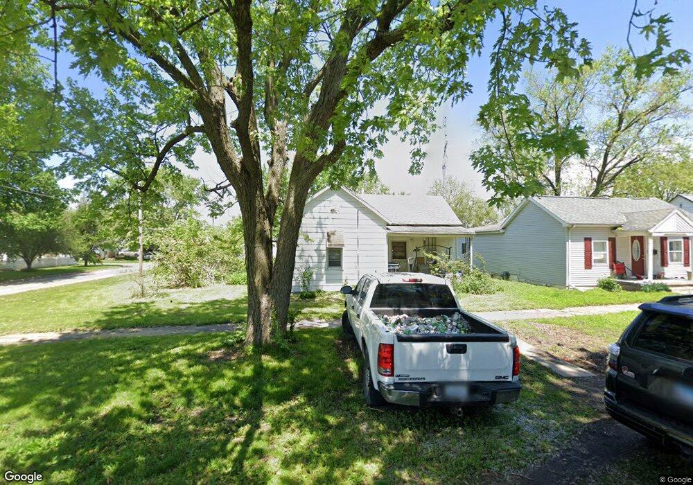
1720 Moultrie Ave Mattoon, IL 61938
Estimated Value: $86,670 - $112,000
3
Beds
1
Bath
1,310
Sq Ft
$74/Sq Ft
Est. Value
About This Home
This home is located at 1720 Moultrie Ave, Mattoon, IL 61938 and is currently estimated at $96,918, approximately $73 per square foot. 1720 Moultrie Ave is a home located in Coles County with nearby schools including Mattoon High School, St Mary School, and St. John's Lutheran School.
Ownership History
Date
Name
Owned For
Owner Type
Purchase Details
Closed on
Jan 28, 2016
Sold by
Witt Family Living Trust
Bought by
Bedsole Benjamin C and Bedsole Christina E
Current Estimated Value
Home Financials for this Owner
Home Financials are based on the most recent Mortgage that was taken out on this home.
Original Mortgage
$42,200
Outstanding Balance
$33,685
Interest Rate
3.99%
Mortgage Type
FHA
Estimated Equity
$63,233
Create a Home Valuation Report for This Property
The Home Valuation Report is an in-depth analysis detailing your home's value as well as a comparison with similar homes in the area
Home Values in the Area
Average Home Value in this Area
Purchase History
We collect this data history from publicly available records. To have your information removed, we recommend requesting removal directly through your county’s website.
| Date | Buyer | Sale Price | Title Company |
|---|---|---|---|
| Bedsole Benjamin C | -- | -- |
Source: Public Records
Mortgage History
We collect this data history from publicly available records. To have your information removed, we recommend requesting removal directly through your county’s website.
| Date | Status | Borrower | Loan Amount |
|---|---|---|---|
| Open | Bedsole Benjamin C | $42,200 |
Source: Public Records
Tax History
| Year | Tax Paid | Tax Assessment Tax Assessment Total Assessment is a certain percentage of the fair market value that is determined by local assessors to be the total taxable value of land and additions on the property. | Land | Improvement |
|---|---|---|---|---|
| 2024 | $1,950 | $22,950 | $4,641 | $18,309 |
| 2023 | $1,762 | $20,491 | $4,144 | $16,347 |
| 2022 | $1,762 | $20,153 | $4,076 | $16,077 |
| 2021 | $1,767 | $18,511 | $3,744 | $14,767 |
| 2020 | $1,748 | $19,179 | $3,879 | $15,300 |
| 2019 | $1,721 | $18,511 | $3,744 | $14,767 |
| 2018 | $1,690 | $18,511 | $3,744 | $14,767 |
| 2017 | $1,685 | $18,511 | $3,744 | $14,767 |
| 2016 | $1,649 | $18,511 | $3,744 | $14,767 |
| 2015 | $128 | $18,511 | $3,744 | $14,767 |
| 2014 | $128 | $18,511 | $3,744 | $14,767 |
| 2013 | $128 | $18,511 | $3,744 | $14,767 |
Source: Public Records
Map
Nearby Homes
- 421 N 21st St
- 909 N 20th St
- 1205 Champaign Ave
- 2413 Moultrie Ave
- 2512 Dewitt Ave
- 2400 Western Ave
- 1617 Lafayette Ave
- 113 S 25th St
- 1509 Lafayette Ave
- 2301 Charleston Ave
- 2617 Richmond Ave
- 2516 Pine Ave
- 1621 Edgar Ave
- 1301 Lafayette Ave
- 812 N 8th St Unit 36
- 1312 Edgar Ave
- 1101 Wabash Ave
- 511 Broadway Ave Unit 101
- 609 Wabash Ave
- 3121 Champaign Ave
- 1716 Moultrie Ave
- 1712 Moultrie Ave
- 1800 Moultrie Ave
- 1708 Moultrie Ave
- 1721 Dewitt Ave
- 1717 Dewitt Ave
- 613 N 18th St
- 1713 Dewitt Ave
- 1704 Moultrie Ave
- 520 N 18th St
- 1808 Moultrie Ave
- 1713 Moultrie Ave
- 1805 Dewitt Ave
- 521 N 18th St
- 1801 Dewitt Ave
- 1705 Dewitt Ave
- 1700 Moultrie Ave
- 1709 Moultrie Ave
- 1809 Dewitt Ave
- 517 N 18th St
Your Personal Tour Guide
Ask me questions while you tour the home.