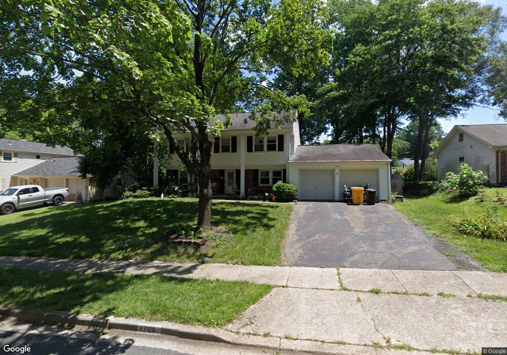
1720 Truro Rd Crofton, MD 21114
Estimated Value: $638,000 - $661,000
Studio
3
Baths
1,956
Sq Ft
$329/Sq Ft
Est. Value
About This Home
This home is located at 1720 Truro Rd, Crofton, MD 21114 and is currently estimated at $644,311, approximately $329 per square foot. 1720 Truro Rd is a home located in Anne Arundel County with nearby schools including Crofton Woods Elementary School, Crofton Middle School, and Crofton High School.
Ownership History
Date
Name
Owned For
Owner Type
Purchase Details
Closed on
Aug 7, 1997
Sold by
Nevin Robert D
Bought by
Brocato Michael and Brocato Cynthia
Current Estimated Value
Purchase Details
Closed on
May 2, 1986
Sold by
Surrick John E
Bought by
Nevin Robert D
Home Financials for this Owner
Home Financials are based on the most recent Mortgage that was taken out on this home.
Original Mortgage
$92,000
Interest Rate
9.9%
Create a Home Valuation Report for This Property
The Home Valuation Report is an in-depth analysis detailing your home's value as well as a comparison with similar homes in the area
Home Values in the Area
Average Home Value in this Area
Purchase History
We collect this data history from publicly available records. To have your information removed, we recommend requesting removal directly through your county’s website.
| Date | Buyer | Sale Price | Title Company |
|---|---|---|---|
| Brocato Michael | $167,500 | -- | |
| Nevin Robert D | $115,000 | -- |
Source: Public Records
Mortgage History
We collect this data history from publicly available records. To have your information removed, we recommend requesting removal directly through your county’s website.
| Date | Status | Borrower | Loan Amount |
|---|---|---|---|
| Previous Owner | Nevin Robert D | $92,000 |
Source: Public Records
Tax History
| Year | Tax Paid | Tax Assessment Tax Assessment Total Assessment is a certain percentage of the fair market value that is determined by local assessors to be the total taxable value of land and additions on the property. | Land | Improvement |
|---|---|---|---|---|
| 2025 | $6,005 | $502,000 | -- | -- |
| 2024 | $6,005 | $477,900 | $0 | $0 |
| 2023 | $5,808 | $453,800 | $269,600 | $184,200 |
| 2022 | $5,488 | $453,700 | $0 | $0 |
| 2020 | $5,176 | $453,500 | $269,600 | $183,900 |
| 2019 | $5,062 | $445,967 | $0 | $0 |
| 2018 | $4,446 | $438,433 | $0 | $0 |
| 2017 | $4,769 | $430,900 | $0 | $0 |
| 2016 | -- | $406,533 | $0 | $0 |
| 2015 | -- | $382,167 | $0 | $0 |
| 2014 | -- | $357,800 | $0 | $0 |
Source: Public Records
Map
Nearby Homes
- 2907 Middle Bridge Ct
- 1776 Crofton Pkwy
- 1721 Urby Dr
- 1631 Defense Hwy
- 1726 Swinburne Ave
- 1755 Carry Place
- 1768 Farmington Ct
- 1691 Freemont Ct
- 1727 Peartree Ln
- 1311 Hidden Trace
- 1304 Quiet Lake Cove
- 1855 Crofton Pkwy
- 1313 Iron Oak Cove
- 1524 Elwyn Ave
- 1519 Crofton Pkwy
- 1802 Lang Dr
- 1323 Foggy Turn Unit 14
- 1654 Albermarle Dr
- 1480 Carlyle Ct Unit 109
- 1474 Carlyle Ct Unit 112
- 1728 Truro Rd
- 1724 Truro Rd
- 1723 Tarrytown Ave
- 1727 Tarrytown Ave
- 1722 Truro Rd
- 1730 Truro Rd
- 1725 Truro Rd
- 1721 Tarrytown Ave
- 1727 Truro Rd
- 1723 Truro Rd
- 1748 Trent St
- 1729 Truro Rd
- 1719 Tarrytown Ave
- 1721 Truro Rd
- 1722 Tarrytown Ave
- 1724 Tarrytown Ave
- 1720 Tarrytown Ave
- 1728 Torrington Place
- 1719 Truro Rd
- 1726 Torrington Place
Your Personal Tour Guide
Ask me questions while you tour the home.