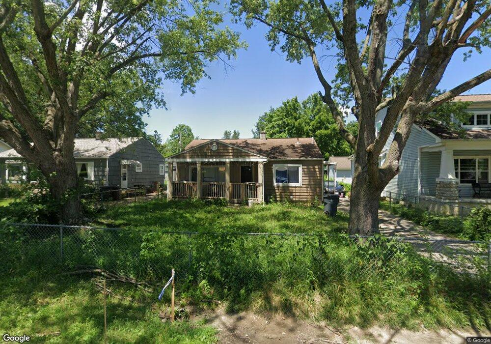
1722 Case Rd Columbus, OH 43224
North Linden NeighborhoodEstimated Value: $165,000 - $212,000
3
Beds
2
Baths
914
Sq Ft
$209/Sq Ft
Est. Value
About This Home
This home is located at 1722 Case Rd, Columbus, OH 43224 and is currently estimated at $190,914, approximately $208 per square foot. 1722 Case Rd is a home located in Franklin County with nearby schools including North Linden Elementary School, Medina Middle School, and Mifflin High School.
Ownership History
Date
Name
Owned For
Owner Type
Purchase Details
Closed on
Oct 7, 2015
Sold by
Sperry Billie Jean and Woods Cove Iii Llc
Bought by
Fusanti Novika
Current Estimated Value
Purchase Details
Closed on
Jul 26, 2005
Sold by
Sperry Rhoda and Sperry Billie Jean
Bought by
Sperry Billie Jean
Purchase Details
Closed on
Sep 24, 1998
Sold by
Sperry Pauline
Bought by
Sperry Rhoda and Sperry Billie Jane
Purchase Details
Closed on
Oct 3, 1980
Bought by
Sperry Pauline
Create a Home Valuation Report for This Property
The Home Valuation Report is an in-depth analysis detailing your home's value as well as a comparison with similar homes in the area
Home Values in the Area
Average Home Value in this Area
Purchase History
| Date | Buyer | Sale Price | Title Company |
|---|---|---|---|
| Fusanti Novika | $30,000 | Attorney | |
| Sperry Billie Jean | $36,500 | -- | |
| Sperry Rhoda | -- | -- | |
| Sperry Pauline | -- | -- |
Source: Public Records
Tax History
| Year | Tax Paid | Tax Assessment Tax Assessment Total Assessment is a certain percentage of the fair market value that is determined by local assessors to be the total taxable value of land and additions on the property. | Land | Improvement |
|---|---|---|---|---|
| 2025 | $3,115 | $52,890 | $9,380 | $43,510 |
| 2024 | $3,115 | $52,890 | $9,380 | $43,510 |
| 2023 | $3,082 | $52,885 | $9,380 | $43,505 |
| 2022 | $2,035 | $27,340 | $5,670 | $21,670 |
| 2021 | $2,038 | $27,340 | $5,670 | $21,670 |
| 2020 | $2,041 | $27,340 | $5,670 | $21,670 |
| 2019 | $1,888 | $21,840 | $4,550 | $17,290 |
| 2018 | $1,412 | $21,840 | $4,550 | $17,290 |
| 2017 | $1,875 | $21,840 | $4,550 | $17,290 |
| 2016 | $1,987 | $22,230 | $3,680 | $18,550 |
| 2015 | $456 | $22,230 | $3,680 | $18,550 |
| 2014 | $1,694 | $22,230 | $3,680 | $18,550 |
| 2013 | $925 | $24,710 | $4,095 | $20,615 |
Source: Public Records
Map
Nearby Homes
- 1885 Case Rd
- 1863 Ward Rd
- 1936 Case Rd
- 3750 Dresden St
- 1887 E Cooke Rd Unit A
- 1946 Lehner Rd
- 3835 Fayette Dr
- 2023 Ferris Rd
- 3967 Karl Rd Unit 224
- 3967 Karl Rd Unit 227
- 3939 Karl Rd Unit 311
- 4117 Karl Rd Unit 208
- 4117 Karl Rd Unit B302
- 3941 Karl Rd Unit 133
- 2100 Ferris Rd
- 2081 Ormond Ave
- 2010 Melrose Ave
- 3767 Karl Rd Unit 322
- 4141 Karl Rd Unit 310
- 4143 Karl Rd Unit 215
Your Personal Tour Guide
Ask me questions while you tour the home.