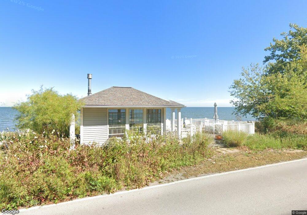
1725 Cedar Point Rd Sandusky, OH 44870
Estimated Value: $1,017,000 - $1,147,000
4
Beds
4
Baths
2,416
Sq Ft
$456/Sq Ft
Est. Value
About This Home
This home is located at 1725 Cedar Point Rd, Sandusky, OH 44870 and is currently estimated at $1,101,242, approximately $455 per square foot. 1725 Cedar Point Rd is a home located in Erie County with nearby schools including Sandusky High School and Monroe Preparatory Academy.
Ownership History
Date
Name
Owned For
Owner Type
Purchase Details
Closed on
Jul 25, 2022
Sold by
Mccune Sally J
Bought by
Sally J Mccune Revised Declaration Of Trust
Current Estimated Value
Purchase Details
Closed on
Jul 9, 2012
Sold by
Mccune Michael P and Mccune Sally J
Bought by
Mccune Sally J and Sally J Mccune Trust
Purchase Details
Closed on
May 26, 1999
Sold by
Est Alice J Dewey
Bought by
Mccune Todd M and Mccune Lisa K
Home Financials for this Owner
Home Financials are based on the most recent Mortgage that was taken out on this home.
Original Mortgage
$55,000
Interest Rate
6.92%
Mortgage Type
New Conventional
Create a Home Valuation Report for This Property
The Home Valuation Report is an in-depth analysis detailing your home's value as well as a comparison with similar homes in the area
Purchase History
We collect this data history from publicly available records. To have your information removed, we recommend requesting removal directly through your county’s website.
| Date | Buyer | Sale Price | Title Company |
|---|---|---|---|
| Sally J Mccune Revised Declaration Of Trust | -- | Moir Linda Tucker | |
| Mccune Sally J | -- | None Available | |
| Mccune Todd M | $108,200 | -- |
Source: Public Records
Mortgage History
We collect this data history from publicly available records. To have your information removed, we recommend requesting removal directly through your county’s website.
| Date | Status | Borrower | Loan Amount |
|---|---|---|---|
| Previous Owner | Mccune Todd M | $55,000 |
Source: Public Records
Tax History
| Year | Tax Paid | Tax Assessment Tax Assessment Total Assessment is a certain percentage of the fair market value that is determined by local assessors to be the total taxable value of land and additions on the property. | Land | Improvement |
|---|---|---|---|---|
| 2025 | $12,942 | $347,413 | $178,570 | $168,843 |
| 2024 | $12,942 | $347,413 | $178,570 | $168,843 |
| 2023 | $13,375 | $269,268 | $149,684 | $119,584 |
| 2022 | $13,328 | $269,258 | $149,684 | $119,574 |
| 2021 | $13,452 | $269,250 | $149,680 | $119,570 |
| 2020 | $13,539 | $249,160 | $149,680 | $99,480 |
| 2019 | $13,928 | $249,160 | $149,680 | $99,480 |
| 2018 | $13,943 | $249,160 | $149,680 | $99,480 |
| 2017 | $14,736 | $262,530 | $154,680 | $107,850 |
| 2016 | $14,729 | $262,530 | $154,680 | $107,850 |
| 2015 | $14,805 | $292,390 | $154,680 | $137,710 |
| 2014 | $13,408 | $266,400 | $139,710 | $126,690 |
| 2013 | $13,271 | $266,400 | $139,710 | $126,690 |
Source: Public Records
Map
Nearby Homes
- 174 Sunset Dr
- 1431 Cedar Point Rd
- 571 Bimini Dr
- 939 Cedar Point Rd
- 30 Marina Point Dr
- 57 Marina Point Dr
- 49 Marina Point Dr
- 31 Marina Point Dr Unit 31
- 32 Marina Point Dr
- 42 Marina Point Dr
- 1215 E Farwell St
- 1310 E Larchmont Dr
- 412 Anderson St
- 444 Hasting Dr
- 1327 5th St
- 1035 1st St
- 908 Ontario St
- 134 W Birchwood Cir
- 808 Curran St
- 907 Ontario St
- 1731 Cedar Point Rd
- 103 Sunset Dr
- 1733 Cedar Point Rd
- 107 Sunset Dr
- 1715 Cedar Point Rd
- 1737 Cedar Point Rd
- 1801 Cedar Point Rd
- 1801 Cedar Point Rd
- 1711 Cedar Point Rd
- 113 Sunset Dr
- 1710 Willow Dr
- 1805 Cedar Point Rd
- 1707 Cedar Point Rd
- 1711 Willow Dr
- 117 Sunset Dr
- 1706 Willow Dr
- 1809 Cedar Point Rd
- 1703 Cedar Point Rd
- 1707 Willow Dr
- 1702 Willow Dr
Your Personal Tour Guide
Ask me questions while you tour the home.