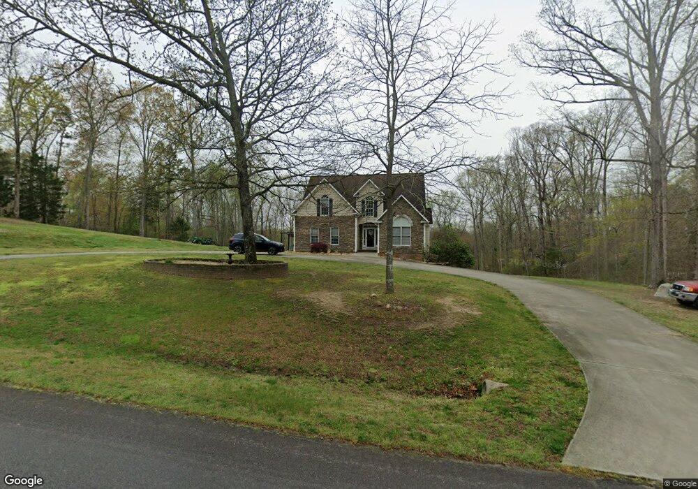
173 Sandpit Rd Advance, NC 27006
Estimated Value: $540,115 - $663,000
4
Beds
3
Baths
3,327
Sq Ft
$177/Sq Ft
Est. Value
About This Home
This home is located at 173 Sandpit Rd, Advance, NC 27006 and is currently estimated at $587,279, approximately $176 per square foot. 173 Sandpit Rd is a home located in Davie County with nearby schools including Pinebrook Elementary School, North Davie Middle School, and Davie County High School.
Ownership History
Date
Name
Owned For
Owner Type
Purchase Details
Closed on
Jun 22, 2009
Sold by
Tolson Pamela Sue
Bought by
Burge James Sean
Current Estimated Value
Home Financials for this Owner
Home Financials are based on the most recent Mortgage that was taken out on this home.
Original Mortgage
$315,400
Outstanding Balance
$199,489
Interest Rate
4.79%
Mortgage Type
New Conventional
Estimated Equity
$387,790
Purchase Details
Closed on
Nov 26, 2008
Sold by
Kb Properties I Llc
Bought by
Burge James Sean and Tolson Pamela Sue
Home Financials for this Owner
Home Financials are based on the most recent Mortgage that was taken out on this home.
Original Mortgage
$313,405
Interest Rate
6.51%
Mortgage Type
New Conventional
Purchase Details
Closed on
Apr 3, 2007
Sold by
Tierney Jeffrey E and Tierney Cynthia V
Bought by
Kb Properties I L L C
Purchase Details
Closed on
Dec 1, 1996
Create a Home Valuation Report for This Property
The Home Valuation Report is an in-depth analysis detailing your home's value as well as a comparison with similar homes in the area
Purchase History
| Date | Buyer | Sale Price | Title Company |
|---|---|---|---|
| Burge James Sean | -- | None Available | |
| Burge James Sean | $330,000 | None Available | |
| Kb Properties I L L C | $200 | -- | |
| -- | $26,000 | -- |
Source: Public Records
Mortgage History
| Date | Status | Borrower | Loan Amount |
|---|---|---|---|
| Open | Burge James Sean | $315,400 | |
| Previous Owner | Burge James Sean | $313,405 |
Source: Public Records
Tax History
| Year | Tax Paid | Tax Assessment Tax Assessment Total Assessment is a certain percentage of the fair market value that is determined by local assessors to be the total taxable value of land and additions on the property. | Land | Improvement |
|---|---|---|---|---|
| 2025 | $3,021 | $438,680 | $47,320 | $391,360 |
| 2024 | $2,908 | $376,240 | $47,320 | $328,920 |
| 2023 | $2,908 | $376,240 | $47,320 | $328,920 |
| 2022 | $2,908 | $376,240 | $47,320 | $328,920 |
| 2021 | $2,908 | $376,240 | $47,320 | $328,920 |
| 2020 | $2,350 | $302,000 | $47,320 | $254,680 |
| 2019 | $2,350 | $302,000 | $47,320 | $254,680 |
| 2018 | $2,350 | $302,000 | $47,320 | $254,680 |
| 2017 | $2,319 | $302,000 | $0 | $0 |
| 2016 | $2,367 | $308,190 | $0 | $0 |
| 2015 | $2,367 | $308,190 | $0 | $0 |
| 2014 | $2,034 | $308,190 | $0 | $0 |
| 2013 | -- | $308,190 | $0 | $0 |
Source: Public Records
Map
Nearby Homes
- 8350 Holler Farm Rd
- 4041 Estate Dr
- 4029 Estate Dr
- 4011 Estate Dr
- 245 Mcknight Rd
- 0 Mcknight Rd
- 292 Morning Star Dr
- 288 Morning Star Dr
- 282 Morning Star Dr
- 278 Morning Star Dr
- 276 Morning Star Dr
- 270 Morning Star Dr
- 271 Morning Star Dr
- 286 Morning Star Dr
- 112 Lovefeast Dr
- 113 Lovefeast Dr
- 114 Lovefeast Dr
- 116 Lovefeast Dr
- 117 Lovefeast Dr
- 244 Morning Star Dr
- 187 Sandpit Rd
- 157 Sandpit Rd
- 211 Sandpit Rd
- 131 Sand Pit Rd
- 131 Sandpit Rd
- 129 Brookside Ln
- 233 Sandpit Rd
- 349 Griffith Rd
- 313 Griffith Rd
- 307 Griffith Rd
- 353 Griffith Rd
- 150 Laurelbrook Ln
- 175 Laurelbrook Ln
- 131 Serenity Hills Trail
- 253 Sandpit Rd
- 295 Griffith Rd
- 4 Laurelbrook Ln
- 368 Griffith Rd
- 1 Laurelbrook Ln
- 320 Griffith Rd
Your Personal Tour Guide
Ask me questions while you tour the home.