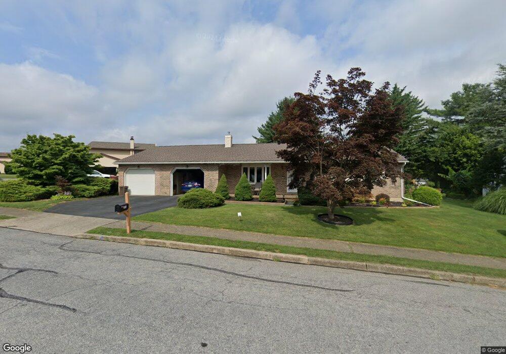
1733 Michael Dr Whitehall, PA 18052
Fullerton NeighborhoodEstimated Value: $339,000 - $366,000
2
Beds
2
Baths
1,380
Sq Ft
$259/Sq Ft
Est. Value
About This Home
This home is located at 1733 Michael Dr, Whitehall, PA 18052 and is currently estimated at $356,983, approximately $258 per square foot. 1733 Michael Dr is a home located in Lehigh County with nearby schools including Zephyr Elementary School, Clarence M Gockley Elementary School, and George D Steckel Elementary School.
Ownership History
Date
Name
Owned For
Owner Type
Purchase Details
Closed on
Oct 7, 2024
Sold by
Sajkowicz Frances A and Sajkowicz Walter J
Bought by
Sajkowicz Walter J and Sajkowicz Frances A
Current Estimated Value
Purchase Details
Closed on
Mar 25, 1994
Sold by
Strisovsky Paul J and Strisovsky Sharon L
Bought by
Sajkowitz Walter J and Ritz Frances A
Purchase Details
Closed on
Dec 27, 1979
Bought by
Strisovsky Paul J and Strisovsky Sharon L
Create a Home Valuation Report for This Property
The Home Valuation Report is an in-depth analysis detailing your home's value as well as a comparison with similar homes in the area
Home Values in the Area
Average Home Value in this Area
Purchase History
We collect this data history from publicly available records. To have your information removed, we recommend requesting removal directly through your county’s website.
| Date | Buyer | Sale Price | Title Company |
|---|---|---|---|
| Sajkowicz Walter J | -- | None Listed On Document | |
| Sajkowitz Walter J | $128,400 | -- | |
| Strisovsky Paul J | $60,900 | -- |
Source: Public Records
Tax History
| Year | Tax Paid | Tax Assessment Tax Assessment Total Assessment is a certain percentage of the fair market value that is determined by local assessors to be the total taxable value of land and additions on the property. | Land | Improvement |
|---|---|---|---|---|
| 2026 | $5,891 | $188,700 | $36,900 | $151,800 |
| 2025 | $5,533 | $188,700 | $36,900 | $151,800 |
| 2024 | $5,347 | $188,700 | $36,900 | $151,800 |
| 2023 | $5,237 | $188,700 | $36,900 | $151,800 |
| 2022 | $5,118 | $188,700 | $151,800 | $36,900 |
| 2021 | $5,033 | $188,700 | $36,900 | $151,800 |
| 2020 | $4,840 | $188,700 | $36,900 | $151,800 |
| 2019 | $4,463 | $188,700 | $36,900 | $151,800 |
| 2018 | $4,346 | $188,700 | $36,900 | $151,800 |
| 2017 | $4,267 | $188,700 | $36,900 | $151,800 |
| 2016 | -- | $188,700 | $36,900 | $151,800 |
| 2015 | -- | $188,700 | $36,900 | $151,800 |
| 2014 | -- | $188,700 | $36,900 | $151,800 |
Source: Public Records
Map
Nearby Homes
- 1755 Peachtree Cir
- 36 Peachtree Cir
- 1407 Presidential Dr
- 21 Madison Ln
- 1921 Belleview Dr
- 136 Cornerstone Place
- 1804 Elmhurst Dr
- 1590 Alta Dr Unit D8
- 1812 Elmhurst Dr
- 1264 California Ave
- 1005 7th St
- 3105 Grantarthur Dr
- 2 Grantarthur #Franklin Ct
- 1611 Abigail Ln
- 1 Grantartur #Taylor Ct
- 4 Grantarthur #Morris Ct
- 3 Grantarthur #Liberty Ct
- 1 Grantarthur #Taylor Ct
- 3128 Grantarthur Ct
- 4 Grantaurthur #Morris Ct
- 1739 Michael Dr
- 1731 Michael Dr
- 1729 Peachtree Cir
- 1741 Michael Dr
- 1734 Michael Dr
- 1732 Michael Dr
- 1736 Michael Dr
- 1738 Michael Dr
- 1740 Michael Dr
- 1727 Peachtree Cir
- 1730 Peachtree Cir
- 1745 Michael Dr
- 1728 Peachtree Cir
- 1742 Michael Dr
- 1732 Peachtree Cir
- 1755 Michael Dr
- 1757 Michael Dr
- 1743 Peachtree Cir
- 1745 Peachtree Cir
- 1747 Peachtree Cir
Your Personal Tour Guide
Ask me questions while you tour the home.