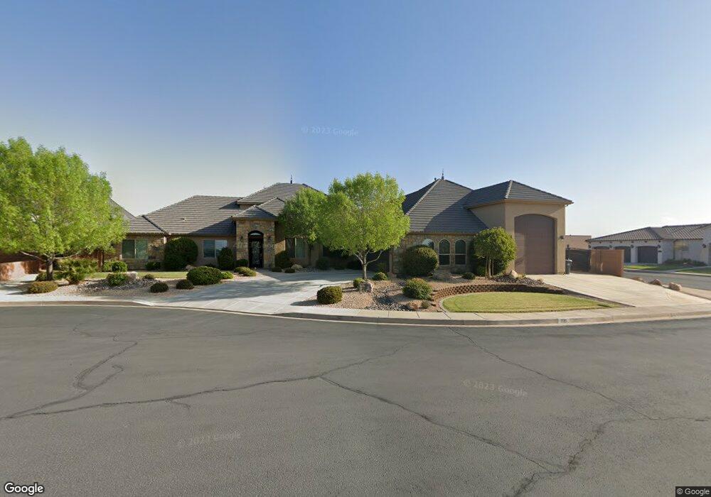
1735 E 380 S St. George, UT 84790
Estimated Value: $873,000 - $1,205,000
5
Beds
5
Baths
4,325
Sq Ft
$249/Sq Ft
Est. Value
About This Home
This home is located at 1735 E 380 S, St. George, UT 84790 and is currently estimated at $1,075,155, approximately $248 per square foot. 1735 E 380 S is a home located in Washington County with nearby schools including Heritage School, Dixie Middle School, and Tonaquint Intermediate School.
Ownership History
Date
Name
Owned For
Owner Type
Purchase Details
Closed on
Feb 5, 2015
Sold by
Nielson Scott T
Bought by
Waldvogel David and Waldvogel Nancy
Current Estimated Value
Home Financials for this Owner
Home Financials are based on the most recent Mortgage that was taken out on this home.
Original Mortgage
$150,000
Outstanding Balance
$114,889
Interest Rate
3.76%
Mortgage Type
Adjustable Rate Mortgage/ARM
Estimated Equity
$960,266
Purchase Details
Closed on
Feb 2, 2015
Sold by
Waldvogel David and Waldvogel Nancy
Bought by
Waldvogel Family Trust
Home Financials for this Owner
Home Financials are based on the most recent Mortgage that was taken out on this home.
Original Mortgage
$150,000
Outstanding Balance
$114,889
Interest Rate
3.76%
Mortgage Type
Adjustable Rate Mortgage/ARM
Estimated Equity
$960,266
Purchase Details
Closed on
Aug 9, 2013
Sold by
Fdr Development Inc
Bought by
Nielson Scott T
Create a Home Valuation Report for This Property
The Home Valuation Report is an in-depth analysis detailing your home's value as well as a comparison with similar homes in the area
Purchase History
| Date | Buyer | Sale Price | Title Company |
|---|---|---|---|
| Waldvogel David | -- | Legal Title Ins Agency Llc | |
| Waldvogel Family Trust | -- | Provo Land Title | |
| Nielson Scott T | -- | Dixie Title Co |
Source: Public Records
Mortgage History
| Date | Status | Borrower | Loan Amount |
|---|---|---|---|
| Open | Waldvogel David | $150,000 |
Source: Public Records
Tax History
| Year | Tax Paid | Tax Assessment Tax Assessment Total Assessment is a certain percentage of the fair market value that is determined by local assessors to be the total taxable value of land and additions on the property. | Land | Improvement |
|---|---|---|---|---|
| 2025 | $3,790 | $567,930 | $115,500 | $452,430 |
| 2023 | $3,648 | $545,050 | $115,500 | $429,550 |
| 2022 | $3,876 | $544,555 | $112,750 | $431,805 |
| 2021 | $3,460 | $725,100 | $115,000 | $610,100 |
| 2020 | $3,271 | $645,500 | $115,000 | $530,500 |
| 2019 | $3,397 | $654,900 | $119,600 | $535,300 |
| 2018 | $3,338 | $332,255 | $0 | $0 |
| 2017 | $3,159 | $305,305 | $0 | $0 |
| 2016 | $3,157 | $282,150 | $0 | $0 |
| 2015 | $3,252 | $278,850 | $0 | $0 |
| 2014 | $1,024 | $88,400 | $0 | $0 |
Source: Public Records
Map
Nearby Homes
- 0 Null Unit 26-269072
- 1684 E 290 S
- 5394 S Aquamarine Ln
- 5409 S Aquamarine Ln
- 5398 S Aquamarine Ln
- 5416 S Aquamarine Ln
- 232 S Acantilado Cir
- 86 S Acantilado Dr
- 1646 E 90 Cir S
- 201 S 2020 East Cir
- 24 S Arroyo Dr
- 145 N Mall Dr Unit 57
- 301 S 1200 E Unit 20
- 301 S 1200 E Unit 24
- 301 S 1200 E Unit 31
- 301 S 1200 E Unit 16
- 301 S 1200 E Unit 52
- 301 S 1200 E Unit 91
- 0 Riverside Dr Unit 22-238008
- 0 Riverside Dr Unit 1834990
- 1735 E 380 South Cir
- 1738 E 330 S
- 1723 E 380 South Cir
- 365 S 1750 E
- 1716 E 330 S
- 1736 E 380 South Cir
- 0 Foremaster Ridge Phase 5
- 1750 E Null
- 1722 E 380 South Cir
- 0 S 1750 E
- 0 S 1750 E
- 0 S 1750 E
- 0 S 1750 E
- 0 1750 St E
- 386 S Five Sisters Dr
- 1737 E 330 S
- 0 Formaster Ridge
- 1721 E 330 S
- 0 Null Unit 25-258376
- 0 Null Unit 22-229800
Your Personal Tour Guide
Ask me questions while you tour the home.