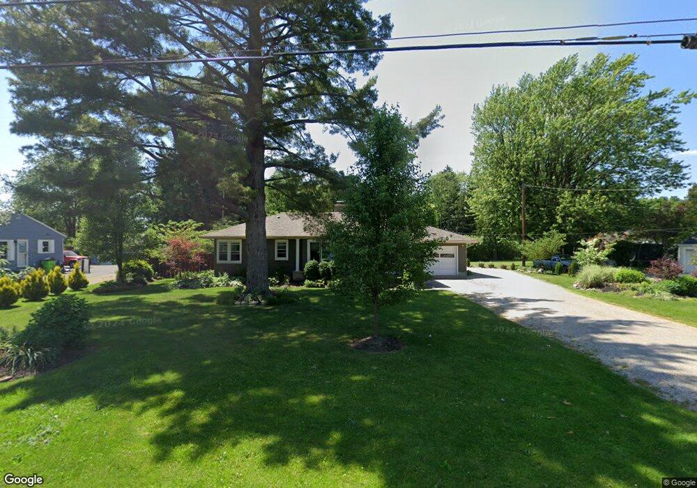
1736 Morrison Rd Fremont, OH 43420
Estimated Value: $204,000 - $236,000
3
Beds
2
Baths
1,044
Sq Ft
$210/Sq Ft
Est. Value
About This Home
This home is located at 1736 Morrison Rd, Fremont, OH 43420 and is currently estimated at $218,950, approximately $209 per square foot. 1736 Morrison Rd is a home located in Sandusky County with nearby schools including Fremont Ross High School, Sacred Heart School, and Bishop Hoffman Catholic School - This is St Joe's School now.
Ownership History
Date
Name
Owned For
Owner Type
Purchase Details
Closed on
May 30, 2018
Sold by
Garnica Alica Kay
Bought by
Granica Alica Kay and Granica Igancio M
Current Estimated Value
Purchase Details
Closed on
Dec 6, 2005
Sold by
Florio John G
Bought by
Garnica Alicia Kay
Home Financials for this Owner
Home Financials are based on the most recent Mortgage that was taken out on this home.
Original Mortgage
$86,400
Interest Rate
6.2%
Mortgage Type
Purchase Money Mortgage
Purchase Details
Closed on
Nov 14, 2000
Sold by
Bessken Susan
Bought by
Florio John G
Home Financials for this Owner
Home Financials are based on the most recent Mortgage that was taken out on this home.
Original Mortgage
$60,000
Interest Rate
7.91%
Mortgage Type
New Conventional
Purchase Details
Closed on
Dec 1, 1988
Bought by
Garnica Alicia Kay
Create a Home Valuation Report for This Property
The Home Valuation Report is an in-depth analysis detailing your home's value as well as a comparison with similar homes in the area
Home Values in the Area
Average Home Value in this Area
Purchase History
| Date | Buyer | Sale Price | Title Company |
|---|---|---|---|
| Granica Alica Kay | -- | None Available | |
| Garnica Alicia Kay | -- | -- | |
| Florio John G | $78,000 | -- | |
| Garnica Alicia Kay | -- | -- |
Source: Public Records
Mortgage History
| Date | Status | Borrower | Loan Amount |
|---|---|---|---|
| Previous Owner | Garnica Alicia Kay | $86,400 | |
| Previous Owner | Florio John G | $60,000 |
Source: Public Records
Tax History
| Year | Tax Paid | Tax Assessment Tax Assessment Total Assessment is a certain percentage of the fair market value that is determined by local assessors to be the total taxable value of land and additions on the property. | Land | Improvement |
|---|---|---|---|---|
| 2025 | $2,608 | $199,700 | $56,600 | $143,100 |
| 2024 | $2,608 | $69,900 | $19,810 | $50,090 |
| 2023 | $2,718 | $49,600 | $13,860 | $35,740 |
| 2022 | $2,060 | $49,600 | $13,860 | $35,740 |
| 2021 | $2,122 | $49,600 | $13,860 | $35,740 |
| 2020 | $1,835 | $42,040 | $13,860 | $28,180 |
| 2019 | $1,505 | $34,510 | $13,860 | $20,650 |
| 2018 | $1,349 | $32,970 | $13,860 | $19,110 |
| 2017 | $1,300 | $30,490 | $13,860 | $16,630 |
| 2016 | $1,139 | $30,490 | $13,860 | $16,630 |
| 2015 | $1,121 | $30,490 | $13,860 | $16,630 |
| 2014 | $1,213 | $31,610 | $13,830 | $17,780 |
| 2013 | $1,187 | $31,610 | $13,830 | $17,780 |
Source: Public Records
Map
Nearby Homes
- 1720 Tiffin Rd
- 1440 W Cole Rd
- 748 S Front St
- 746 S Front St
- 1485 Autumn Woods Dr
- 0 S Buchanan St
- 430 Vine St
- 515 S Arch St
- 411 S Collinwood Blvd
- 1719 Buckland Ave
- 1012 Short St
- 918 Birdseye Blvd
- 1116 Buckland Ave
- 124 Morrison St
- 1310 Mcpherson Blvd
- 1107 Garrison St
- 1512 Mcpherson Blvd
- 1128 Garrison St
- 758 Barker Rd
- 0 E State St Unit 20260933
- 1744 Morrison Rd
- 1724 Morrison Rd
- 1737 Morrison Rd
- 1729 Morrison Rd
- 1758 Morrison Rd
- 1749 Morrison Rd
- 510 E Cole Rd
- 1719 Morrison Rd
- 500 E Cole Rd
- 11 Melissa Dr
- 21 Melissa Dr
- 650 E Cole Rd
- 1713 Morrison Rd
- 100 Springbrook Dr
- 27 Melissa Dr
- 521 E Cole Rd
- 104 Springbrook Dr
- 535 E Cole Rd
- 408 E Cole Rd
- 607 E Cole Rd
Your Personal Tour Guide
Ask me questions while you tour the home.