Estimated Value: $209,806 - $242,000
3
Beds
2
Baths
1,344
Sq Ft
$165/Sq Ft
Est. Value
About This Home
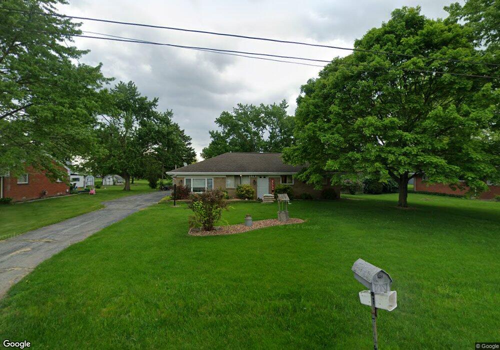
This home is located at 1747 N Thyre Dr, Genoa, OH 43430 and is currently estimated at $221,202, approximately $164 per square foot. 1747 N Thyre Dr is a home located in Ottawa County with nearby schools including Genoa Elementary School and Community Christian Academy.
Ownership History
Date
Name
Owned For
Owner Type
Purchase Details
Closed on
Nov 4, 2009
Sold by
Secretary Of Veterans Affairs
Bought by
Shank Jon A
Current Estimated Value
Home Financials for this Owner
Home Financials are based on the most recent Mortgage that was taken out on this home.
Original Mortgage
$87,720
Interest Rate
4.96%
Mortgage Type
Seller Take Back
Purchase Details
Closed on
Aug 6, 2009
Sold by
Murawski Diana
Bought by
Secretary Of Veterans Affairs
Purchase Details
Closed on
Aug 5, 1997
Sold by
Tracy Robert G
Bought by
Murawski Michael J and Murawski Diana L
Home Financials for this Owner
Home Financials are based on the most recent Mortgage that was taken out on this home.
Original Mortgage
$121,200
Interest Rate
7.71%
Mortgage Type
VA
Purchase Details
Closed on
Aug 26, 1992
Sold by
Tracy Robert and Tracy Dolores J
Bought by
Tracy Robert G
Create a Home Valuation Report for This Property
The Home Valuation Report is an in-depth analysis detailing your home's value as well as a comparison with similar homes in the area
Purchase History
| Date | Buyer | Sale Price | Title Company |
|---|---|---|---|
| Shank Jon A | $86,000 | Chicago Title Servicelink Di | |
| Secretary Of Veterans Affairs | $96,667 | None Available | |
| Murawski Michael J | $118,000 | -- | |
| Tracy Robert G | -- | -- |
Source: Public Records
Mortgage History
| Date | Status | Borrower | Loan Amount |
|---|---|---|---|
| Previous Owner | Shank Jon A | $87,720 | |
| Previous Owner | Murawski Michael J | $121,200 |
Source: Public Records
Tax History
| Year | Tax Paid | Tax Assessment Tax Assessment Total Assessment is a certain percentage of the fair market value that is determined by local assessors to be the total taxable value of land and additions on the property. | Land | Improvement |
|---|---|---|---|---|
| 2024 | $3,217 | $57,793 | $12,926 | $44,867 |
| 2023 | $2,738 | $49,911 | $11,750 | $38,161 |
| 2022 | $2,700 | $49,911 | $11,750 | $38,161 |
| 2021 | $2,402 | $49,910 | $11,750 | $38,160 |
| 2020 | $2,223 | $43,420 | $9,250 | $34,170 |
| 2019 | $2,198 | $43,420 | $9,250 | $34,170 |
| 2018 | $2,208 | $43,420 | $9,250 | $34,170 |
| 2017 | $2,136 | $41,070 | $9,250 | $31,820 |
| 2016 | $2,145 | $41,070 | $9,250 | $31,820 |
| 2015 | $2,155 | $41,070 | $9,250 | $31,820 |
| 2014 | $1,011 | $41,070 | $9,250 | $31,820 |
| 2013 | $2,021 | $41,070 | $9,250 | $31,820 |
Source: Public Records
Map
Nearby Homes
- 1615 N Thyre Dr
- 1320 Superior St
- 1309 Superior St
- 1216 Main St
- 21682 State Route 51 W
- 207 E 11th St
- 915 Buckeye St
- 904 Main St
- 23526 W Manor Dr
- 108 W 8th St
- 416 Castle Cove
- 330 5th St
- 304 Main St
- 1861 N Opfer-Lentz Rd
- 26810 Woodland Ct
- 26931 W Woodland Ct
- 28899 Hille Dr
- 18565 W Moline Martin Rd
- 0 Recker Rd
- Lot 3 of Woody Dr
- 1759 N Thyre Dr
- 1725 N Thyre Dr
- 1703 N Thyre Dr
- 1748 N Thyre Dr
- 1760 N Thyre Dr
- 1726 N Thyre Dr
- 1704 N Thyre Dr
- 1681 N Thyre Dr
- 1682 N Thyre Dr
- 1743 N Smith Dr
- 22141 W Elmwood Pkwy
- 1755 N Smith Dr
- 1711 N Smith Dr
- 22163 W Elmwood Pkwy
- 1689 N Smith Dr
- 22119 W Elmwood Pkwy
- 22195 W Elmwood Pkwy
- 22097 W Elmwood Pkwy
- 1667 N Smith Dr
- 1704 N Genoa Clay Center Rd Unit R
Your Personal Tour Guide
Ask me questions while you tour the home.