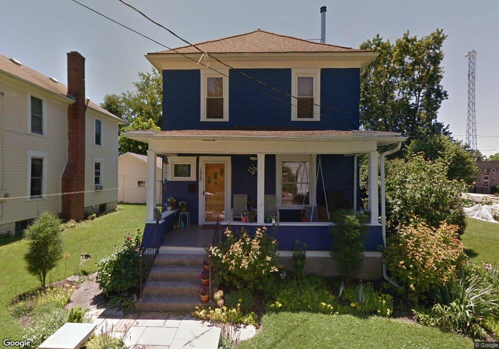
175 2nd St Athens, OH 45701
Estimated Value: $181,894 - $220,000
2
Beds
1
Bath
1,280
Sq Ft
$157/Sq Ft
Est. Value
About This Home
This home is located at 175 2nd St, Athens, OH 45701 and is currently estimated at $200,724, approximately $156 per square foot. 175 2nd St is a home located in Athens County with nearby schools including West Elementary School, Athens Middle School, and Athens High School.
Ownership History
Date
Name
Owned For
Owner Type
Purchase Details
Closed on
Apr 8, 2011
Sold by
Harris James M and Lash Angela Christine
Bought by
Harris James M and Lash Angela Christine
Current Estimated Value
Purchase Details
Closed on
May 31, 2007
Sold by
Mcsteen Michael P and Mcsteen Patricia E
Bought by
Harris James M
Home Financials for this Owner
Home Financials are based on the most recent Mortgage that was taken out on this home.
Original Mortgage
$101,850
Outstanding Balance
$56,477
Interest Rate
5.12%
Mortgage Type
Purchase Money Mortgage
Estimated Equity
$144,247
Purchase Details
Closed on
Sep 2, 1998
Sold by
Barker Martha A
Bought by
Mcsteen Michael P
Purchase Details
Closed on
Aug 6, 1998
Sold by
Barker Martha A
Bought by
Barker Martha A
Purchase Details
Closed on
Jul 9, 1992
Sold by
Barker Martha A
Bought by
Barker Martha A
Purchase Details
Closed on
Jun 24, 1992
Sold by
Barker Harold A and Barker Martha
Bought by
Barker Martha A
Create a Home Valuation Report for This Property
The Home Valuation Report is an in-depth analysis detailing your home's value as well as a comparison with similar homes in the area
Home Values in the Area
Average Home Value in this Area
Purchase History
| Date | Buyer | Sale Price | Title Company |
|---|---|---|---|
| Harris James M | -- | Attorney | |
| Harris James M | $105,000 | Attorney | |
| Mcsteen Michael P | $70,000 | -- | |
| Barker Martha A | -- | -- | |
| Barker Martha A | -- | -- | |
| Barker Martha A | -- | -- |
Source: Public Records
Mortgage History
| Date | Status | Borrower | Loan Amount |
|---|---|---|---|
| Open | Harris James M | $101,850 |
Source: Public Records
Tax History
| Year | Tax Paid | Tax Assessment Tax Assessment Total Assessment is a certain percentage of the fair market value that is determined by local assessors to be the total taxable value of land and additions on the property. | Land | Improvement |
|---|---|---|---|---|
| 2025 | $2,537 | $47,010 | $4,360 | $42,650 |
| 2024 | $4,418 | $47,010 | $4,360 | $42,650 |
| 2023 | $2,326 | $47,010 | $4,360 | $42,650 |
| 2022 | $1,951 | $37,680 | $4,360 | $33,320 |
| 2021 | $1,959 | $37,680 | $4,360 | $33,320 |
| 2020 | $1,957 | $37,680 | $4,360 | $33,320 |
| 2019 | $1,850 | $36,250 | $3,910 | $32,340 |
| 2018 | $1,783 | $35,410 | $3,910 | $31,500 |
| 2017 | $3,154 | $35,410 | $3,910 | $31,500 |
| 2016 | $1,536 | $31,580 | $3,720 | $27,860 |
| 2015 | $2,884 | $31,580 | $3,720 | $27,860 |
| 2014 | $2,884 | $31,580 | $3,720 | $27,860 |
| 2013 | $2,734 | $30,760 | $3,720 | $27,040 |
Source: Public Records
Map
Nearby Homes
- 56.15/15.5 Central & Clark
- 15 S Shafer St Unit 201
- 15 S Shafer St Unit 1803
- 15 S Shafer St Unit 1509
- 15 S Shafer St Unit 203
- 15 S Shafer St Unit 1105
- 15 S Shafer St Unit 2102
- 15 S Shafer St Unit 510
- 11 Walker St
- 42 Walker St
- 22 Pratt St
- 193 N Lancaster St
- 0 Roberts St
- 247 W Union St Unit 1003A
- 115 N Congress St
- 88 W Union St
- 80 Court
- 5 Maple Grove Way
- 11 Forest St
- 115 University Estates Blvd
Your Personal Tour Guide
Ask me questions while you tour the home.