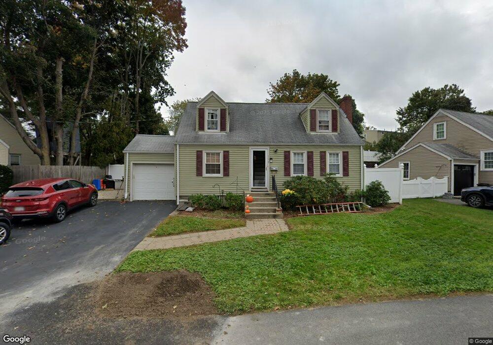
175 Beal Rd Waltham, MA 02453
Warrendale NeighborhoodEstimated Value: $834,000 - $870,000
3
Beds
2
Baths
1,152
Sq Ft
$741/Sq Ft
Est. Value
About This Home
This home is located at 175 Beal Rd, Waltham, MA 02453 and is currently estimated at $854,091, approximately $741 per square foot. 175 Beal Rd is a home located in Middlesex County with nearby schools including James Fitzgerald Elementary School, John W. Mcdevitt Middle School, and Waltham Sr High School.
Create a Home Valuation Report for This Property
The Home Valuation Report is an in-depth analysis detailing your home's value as well as a comparison with similar homes in the area
Home Values in the Area
Average Home Value in this Area
Map
Nearby Homes
- 158 Warren St
- 78 Barbara Rd Unit 1
- 111 Warren St
- 61 Canterbury Rd
- 65 Brightwood Rd
- 329 Warren St
- 67 Prospect St
- 74 Rose Hill Way
- 61 Wilmot St
- 18 Prospect St
- 12 Bennett Rd
- 32 Grosvenor Rd
- 43 Grandview Ave
- 601 Main St
- 218 Warren St
- 25 Piermont St
- 25-27 King St
- 26-28 Desmond Ave
- 38 Grant Ave
- 11 Bright St
- 167 Beal Rd
- 161 Beal Rd
- 52 Cleveland Rd
- 60 Cleveland Rd
- 181 Beal Rd
- 157 Beal Rd
- 46 Cleveland Rd
- 172 Beal Rd
- 42 Cleveland Rd
- 151 Beal Rd
- 178 Beal Rd
- 59 Cleveland Rd
- 182 Beal Rd
- 55 Cleveland Rd
- 65 Cleveland Rd
- 49 Cleveland Rd
- 49 Cleveland Rd Unit B
- 49 Cleveland Rd Unit A
- 49 Cleveland Rd Unit 1
- 195 Beal Rd
Your Personal Tour Guide
Ask me questions while you tour the home.