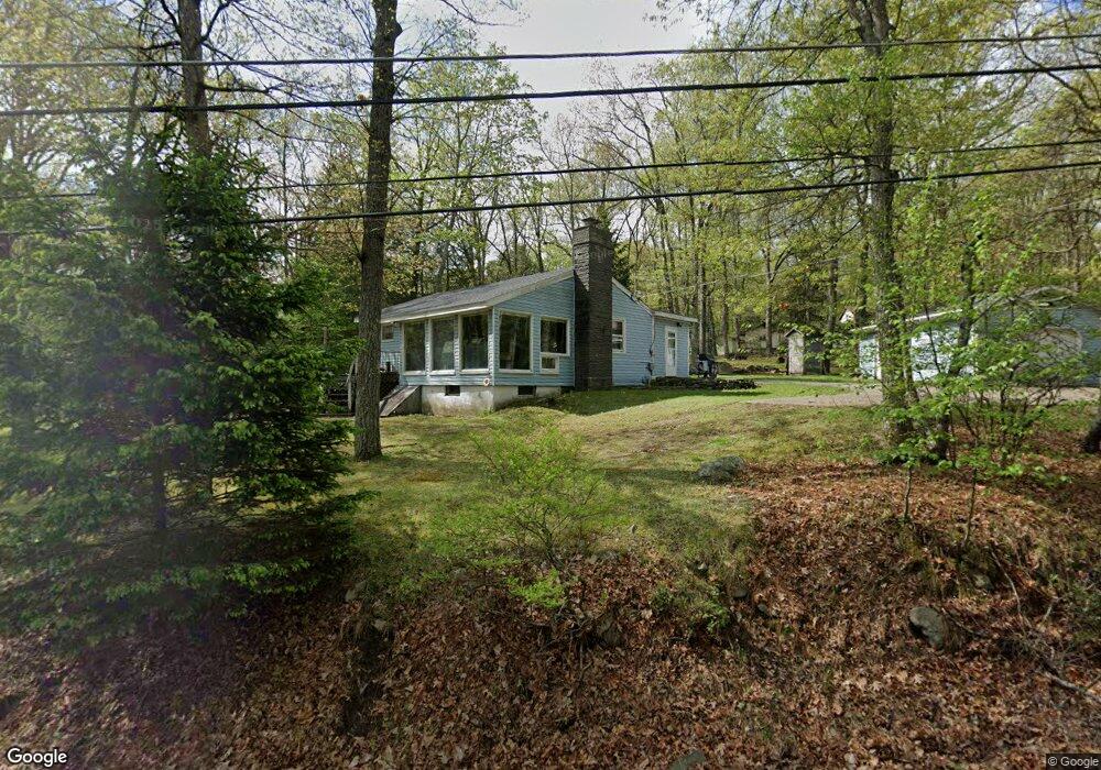
175 Brewster Rd Dingmans Ferry, PA 18328
Estimated Value: $150,000 - $189,662
2
Beds
1
Bath
1,222
Sq Ft
$139/Sq Ft
Est. Value
About This Home
This home is located at 175 Brewster Rd, Dingmans Ferry, PA 18328 and is currently estimated at $169,831, approximately $138 per square foot. 175 Brewster Rd is a home with nearby schools including Bushkill Elementary and Lehman Intermediate School.
Ownership History
Date
Name
Owned For
Owner Type
Purchase Details
Closed on
Jul 27, 2021
Sold by
Greenjack Paul
Bought by
Greenjack Paul and Greenjack Jennifer
Current Estimated Value
Home Financials for this Owner
Home Financials are based on the most recent Mortgage that was taken out on this home.
Original Mortgage
$90,000
Interest Rate
2.93%
Mortgage Type
New Conventional
Create a Home Valuation Report for This Property
The Home Valuation Report is an in-depth analysis detailing your home's value as well as a comparison with similar homes in the area
Home Values in the Area
Average Home Value in this Area
Purchase History
| Date | Buyer | Sale Price | Title Company |
|---|---|---|---|
| Greenjack Paul | -- | Accommodation |
Source: Public Records
Mortgage History
| Date | Status | Borrower | Loan Amount |
|---|---|---|---|
| Closed | Greenjack Paul | $90,000 |
Source: Public Records
Tax History
| Year | Tax Paid | Tax Assessment Tax Assessment Total Assessment is a certain percentage of the fair market value that is determined by local assessors to be the total taxable value of land and additions on the property. | Land | Improvement |
|---|---|---|---|---|
| 2025 | $2,511 | $15,940 | $1,910 | $14,030 |
| 2024 | $2,511 | $15,940 | $1,910 | $14,030 |
| 2023 | $2,472 | $15,940 | $1,910 | $14,030 |
| 2022 | $2,393 | $15,940 | $1,910 | $14,030 |
| 2021 | $2,342 | $15,940 | $1,910 | $14,030 |
| 2020 | $2,342 | $15,940 | $1,910 | $14,030 |
| 2019 | $2,318 | $15,940 | $1,910 | $14,030 |
| 2018 | $2,290 | $15,940 | $1,910 | $14,030 |
| 2017 | $2,241 | $15,940 | $1,910 | $14,030 |
| 2016 | $0 | $15,940 | $1,910 | $14,030 |
| 2014 | -- | $15,940 | $1,910 | $14,030 |
Source: Public Records
Map
Nearby Homes
- 123 Mosier Rd
- 216 Canterbrook Dr
- 193 Old Route 402
- 805 Pastern Ct
- 130 Canterbrook Dr
- 130 Canterbrook Dr Unit 130
- 137 Gaskin Dr
- 204 Lincoln Dr
- 128 Gaskin Dr
- 128 Horseshoe Ln
- 0 Ness Rd
- 101 Burning Tree Dr
- 114 Gaskin Dr
- 121 Canterbrook Dr
- 115 Canyon Dr
- 100 Lincoln Dr
- 806 Gaskin Ct N
- 802 Sunrise Ct
- 432 Maple Ridge Dr
- 114 Orchard Dr
- 173 Brewster Rd
- 177 Brewster Rd
- 0 Stoney Hill Rd
- 115 Stoney Hill Rd
- 113 Stoney Hill Rd
- 0 Brewster Rd
- 108 Stoney Hill Rd
- 104 Stoney Hill Rd
- 102 Stoney Hill Rd
- 116 Stoney Hill Rd
- 114 Stoney Hill Rd
- 112 Stoney Hill Rd
- 181 Brewster Rd
- 110 Stoney Hill Rd
- 225 Rock Hill Rd
- 167 Brewster Rd
- 224 Rock Hill Rd
- 224 Rock Hill Dr
- 0 Rock Hill Dr
- 223 Rock Hill Dr
Your Personal Tour Guide
Ask me questions while you tour the home.