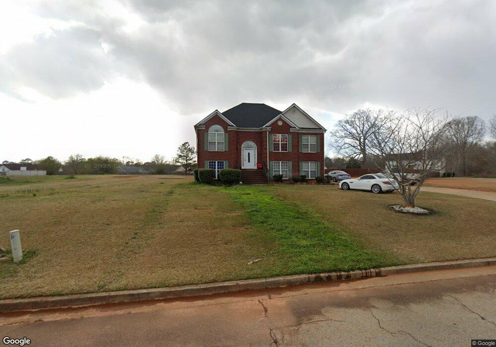
175 River Park Cir McDonough, GA 30252
Estimated Value: $330,994 - $368,000
3
Beds
3
Baths
2,262
Sq Ft
$151/Sq Ft
Est. Value
About This Home
This home is located at 175 River Park Cir, McDonough, GA 30252 and is currently estimated at $342,499, approximately $151 per square foot. 175 River Park Cir is a home located in Henry County with nearby schools including New Hope Elementary School, Ola Middle School, and Ola High School.
Ownership History
Date
Name
Owned For
Owner Type
Purchase Details
Closed on
May 13, 2005
Sold by
Reid Sandra M D
Bought by
Farley Walter
Current Estimated Value
Home Financials for this Owner
Home Financials are based on the most recent Mortgage that was taken out on this home.
Original Mortgage
$161,100
Outstanding Balance
$98,982
Interest Rate
8.75%
Mortgage Type
New Conventional
Estimated Equity
$243,517
Purchase Details
Closed on
Jul 2, 2001
Sold by
Dudley Sandy M and Dudley Sheryl M
Bought by
River Park Land Trust
Purchase Details
Closed on
Feb 16, 2001
Sold by
Gt Architecture Contractors Corp
Bought by
Dudley Sandy M and Dudley Sheryl M
Home Financials for this Owner
Home Financials are based on the most recent Mortgage that was taken out on this home.
Original Mortgage
$149,800
Interest Rate
7.02%
Mortgage Type
FHA
Create a Home Valuation Report for This Property
The Home Valuation Report is an in-depth analysis detailing your home's value as well as a comparison with similar homes in the area
Home Values in the Area
Average Home Value in this Area
Purchase History
| Date | Buyer | Sale Price | Title Company |
|---|---|---|---|
| Farley Walter | $150,000 | -- | |
| River Park Land Trust | -- | -- | |
| Dudley Sandy M | $151,000 | -- |
Source: Public Records
Mortgage History
| Date | Status | Borrower | Loan Amount |
|---|---|---|---|
| Open | Farley Walter | $161,100 | |
| Previous Owner | Dudley Sandy M | $149,800 |
Source: Public Records
Tax History
| Year | Tax Paid | Tax Assessment Tax Assessment Total Assessment is a certain percentage of the fair market value that is determined by local assessors to be the total taxable value of land and additions on the property. | Land | Improvement |
|---|---|---|---|---|
| 2025 | $4,066 | $144,680 | $18,000 | $126,680 |
| 2024 | $4,066 | $130,600 | $18,000 | $112,600 |
| 2023 | $3,220 | $125,360 | $14,000 | $111,360 |
| 2022 | $3,160 | $101,440 | $14,000 | $87,440 |
| 2021 | $2,704 | $82,160 | $14,000 | $68,160 |
| 2020 | $2,566 | $76,320 | $12,000 | $64,320 |
| 2019 | $2,478 | $72,600 | $12,000 | $60,600 |
| 2018 | $2,282 | $64,320 | $12,000 | $52,320 |
| 2016 | $2,054 | $58,400 | $10,000 | $48,400 |
| 2015 | $1,868 | $52,360 | $8,000 | $44,360 |
| 2014 | $1,668 | $46,920 | $8,000 | $38,920 |
Source: Public Records
Map
Nearby Homes
- 142 River Park Cir
- 845 Graeme Dr
- 145 Creekside Way
- 290 Laney Ct
- 725 Old Jackson Rd
- 285 Creekside Way
- 471 Kimberly Ct
- 767 Old Jackson Rd
- 461 Old Jackson Rd
- 175 Laney Ct Unit 1
- 275 S Bethany Rd
- 315 S Bethany Rd
- 136 Crown Forest Dr
- 0 Plantation Rd Unit 26647144
- 0 Plantation Rd Unit 10713349
- 125 Karen Dr
- 290 New Hope Rd
- 1891 Highway 81 E
- 281 Laney Dr
- 363 Laney Rd
- 173 River Park Cir
- 173 River Park Cir Unit 74
- 113 River Park Cir
- 174 River Park Cir
- 111 River Park Cir
- 115 River Park Cir
- 176 River Park Cir
- 117 River Park Cir
- 172 River Park Cir
- 209 Chestatee Trace
- 171 River Park Cir Unit 171
- 171 River Park Cir
- 178 River Park Cir
- 205 Chestatee Trace
- 170 River Park Cir
- 114 River Park Cir
- 208 Chestatee Trace Unit 51
- 208 Chestatee Trace
- 112 River Park Cir
- 201 Chestatee Trace
Your Personal Tour Guide
Ask me questions while you tour the home.