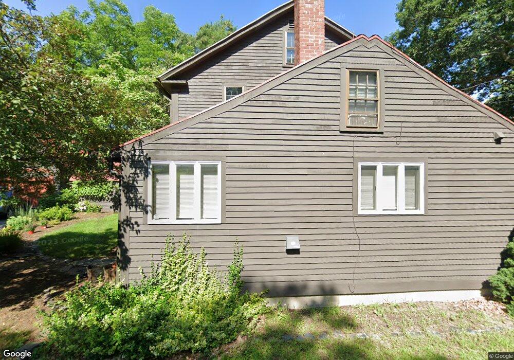
176 Clark Rd Alfred, ME 04002
Estimated Value: $456,483 - $508,000
About This Home
This home is located at 176 Clark Rd, Alfred, ME 04002 and is currently estimated at $484,621, approximately $211 per square foot. 176 Clark Rd is a home located in York County with nearby schools including Massabesic High School and St Thomas Consolidated School.
Ownership History
We collect this data history from publicly available records. To have your information removed, we recommend requesting removal directly through your county’s website.
Purchase Details
Home Financials for this Owner
Home Financials are based on the most recent Mortgage that was taken out on this home.Home Values in the Area
Average Home Value in this Area
Purchase History
We collect this data history from publicly available records. To have your information removed, we recommend requesting removal directly through your county’s website.
| Date | Buyer | Sale Price | Title Company |
|---|---|---|---|
| -- | -- |
Mortgage History
We collect this data history from publicly available records. To have your information removed, we recommend requesting removal directly through your county’s website.
| Date | Status | Borrower | Loan Amount |
|---|---|---|---|
| Open | $240,052 |
Tax History
We collect this data history from publicly available records. To have your information removed, we recommend requesting removal directly through your county’s website.
| Year | Tax Paid | Tax Assessment Tax Assessment Total Assessment is a certain percentage of the fair market value that is determined by local assessors to be the total taxable value of land and additions on the property. | Land | Improvement |
|---|---|---|---|---|
| 2025 | $3,969 | $411,274 | $128,750 | $282,524 |
| 2024 | $3,887 | $411,274 | $128,750 | $282,524 |
| 2023 | $4,345 | $231,100 | $70,000 | $161,100 |
| 2022 | $4,160 | $231,100 | $70,000 | $161,100 |
| 2021 | $3,986 | $231,100 | $70,000 | $161,100 |
| 2020 | $3,790 | $231,100 | $70,000 | $161,100 |
| 2019 | $3,790 | $231,100 | $70,000 | $161,100 |
| 2018 | $3,674 | $231,100 | $70,000 | $161,100 |
| 2017 | $3,674 | $231,100 | $70,000 | $161,100 |
| 2016 | $3,501 | $231,100 | $70,000 | $161,100 |
| 2015 | $3,351 | $231,100 | $70,000 | $161,100 |
| 2014 | $3,293 | $231,100 | $70,000 | $161,100 |
| 2013 | $3,178 | $231,100 | $70,000 | $161,100 |
Map
- 7 E Branch Dr
- 150 Kennebunk Rd
- TBD Kennebunk Rd
- 268 Kennebunk Rd
- 2252 Alfred Rd
- 10 School St
- 104 Roux Road Extension
- 51 Riverside Dr
- Parcel A Olde Farnham Rd
- 9 Fallen Oak
- 58 Sanford Rd
- 45 Gore Rd
- 232 Waterboro Rd
- 333 Williams Rd
- 65 Old County Rd
- 85 Branch View Terrace N
- 592 Walker Rd
- 36 Sevigny Dr
- TBD Bernier Rd
- TBD1 Bernier Rd
- 175 Clark Rd
- 0 Drown Rd
- 306 Biddeford Rd
- 288 Biddeford Rd
- 17 Blueberry Hill Rd
- 157 Clark Rd
- 279 Biddeford Rd
- 152 Clark Rd
- 23 Drown Rd
- 9 Meadow View
- 18 Meadow View
- 265 Biddeford Rd
- 22 Blueberry Hill Rd
- 352 Biddeford Rd
- 266 Biddeford Rd
- 39 Blueberry Hill Rd
- 266 & 258 Biddeford Rd
- 39 Drown Rd
- 0 Blueberry Hill
- 0 Blueberry Hill Rd
Ask me questions while you tour the home.