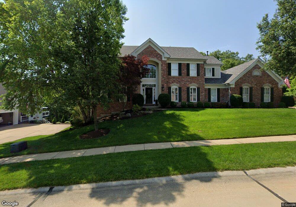
17618 Lasiandra Dr Chesterfield, MO 63005
Estimated Value: $861,101 - $1,036,000
4
Beds
5
Baths
4,487
Sq Ft
$213/Sq Ft
Est. Value
About This Home
This home is located at 17618 Lasiandra Dr, Chesterfield, MO 63005 and is currently estimated at $954,025, approximately $212 per square foot. 17618 Lasiandra Dr is a home located in St. Louis County with nearby schools including Chesterfield Elementary School, Rockwood Valley Middle School, and Lafayette High School.
Ownership History
Date
Name
Owned For
Owner Type
Purchase Details
Closed on
Oct 11, 2000
Sold by
Kessler Homes Co
Bought by
Harrell Michael W and Harrell Michelle L
Current Estimated Value
Home Financials for this Owner
Home Financials are based on the most recent Mortgage that was taken out on this home.
Original Mortgage
$380,000
Outstanding Balance
$136,897
Interest Rate
7.75%
Estimated Equity
$817,128
Purchase Details
Closed on
Mar 1, 2000
Sold by
Hardesty Properties Co
Bought by
Kessler Homes Inc
Create a Home Valuation Report for This Property
The Home Valuation Report is an in-depth analysis detailing your home's value as well as a comparison with similar homes in the area
Home Values in the Area
Average Home Value in this Area
Purchase History
| Date | Buyer | Sale Price | Title Company |
|---|---|---|---|
| Harrell Michael W | $475,000 | -- | |
| Kessler Homes Inc | $150,000 | -- |
Source: Public Records
Mortgage History
| Date | Status | Borrower | Loan Amount |
|---|---|---|---|
| Open | Harrell Michael W | $380,000 |
Source: Public Records
Tax History
| Year | Tax Paid | Tax Assessment Tax Assessment Total Assessment is a certain percentage of the fair market value that is determined by local assessors to be the total taxable value of land and additions on the property. | Land | Improvement |
|---|---|---|---|---|
| 2025 | $11,323 | $161,670 | $42,790 | $118,880 |
| 2024 | $11,323 | $159,560 | $21,390 | $138,170 |
| 2023 | $11,029 | $159,560 | $21,390 | $138,170 |
| 2022 | $9,905 | $133,270 | $23,770 | $109,500 |
| 2021 | $9,849 | $133,270 | $23,770 | $109,500 |
| 2020 | $10,028 | $131,020 | $21,390 | $109,630 |
| 2019 | $9,972 | $131,020 | $21,390 | $109,630 |
| 2018 | $10,132 | $125,530 | $19,020 | $106,510 |
| 2017 | $8,958 | $113,550 | $19,020 | $94,530 |
| 2016 | $9,197 | $112,020 | $21,390 | $90,630 |
Source: Public Records
Map
Nearby Homes
- 17669 Lasiandra Dr
- 1513 Honey Locust Ct
- 1556 Wildhorse Parkway Dr
- 17602 Ailanthus Dr
- 1631 Highland Valley Cir
- 1032 Chesterfield Forest
- 17710 Wilding Place Dr
- 1460 Highland Valley Dr
- 17659 Wildridge Dr
- 1001 Chesterfield Forest Dr
- 17755 Drummer Ln
- 1140 Keystone Trail Dr
- 17651 Westhampton Woods Dr
- 16925 Lewis Spring Farms Rd
- 16614 Highland Summit Dr
- 1048 Keystone Trail Dr
- 16907 Lewis Spring Farms Rd
- 310 Wardenburg Farms Dr
- 2470 Indian Tree Cir
- 1040 Greystone Manor Pkwy
- 1602 Lily Wood Ct
- 17614 Lasiandra Dr
- 1608 Lily Wood Ct
- 17621 Lasiandra Dr
- 17610 Lasiandra Dr
- 17613 Lasiandra Dr
- 17629 Lasiandra Dr
- 1605 Lily Wood Ct
- 17609 Lasiandra Dr
- 17606 Lasiandra Dr
- 1609 Lily Wood Ct
- 17633 Lasiandra Dr
- 17605 Lasiandra Dr
- 17630 Lasiandra Dr
- 17602 Lasiandra Dr
- 1617 Lily Wood Ct
- 0 Tbb Lot 1 Breton Woods Ct Unit 12029319
- 0 Tbb Lot 2 Breton Woods Ct Unit 12026559
- 17254 Orrville Rd
- 1516 Lace Bark Ct
Your Personal Tour Guide
Ask me questions while you tour the home.