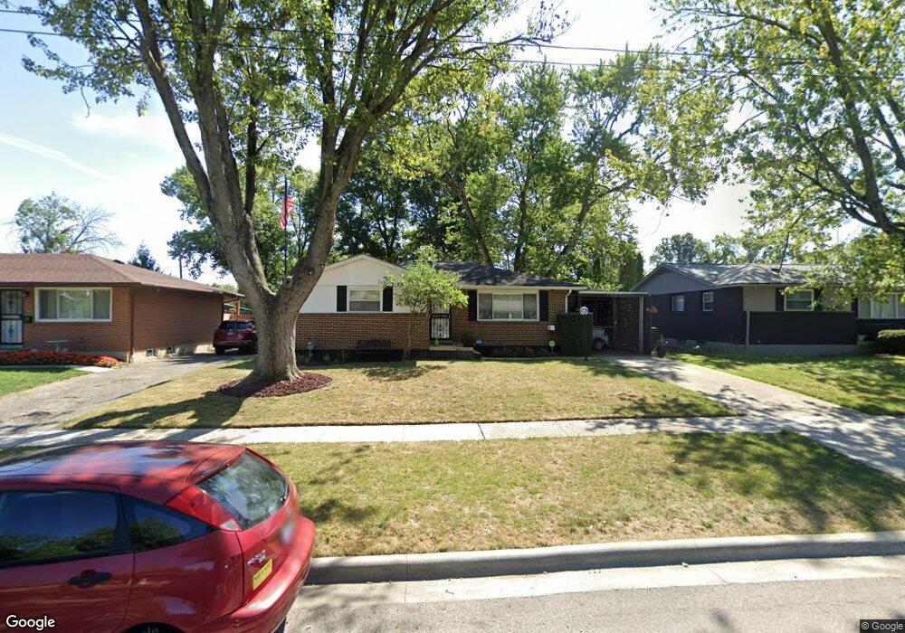
1768 Simpson Dr Columbus, OH 43227
Leawood NeighborhoodEstimated Value: $187,227 - $210,000
About This Home
This home is located at 1768 Simpson Dr, Columbus, OH 43227 and is currently estimated at $197,807, approximately $185 per square foot. 1768 Simpson Dr is a home located in Franklin County with nearby schools including Leawood Elementary School, Sherwood Middle School, and Walnut Ridge High School.
Ownership History
We collect this data history from publicly available records. To have your information removed, we recommend requesting removal directly through your county’s website.
Purchase Details
Home Financials for this Owner
Home Financials are based on the most recent Mortgage that was taken out on this home.Purchase Details
Purchase Details
Home Values in the Area
Average Home Value in this Area
Purchase History
We collect this data history from publicly available records. To have your information removed, we recommend requesting removal directly through your county’s website.
| Date | Buyer | Sale Price | Title Company |
|---|---|---|---|
| $89,900 | Talon Group | ||
| $77,900 | Foundation Title Agency Inc | ||
| $64,900 | -- |
Mortgage History
We collect this data history from publicly available records. To have your information removed, we recommend requesting removal directly through your county’s website.
| Date | Status | Borrower | Loan Amount |
|---|---|---|---|
| Open | $89,900 |
Tax History
We collect this data history from publicly available records. To have your information removed, we recommend requesting removal directly through your county’s website.
| Year | Tax Paid | Tax Assessment Tax Assessment Total Assessment is a certain percentage of the fair market value that is determined by local assessors to be the total taxable value of land and additions on the property. | Land | Improvement |
|---|---|---|---|---|
| 2025 | $2,433 | $54,220 | $16,030 | $38,190 |
| 2024 | $2,433 | $54,220 | $16,030 | $38,190 |
| 2023 | $2,402 | $54,215 | $16,030 | $38,185 |
| 2022 | $1,823 | $35,140 | $7,070 | $28,070 |
| 2021 | $1,826 | $35,140 | $7,070 | $28,070 |
| 2020 | $1,828 | $35,140 | $7,070 | $28,070 |
| 2019 | $1,686 | $27,800 | $5,640 | $22,160 |
| 2018 | $1,587 | $27,800 | $5,640 | $22,160 |
| 2017 | $1,685 | $27,800 | $5,640 | $22,160 |
| 2016 | $2,176 | $24,780 | $5,530 | $19,250 |
| 2015 | $1,490 | $24,780 | $5,530 | $19,250 |
| 2014 | $1,494 | $24,780 | $5,530 | $19,250 |
| 2013 | $867 | $29,155 | $6,510 | $22,645 |
Map
- 4475 Ellery Dr
- 4467 Ellery Dr
- 4446 Drifton Dr
- 4492 Keeler Dr
- 4487 Dundee Ave
- 4668 Belfast Dr
- 4636 Dundee Ave
- 4706 Dundee Ave
- 1585 Shady Lane Rd
- 1654 Wilton Dr
- 1547 Duffield Dr
- 1646 Clyde Place
- 4467 Grimsby Rd
- 1407 Simpson Dr
- 4303 Colby Ave
- 1422 Benson Dr
- 4530 Amesbury Rd
- 0 Groves Rd
- 0 Colvin Rd
- 1301 Bernhard Rd
- 1776 Simpson Dr
- 1784 Simpson Dr
- 1760 Simpson Dr
- 4490 Ellery Dr
- 1791 Shady Lane Rd
- 4520 Ellery Dr
- 1785 Shady Lane Rd
- 1756 Simpson Dr
- 1769 Simpson Dr
- 1779 Shady Lane Rd
- 1761 Simpson Dr
- 1777 Simpson Dr
- 1785 Simpson Dr
- 1750 Simpson Dr
- 1793 Simpson Dr
- 1773 Shady Lane Rd
- 1751 Simpson Dr
- 4509 Ellery Dr
- 4485 Ellery Dr
- 4499 Ellery Dr
Ask me questions while you tour the home.