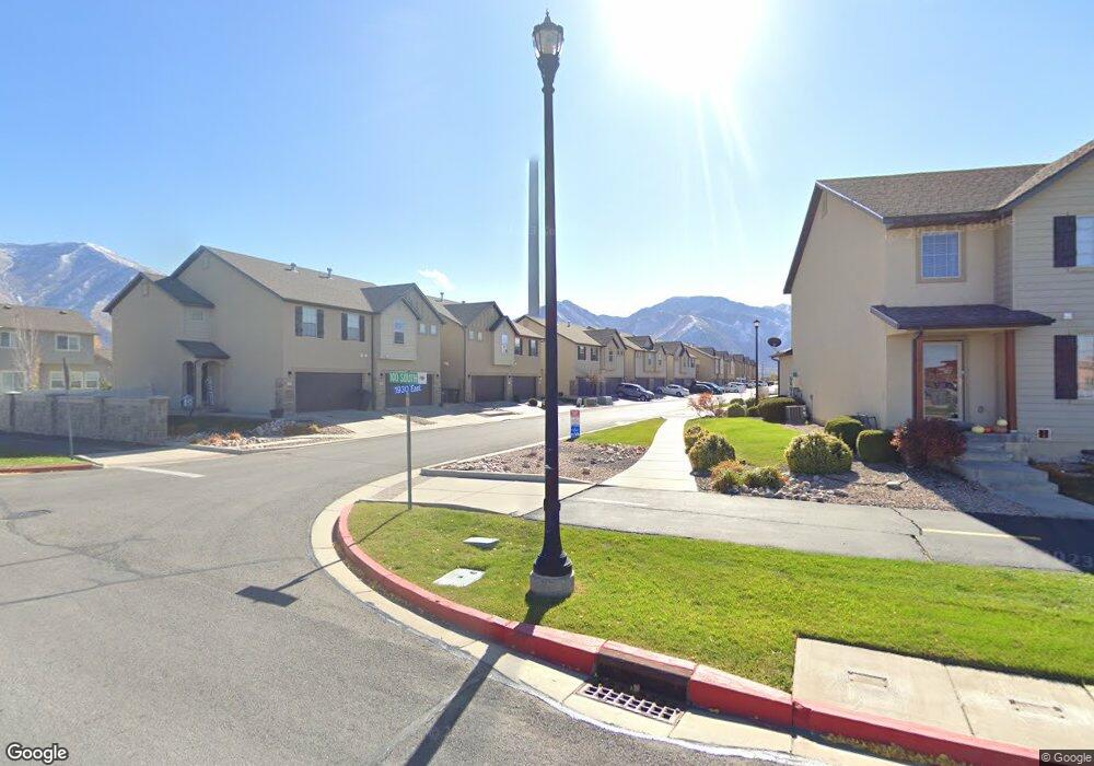
177 S 1930 E Spanish Fork, UT 84660
Estimated Value: $377,056 - $395,000
3
Beds
3
Baths
2,060
Sq Ft
$188/Sq Ft
Est. Value
About This Home
This home is located at 177 S 1930 E, Spanish Fork, UT 84660 and is currently estimated at $386,764, approximately $187 per square foot. 177 S 1930 E is a home located in Utah County with nearby schools including Sierra Bonita Elementary School, Mapleton Junior High School, and Maple Mountain High School.
Ownership History
Date
Name
Owned For
Owner Type
Purchase Details
Closed on
Sep 9, 2021
Sold by
Mcdaniel Kyle and Mcdaniel Cami
Bought by
Mcdaniel Kyle and Mcdaniel Cami
Current Estimated Value
Home Financials for this Owner
Home Financials are based on the most recent Mortgage that was taken out on this home.
Original Mortgage
$198,000
Outstanding Balance
$180,165
Interest Rate
2.8%
Mortgage Type
New Conventional
Estimated Equity
$206,599
Purchase Details
Closed on
Sep 5, 2019
Sold by
Harrison Amanda and Harrison Benjamin
Bought by
Mcdaniel Kyle and Mcdaniel Cami
Home Financials for this Owner
Home Financials are based on the most recent Mortgage that was taken out on this home.
Original Mortgage
$204,000
Interest Rate
3.6%
Purchase Details
Closed on
Feb 15, 2017
Sold by
Hamilton Colton and Smith Hannah
Bought by
Harrison Benjamin and Harrison Amanda
Home Financials for this Owner
Home Financials are based on the most recent Mortgage that was taken out on this home.
Original Mortgage
$190,000
Interest Rate
4.2%
Mortgage Type
New Conventional
Purchase Details
Closed on
Sep 13, 2016
Sold by
Scotson Arthur and Scotson Taazbaa
Bought by
Hamilton Collton and Smith Hannah
Home Financials for this Owner
Home Financials are based on the most recent Mortgage that was taken out on this home.
Original Mortgage
$192,154
Interest Rate
3.62%
Mortgage Type
FHA
Purchase Details
Closed on
May 1, 2008
Sold by
Maple Mountain Of Spanish Fork Llc
Bought by
Scotson Arthur
Home Financials for this Owner
Home Financials are based on the most recent Mortgage that was taken out on this home.
Original Mortgage
$176,081
Interest Rate
5.81%
Mortgage Type
VA
Purchase Details
Closed on
Apr 30, 2008
Sold by
Scotson Arthur
Bought by
Scotson Arthur and Scotson Taazbaa
Home Financials for this Owner
Home Financials are based on the most recent Mortgage that was taken out on this home.
Original Mortgage
$176,081
Interest Rate
5.81%
Mortgage Type
VA
Create a Home Valuation Report for This Property
The Home Valuation Report is an in-depth analysis detailing your home's value as well as a comparison with similar homes in the area
Home Values in the Area
Average Home Value in this Area
Purchase History
We collect this data history from publicly available records. To have your information removed, we recommend requesting removal directly through your county’s website.
| Date | Buyer | Sale Price | Title Company |
|---|---|---|---|
| Mcdaniel Kyle | -- | Meridian Title Compan | |
| Mcdaniel Kyle | -- | Key Land Title | |
| Harrison Benjamin | -- | Provo Land Title Co | |
| Hamilton Collton | -- | North American Title | |
| Scotson Arthur | -- | Provo Land Title Company | |
| Scotson Arthur | -- | Provo Land Title Company |
Source: Public Records
Mortgage History
We collect this data history from publicly available records. To have your information removed, we recommend requesting removal directly through your county’s website.
| Date | Status | Borrower | Loan Amount |
|---|---|---|---|
| Open | Mcdaniel Kyle | $198,000 | |
| Closed | Mcdaniel Kyle | $204,000 | |
| Previous Owner | Harrison Benjamin | $190,000 | |
| Previous Owner | Hamilton Collton | $192,154 | |
| Previous Owner | Scotson Arthur | $176,081 | |
| Previous Owner | Scotson Arthur | $4,092 |
Source: Public Records
Tax History
| Year | Tax Paid | Tax Assessment Tax Assessment Total Assessment is a certain percentage of the fair market value that is determined by local assessors to be the total taxable value of land and additions on the property. | Land | Improvement |
|---|---|---|---|---|
| 2025 | $1,991 | $200,475 | -- | -- |
| 2024 | $1,991 | $205,205 | $0 | $0 |
| 2023 | $1,941 | $200,255 | $0 | $0 |
| 2022 | $1,866 | $188,815 | $0 | $0 |
| 2021 | $1,594 | $258,100 | $38,700 | $219,400 |
| 2020 | $1,543 | $242,900 | $36,400 | $206,500 |
| 2019 | $1,431 | $237,000 | $31,000 | $206,000 |
| 2018 | $1,325 | $212,100 | $27,000 | $185,100 |
| 2017 | $1,179 | $101,420 | $0 | $0 |
| 2016 | -- | $95,700 | $0 | $0 |
| 2015 | $1,082 | $90,750 | $0 | $0 |
| 2014 | $958 | $80,685 | $0 | $0 |
Source: Public Records
Map
Nearby Homes
- 1891 E 160 S
- 1867 E 160 S
- 1821 E 230 S
- 236 S 1800 E
- 1658 Dover Dr
- 2075 E 130 N
- 1309 S 3690 E
- 2138 E 200 N Unit 54M
- 2138 E 200 N Unit 55SFM
- 2162 E 200 N Unit 56
- 51 N Spanish Fork Pkwy
- 441 S 2320 E
- 309 N 1980 E
- 2302 E 320 N Unit 41
- 2248 E 320 N Unit 44
- 2282 E 320 N Unit 42
- 2264 E 320 N Unit 43
- 2288 E 390 N Unit 34M
- 2278 E 390 N Unit 35M
- 2281 E 320 N Unit 39
Your Personal Tour Guide
Ask me questions while you tour the home.