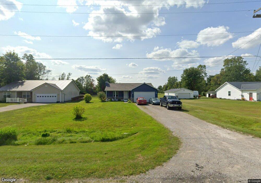
1771 Hickory Rd Kimball, MI 48074
Estimated Value: $189,000 - $259,000
3
Beds
2
Baths
1,169
Sq Ft
$193/Sq Ft
Est. Value
About This Home
This home is located at 1771 Hickory Rd, Kimball, MI 48074 and is currently estimated at $225,698, approximately $193 per square foot. 1771 Hickory Rd is a home located in St. Clair County with nearby schools including Kimball Elementary School, Central Middle School, and Port Huron High School.
Ownership History
Date
Name
Owned For
Owner Type
Purchase Details
Closed on
Aug 6, 2025
Sold by
Sebok-Strock Kimberly A
Bought by
Sebok-Strock Kimberly A and Kimberly A Sebok-Strock Revocable Living Trus
Current Estimated Value
Purchase Details
Closed on
Feb 25, 2022
Sold by
Lynn Evans-Cameron Sheree
Bought by
Cameron Randy
Home Financials for this Owner
Home Financials are based on the most recent Mortgage that was taken out on this home.
Original Mortgage
$128,000
Interest Rate
3.92%
Mortgage Type
New Conventional
Create a Home Valuation Report for This Property
The Home Valuation Report is an in-depth analysis detailing your home's value as well as a comparison with similar homes in the area
Home Values in the Area
Average Home Value in this Area
Purchase History
| Date | Buyer | Sale Price | Title Company |
|---|---|---|---|
| Sebok-Strock Kimberly A | -- | None Listed On Document | |
| Cameron Randy | -- | New Title Company Name |
Source: Public Records
Mortgage History
| Date | Status | Borrower | Loan Amount |
|---|---|---|---|
| Previous Owner | Cameron Randy | $128,000 |
Source: Public Records
Tax History
| Year | Tax Paid | Tax Assessment Tax Assessment Total Assessment is a certain percentage of the fair market value that is determined by local assessors to be the total taxable value of land and additions on the property. | Land | Improvement |
|---|---|---|---|---|
| 2025 | $796 | $105,300 | $0 | $0 |
| 2024 | $773 | $95,900 | $0 | $0 |
| 2023 | $708 | $93,300 | $0 | $0 |
| 2022 | $1,219 | $76,800 | $0 | $0 |
| 2020 | $1,117 | $71,000 | $71,000 | $0 |
| 2019 | $1,079 | $57,800 | $0 | $0 |
| 2018 | $1,054 | $56,700 | $0 | $0 |
| 2017 | $1,042 | $52,400 | $0 | $0 |
| 2016 | $576 | $52,400 | $0 | $0 |
| 2015 | -- | $50,500 | $50,500 | $0 |
| 2014 | -- | $40,500 | $40,500 | $0 |
| 2013 | -- | $51,800 | $0 | $0 |
Source: Public Records
Map
Nearby Homes
- V/L Allen
- 1604 Allen Rd
- 1906 Morningstar Ave
- 1786 Omar Rd
- 1814 Leland Rd
- 2007 Edward Ln E
- 0 Allen Rd Unit 20250008597
- 0 Allen Rd Unit 20250008612
- 2047 Edward Ln E
- 00 Howard Rd
- 00 Griswold Rd
- 6154 Birch Creek Ct
- 0 Wadhams Rd Unit 50155021
- 1405 Range Rd
- 5117 Ravenswood Rd
- 00 Range Rd
- 0000 Range Rd
- 0 Lapeer Rd Unit 50137357
- 0 Ravenswood Rd Unit 20251017048
- 0000 Ravenswood Rd
- 1769 Hickory Rd
- 1785 Hickory Rd
- 1791 Hickory Rd
- 1786 Hickory Rd
- 1813 Hickory Rd
- 1796 Hickory Rd
- 1810 Hickory Rd
- 1823 Hickory Rd
- 1820 Hickory Rd
- 1833 Hickory Rd
- 1834 Hickory Rd
- 1840 Hickory Rd
- 1853 Hickory Rd
- 1857 Hickory Rd
- 1852 Hickory Rd
- 1859 Hickory Rd
- 1862 Hickory Rd
- 1869 Hickory Rd
- 1866 Hickory Rd
- 1883 Hickory Rd Unit Bldg-Unit
Your Personal Tour Guide
Ask me questions while you tour the home.