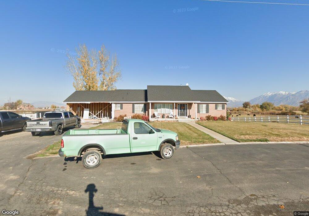
1776 W 6800 S Spanish Fork, UT 84660
Estimated Value: $842,000 - $1,433,296
5
Beds
5
Baths
2,329
Sq Ft
$488/Sq Ft
Est. Value
About This Home
This home is located at 1776 W 6800 S, Spanish Fork, UT 84660 and is currently estimated at $1,137,648, approximately $488 per square foot. 1776 W 6800 S is a home with nearby schools including Brockbank Elementary School, Spanish Fork Jr High School, and Spanish Fork High School.
Ownership History
Date
Name
Owned For
Owner Type
Purchase Details
Closed on
Jun 8, 2015
Sold by
Beck Bill L and Beck Linda L
Bought by
Beck William L and Beck Linda L
Current Estimated Value
Create a Home Valuation Report for This Property
The Home Valuation Report is an in-depth analysis detailing your home's value as well as a comparison with similar homes in the area
Purchase History
| Date | Buyer | Sale Price | Title Company |
|---|---|---|---|
| Beck William L | -- | Security Title & Abstract | |
| Beck Bill L | -- | Security Title & Abstract |
Source: Public Records
Tax History
| Year | Tax Paid | Tax Assessment Tax Assessment Total Assessment is a certain percentage of the fair market value that is determined by local assessors to be the total taxable value of land and additions on the property. | Land | Improvement |
|---|---|---|---|---|
| 2025 | $3,849 | $453,095 | -- | -- |
| 2024 | $3,849 | $384,721 | $0 | $0 |
| 2023 | $3,899 | $390,019 | $0 | $0 |
| 2022 | $3,073 | $852,100 | $427,200 | $424,900 |
| 2021 | $2,685 | $611,600 | $291,000 | $320,600 |
| 2020 | $2,417 | $571,500 | $250,900 | $320,600 |
| 2019 | $2,184 | $488,300 | $195,900 | $292,400 |
| 2018 | $2,094 | $439,900 | $175,900 | $264,000 |
| 2017 | $2,024 | $157,373 | $0 | $0 |
| 2016 | $2,241 | $168,928 | $0 | $0 |
| 2015 | $2,140 | $159,980 | $0 | $0 |
| 2014 | $2,141 | $160,107 | $0 | $0 |
Source: Public Records
Map
Nearby Homes
- 6829 S River Ln
- 1996 W 6800 S
- 2022 W 6800 S
- 6538 S River Dr
- 6538 S River Ln
- 619 W 6800 St S
- 7076 S River Ln
- 1797 W 6400 S
- 1733 W 6400 S
- 6464 S River Ln
- 6425 S River Ln
- 7106 S River Ln
- 2135 W 6800 S
- 1347 S River Ln
- 1139 S River Ln
- 1117 S River Ln
- 886 S River Ln
- 5006 S River Dr
- 2156 W 6800 S
- 1875 W 6400 S
Your Personal Tour Guide
Ask me questions while you tour the home.