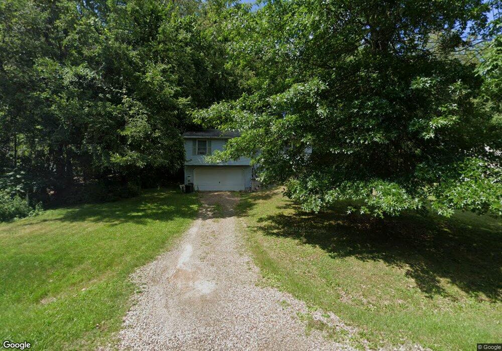
1777 Barnes Dr Wooster, OH 44691
Estimated Value: $191,737 - $229,000
3
Beds
1
Bath
1,052
Sq Ft
$205/Sq Ft
Est. Value
About This Home
This home is located at 1777 Barnes Dr, Wooster, OH 44691 and is currently estimated at $215,434, approximately $204 per square foot. 1777 Barnes Dr is a home located in Wayne County with nearby schools including Triway High School, St Mary Of Immaculate Conception School, and Montessori School of Wooster.
Ownership History
Date
Name
Owned For
Owner Type
Purchase Details
Closed on
Jan 5, 2024
Sold by
Patrick Rose M
Bought by
Weakley Shirley J
Current Estimated Value
Purchase Details
Closed on
Apr 23, 1998
Sold by
Ambilt Corp
Bought by
Patrick Rose M
Home Financials for this Owner
Home Financials are based on the most recent Mortgage that was taken out on this home.
Original Mortgage
$17,000
Interest Rate
7.26%
Mortgage Type
New Conventional
Purchase Details
Closed on
Dec 15, 1997
Sold by
Barnes Clarence R
Bought by
Ambilt Corp
Create a Home Valuation Report for This Property
The Home Valuation Report is an in-depth analysis detailing your home's value as well as a comparison with similar homes in the area
Home Values in the Area
Average Home Value in this Area
Purchase History
| Date | Buyer | Sale Price | Title Company |
|---|---|---|---|
| Weakley Shirley J | -- | None Listed On Document | |
| Patrick Rose M | $17,000 | -- | |
| Ambilt Corp | $14,000 | -- |
Source: Public Records
Mortgage History
| Date | Status | Borrower | Loan Amount |
|---|---|---|---|
| Previous Owner | Patrick Rose M | $17,000 |
Source: Public Records
Tax History
| Year | Tax Paid | Tax Assessment Tax Assessment Total Assessment is a certain percentage of the fair market value that is determined by local assessors to be the total taxable value of land and additions on the property. | Land | Improvement |
|---|---|---|---|---|
| 2025 | $1,951 | $52,370 | $11,830 | $40,540 |
| 2024 | $1,951 | $52,370 | $11,830 | $40,540 |
| 2023 | $2,352 | $52,370 | $11,830 | $40,540 |
| 2022 | $2,314 | $41,890 | $9,460 | $32,430 |
| 2021 | $2,133 | $41,890 | $9,460 | $32,430 |
| 2020 | $1,647 | $41,890 | $9,460 | $32,430 |
| 2019 | $2,075 | $38,400 | $7,250 | $31,150 |
| 2018 | $2,069 | $38,400 | $7,250 | $31,150 |
| 2017 | $2,043 | $38,400 | $7,250 | $31,150 |
| 2016 | $1,999 | $36,920 | $7,250 | $29,670 |
| 2015 | $1,965 | $36,920 | $7,250 | $29,670 |
| 2014 | $1,966 | $36,920 | $7,250 | $29,670 |
| 2013 | $2,148 | $34,470 | $7,770 | $26,700 |
Source: Public Records
Map
Nearby Homes
- 1330 Columbus Rd
- 1350 Blachleyville Rd
- 0 Heyl Rd
- 2585 Greenbriar Ln
- 2508 Prairie Ln
- 5 E Melrose Unit 5
- 3574 Batdorf Rd
- 2535 Millersburg Rd
- 323 N Grant St
- 227 N Walnut St
- 739 Western Dr
- 4859 Prosperity Way
- 223 E Larwill St
- 423 N Market St
- 1026 Douglas Dr
- 753 N Grant St
- 851 Park Blvd
- 708 N Bever St
- 900 Quinby Ave
- 189 Billiar St
Your Personal Tour Guide
Ask me questions while you tour the home.