
17785 Wilt Rd Sisters, OR 97759
Estimated payment $7,610/month
Highlights
- Panoramic View
- 156.96 Acre Lot
- Outdoor Water Feature
- Sisters Elementary School Rated A-
- Wooded Lot
- No HOA
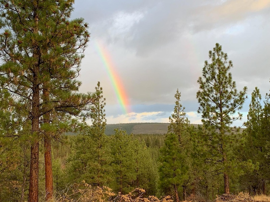
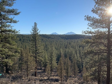
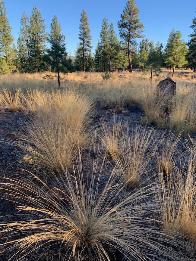
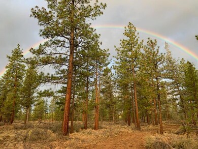
About This Lot
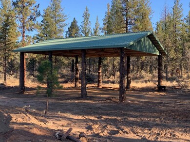
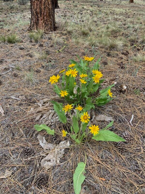
This showcase acreage is like no other. 3 adjoining pieces make up this square -156 acre slice of your own private Heaven. One well is drilled, and will bring forth approximately 48 gallons per minute of the purest water on the planet when you're ready. Pond and graveled driveway at one of the prime residence locations on-site; with pump & solar battery house along with a pole barn right there too. Deer, Elk, Bear, Turkeys, and an abundance of native plants & animals. This is one of those truly rare properties you just cannot find elsewhere so near Sisters; yet so far removed and private.

Property Details
Property Type
- Land
Est. Annual Taxes
- $667
Lot Details
- 156.96 Acre Lot
- Dirt Road
- Native Plants
- Wooded Lot
- Garden
- Additional Parcels
- Zoning described as F2
Property Views
- Pond
- Panoramic
- Canyon
- Ridge
- Mountain
- Forest
Schools
- Sisters Elementary School
- Sisters Middle School
- Sisters High School
Utilities
- Private Water Source
- Well
- Septic Needed
Additional Features
- Solar owned by seller
- Mobile Home Allowed
Listing and Financial Details
- Assessor Parcel Number 135720
Community Details
Overview
- No Home Owners Association
- Property is near a preserve or public land
Recreation
- Trails
- Outdoor Water Feature
Map
Tax History
We collect this data history from publicly available records. To have your information removed, we recommend requesting removal directly through your county’s website.
| Year | Tax Paid | Tax Assessment Tax Assessment Total Assessment is a certain percentage of the fair market value that is determined by local assessors to be the total taxable value of land and additions on the property. | Land | Improvement |
|---|---|---|---|---|
| 2025 | $376 | $8,847 | $8,847 | -- |
| 2024 | $373 | $8,589 | $8,589 | -- |
| 2023 | $386 | $8,339 | $8,339 | $0 |
| 2022 | $297 | $7,862 | $0 | $0 |
| 2021 | $295 | $7,633 | $0 | $0 |
| 2020 | $267 | $7,633 | $0 | $0 |
| 2019 | $271 | $7,411 | $0 | $0 |
| 2018 | $264 | $7,195 | $0 | $0 |
| 2017 | $259 | $6,986 | $0 | $0 |
| 2016 | $265 | $5,850 | $0 | $0 |
| 2015 | $260 | $5,850 | $0 | $0 |
| 2014 | $222 | $5,850 | $0 | $0 |
Property History
We collect this data history from publicly available records. To have your information removed, we recommend requesting removal directly through your county’s website.
| Date | Event | Price | List to Sale | Price per Sq Ft | Prior Sale |
|---|---|---|---|---|---|
| 09/25/2025 09/25/25 | Price Changed | $1,400,000 | +12.0% | -- | |
| 09/19/2025 09/19/25 | Price Changed | $1,250,000 | -21.9% | -- | |
| 04/09/2024 04/09/24 | For Sale | $1,600,000 | +704.0% | -- | |
| 02/23/2018 02/23/18 | Sold | $199,000 | 0.0% | -- | View Prior Sale |
| 01/05/2018 01/05/18 | Pending | -- | -- | -- | |
| 03/21/2016 03/21/16 | For Sale | $199,000 | -- | -- |
Purchase History
We collect this data history from publicly available records. To have your information removed, we recommend requesting removal directly through your county’s website.
| Date | Type | Sale Price | Title Company |
|---|---|---|---|
| Warranty Deed | -- | None Listed On Document | |
| Special Warranty Deed | -- | Western Title & Escrow |
Mortgage History
We collect this data history from publicly available records. To have your information removed, we recommend requesting removal directly through your county’s website.
| Date | Status | Loan Amount | Loan Type |
|---|---|---|---|
| Previous Owner | $155,000 | Commercial |
Source: Oregon Datashare
MLS Number: 220180286
APN: 135720
Disclaimer: Certain information contained herein is derived from information provided by parties other than Homes.com. All information provided is deemed reliable, but is not guaranteed to be accurate and should be independently verified.
![]() © 2026 Oregon Datashare (KCAR | MLSCO | SOMLS). All rights reserved. The data relating to real estate for sale on this web site comes in part from the Internet Data Exchange Program of the Oregon Datashare. Real estate listings held by IDX Brokerage firms other than Ten-X are marked with the Internet Data Exchange logo or the Internet Data Exchange thumbnail logo and detailed information about them includes the name of the listing Brokers. Information provided is for consumers' personal, non-commercial use and may not be used for any purpose other than to identify prospective properties the viewer may be interested in purchasing. The consumer will not copy, retransmit nor redistribute any of the content from this website. Information provided is deemed reliable, but not guaranteed.
© 2026 Oregon Datashare (KCAR | MLSCO | SOMLS). All rights reserved. The data relating to real estate for sale on this web site comes in part from the Internet Data Exchange Program of the Oregon Datashare. Real estate listings held by IDX Brokerage firms other than Ten-X are marked with the Internet Data Exchange logo or the Internet Data Exchange thumbnail logo and detailed information about them includes the name of the listing Brokers. Information provided is for consumers' personal, non-commercial use and may not be used for any purpose other than to identify prospective properties the viewer may be interested in purchasing. The consumer will not copy, retransmit nor redistribute any of the content from this website. Information provided is deemed reliable, but not guaranteed.
- 18070 Mountain View Rd
- 17127 Mountain View Rd
- 17945 Mountain View Rd
- 17720 Mountain View Rd
- 70266 Sorrell Dr
- 17400 Spur Dr
- 17584 Mountain View Rd
- 70160 Mustang Dr
- 70116 Appaloosa Dr
- 70129 Cayuse Dr
- 70085 Cayuse Dr
- 70064 Appaloosa Dr
- 70060 Annies Dr
- 70030 Annies Dr
- 16959 Canyon Crest Dr
- 16611 Wilt Rd
- 18150 Wanona Rd
- 16514 Wren Ln
- 16431 Marmott Ln
- 69592 Lake Dr
- 14836 Saddle Horn
- 930 W Felicity Ln Unit 105, Building A
- 210 N Woodson St
- 675 N Reed St
- 14579 Crossroads Loop
- 67430 Harrington Loop Rd
- 6690 Old Ranch House Rd
- 11108 Desert Sky Loop Unit SI ID1550262P
- 11136 Desert Sky Loop
- 1277 Highland View Loop
- 1140 Golden Pheasant Dr
- 8464 Forest Ridge Loop
- 2500 SW 83rd St
- 2960 NW Northwest Way
- 333 SW 35th St
- 2582 NW Kingwood Ave
- 2297 NW Maple Ave
- 65601 Us-20
- 4083 SW Obsidian Place
- 612 NW 25th St
Ask me questions while you tour the home.