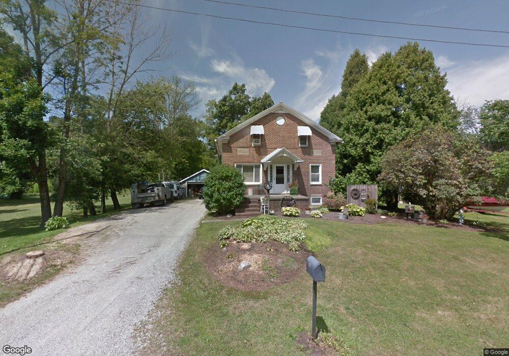
1781 Windsor Rd Mansfield, OH 44905
Estimated Value: $188,000 - $225,000
4
Beds
2
Baths
1,617
Sq Ft
$124/Sq Ft
Est. Value
About This Home
This home is located at 1781 Windsor Rd, Mansfield, OH 44905 and is currently estimated at $199,923, approximately $123 per square foot. 1781 Windsor Rd is a home located in Richland County with nearby schools including Madison High School, St. Mary Catholic School, and Temple-Christian School.
Ownership History
Date
Name
Owned For
Owner Type
Purchase Details
Closed on
May 13, 2015
Sold by
Cox Mark A and Cox Amy N
Bought by
Cox Mark A and Cox Amy N
Current Estimated Value
Home Financials for this Owner
Home Financials are based on the most recent Mortgage that was taken out on this home.
Original Mortgage
$72,400
Outstanding Balance
$23,415
Interest Rate
2.95%
Mortgage Type
New Conventional
Estimated Equity
$176,508
Purchase Details
Closed on
Aug 2, 1995
Sold by
Boyd Walter J
Bought by
Cox Mark A and Cox Amy N
Create a Home Valuation Report for This Property
The Home Valuation Report is an in-depth analysis detailing your home's value as well as a comparison with similar homes in the area
Home Values in the Area
Average Home Value in this Area
Purchase History
We collect this data history from publicly available records. To have your information removed, we recommend requesting removal directly through your county’s website.
| Date | Buyer | Sale Price | Title Company |
|---|---|---|---|
| Cox Mark A | -- | Southern Title | |
| Cox Mark A | $70,000 | -- |
Source: Public Records
Mortgage History
We collect this data history from publicly available records. To have your information removed, we recommend requesting removal directly through your county’s website.
| Date | Status | Borrower | Loan Amount |
|---|---|---|---|
| Open | Cox Mark A | $72,400 |
Source: Public Records
Tax History
| Year | Tax Paid | Tax Assessment Tax Assessment Total Assessment is a certain percentage of the fair market value that is determined by local assessors to be the total taxable value of land and additions on the property. | Land | Improvement |
|---|---|---|---|---|
| 2025 | $2,258 | $45,630 | $5,190 | $40,440 |
| 2024 | $2,258 | $45,630 | $5,190 | $40,440 |
| 2023 | $2,306 | $45,630 | $5,190 | $40,440 |
| 2022 | $1,697 | $30,930 | $4,160 | $26,770 |
| 2021 | $1,696 | $30,930 | $4,160 | $26,770 |
| 2020 | $1,709 | $30,930 | $4,160 | $26,770 |
| 2019 | $1,549 | $26,160 | $3,490 | $22,670 |
| 2018 | $1,536 | $26,160 | $3,490 | $22,670 |
| 2017 | $1,487 | $26,160 | $3,490 | $22,670 |
| 2016 | $1,467 | $24,870 | $3,320 | $21,550 |
| 2015 | $1,467 | $24,870 | $3,320 | $21,550 |
| 2014 | $1,476 | $24,870 | $3,320 | $21,550 |
| 2012 | $712 | $26,180 | $3,490 | $22,690 |
Source: Public Records
Map
Nearby Homes
- 1860 Hulit Rd
- 2037 Windsor Rd
- 1978 Outer Dr
- 0 Willow Dr
- 1779 Ashland Rd
- 1886 Beal Rd
- 690 Ashland Rd
- 2264 Crider Rd
- 1508 Beal Rd
- 1106 Oakdale Dr
- 1053 Reed Rd
- 987 Becky Dr
- 1636 N Stewart Rd
- 1123 Fleming Falls Rd
- 1245 N Stewart Rd
- 961 Neil Cir N
- 951 Dresden Dr
- 1425 County Road 1688
- 888 Beal Rd
- 620 Running Brook Way
- 1771 Windsor Rd
- 1784 Windsor Rd
- 1742 Windsor Rd Unit A
- 0 Hulit Rd
- 0 Norris Rd
- 1992 Hulit Rd
- 1951 Trolley Dr
- 2023 Hulit Rd
- 1806 Windsor Rd
- 2007 Hulit Rd
- 1740 Windsor Rd
- 1976 Hulit Rd
- 1999 Hulit Rd
- 2049 Norris Rd
- 1739 Windsor Rd
- 1941 Trolley Dr
- 1989 Hulit Rd
- 1724 Windsor Rd
- 2050 Norris Rd
- 1933 Trolley Dr
Your Personal Tour Guide
Ask me questions while you tour the home.