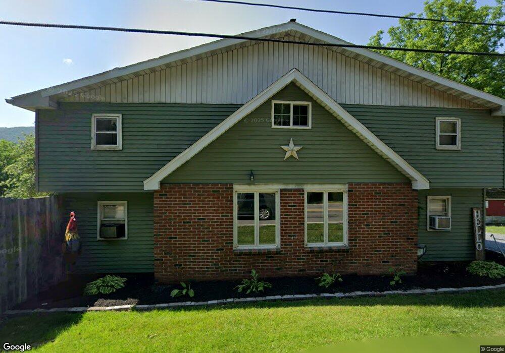
1785 Lower Smith Gap Rd Kunkletown, PA 18058
Estimated Value: $363,000 - $386,000
3
Beds
2
Baths
1,732
Sq Ft
$216/Sq Ft
Est. Value
About This Home
This home is located at 1785 Lower Smith Gap Rd, Kunkletown, PA 18058 and is currently estimated at $374,500, approximately $216 per square foot. 1785 Lower Smith Gap Rd is a home located in Carbon County with nearby schools including Palmerton Area High School.
Ownership History
Date
Name
Owned For
Owner Type
Purchase Details
Closed on
Aug 9, 2021
Sold by
Redshaw Glenn R
Bought by
Lorah Aaron C and King Katelin A
Current Estimated Value
Home Financials for this Owner
Home Financials are based on the most recent Mortgage that was taken out on this home.
Original Mortgage
$217,000
Outstanding Balance
$197,320
Interest Rate
2.9%
Mortgage Type
Future Advance Clause Open End Mortgage
Estimated Equity
$177,180
Purchase Details
Closed on
Jan 27, 1987
Bought by
Redshaw Robert W and Redshaw Viola
Create a Home Valuation Report for This Property
The Home Valuation Report is an in-depth analysis detailing your home's value as well as a comparison with similar homes in the area
Home Values in the Area
Average Home Value in this Area
Purchase History
| Date | Buyer | Sale Price | Title Company |
|---|---|---|---|
| Lorah Aaron C | $237,000 | Carbon Search & Stlmt Svcs I | |
| Redshaw Robert W | $105,000 | -- |
Source: Public Records
Mortgage History
| Date | Status | Borrower | Loan Amount |
|---|---|---|---|
| Open | Lorah Aaron C | $217,000 |
Source: Public Records
Tax History
| Year | Tax Paid | Tax Assessment Tax Assessment Total Assessment is a certain percentage of the fair market value that is determined by local assessors to be the total taxable value of land and additions on the property. | Land | Improvement |
|---|---|---|---|---|
| 2025 | $3,511 | $40,822 | $1,272 | $39,550 |
| 2024 | $3,283 | $40,822 | $1,272 | $39,550 |
| 2023 | $3,170 | $40,822 | $1,272 | $39,550 |
| 2022 | $3,929 | $53,100 | $13,550 | $39,550 |
| 2021 | $3,804 | $53,100 | $13,550 | $39,550 |
| 2020 | $3,750 | $53,100 | $13,550 | $39,550 |
| 2019 | $3,644 | $53,100 | $13,550 | $39,550 |
| 2018 | $3,644 | $53,100 | $13,550 | $39,550 |
| 2017 | $3,578 | $53,100 | $13,550 | $39,550 |
| 2016 | -- | $53,100 | $13,550 | $39,550 |
| 2015 | -- | $53,100 | $13,550 | $39,550 |
| 2014 | -- | $53,100 | $13,550 | $39,550 |
Source: Public Records
Map
Nearby Homes
- 15 Chestnut Ridge Cir
- 0 Co Line & Lr 45052 Unit PM-137915
- 295 Railbed Trail
- 1357 N Cottonwood Rd
- 3225 Delps Rd
- 3088 Delps Rd
- 3749 Mountain View Dr
- 0 Mountain View Dr Unit 769079
- 0 Olive Rd
- Lot 38 Woodview Hills
- 150 Red Oak Dr
- 3045 W Scenic Dr
- 1850 Spruce Hollow Rd
- 4083 W Mountain View Dr
- 3983 Hastings Rd
- 1412 Heytesbury Rd
- 1410 Heytesbury Rd
- 355 Hickory Rd
- 1089 Walnut Dr
- 4162 Bunker Hill Ln W
- 1730 Lower Smith Gap Rd
- 1844 Lower Smith Gap Rd
- 1905 Lower Smith Gap Rd
- 1670 Lower Smith Gap Rd
- 1925 Lower Smith Gap Rd
- 1945 Lower Smith Gap Rd
- 1885 Lower Smith Gap Rd
- 1960 Lower Smith Gap Rd
- 1965 Lower Smith Gap Rd
- 1980 Lower Smith Gap Rd
- 75 Whitetail Ln
- 1645 Lower Smith Gap Rd
- 12 Chestnut Ridge Cir
- 2 Chestnut Ridge Cir
- 2 Chestnut Ridge Cir Unit Lot 2
- 1 Chestnut Ridge Cir
- 1830 Lower Smith Gap Rd
- 205 Whitetail Ln
- 14 Chestnut Ridge Cir
- 10 Chestnut Ridge Cir
Your Personal Tour Guide
Ask me questions while you tour the home.