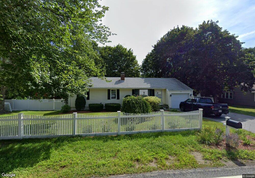
179 Maple St West Boylston, MA 01583
Estimated Value: $457,757 - $483,000
3
Beds
2
Baths
1,056
Sq Ft
$441/Sq Ft
Est. Value
About This Home
This home is located at 179 Maple St, West Boylston, MA 01583 and is currently estimated at $465,939, approximately $441 per square foot. 179 Maple St is a home located in Worcester County with nearby schools including Major Edwards Elementary School, West Boylston Junior/Senior High School, and Abby Kelley Foster Charter Public School.
Ownership History
Date
Name
Owned For
Owner Type
Purchase Details
Closed on
Jul 1, 2011
Sold by
Drew Kathleen E and Early Maureen E
Bought by
Rukakoski Mark W and Rukakoski Kathryn C
Current Estimated Value
Home Financials for this Owner
Home Financials are based on the most recent Mortgage that was taken out on this home.
Original Mortgage
$205,943
Outstanding Balance
$139,932
Interest Rate
4.25%
Mortgage Type
FHA
Estimated Equity
$326,008
Create a Home Valuation Report for This Property
The Home Valuation Report is an in-depth analysis detailing your home's value as well as a comparison with similar homes in the area
Home Values in the Area
Average Home Value in this Area
Purchase History
| Date | Buyer | Sale Price | Title Company |
|---|---|---|---|
| Rukakoski Mark W | $211,300 | -- |
Source: Public Records
Mortgage History
| Date | Status | Borrower | Loan Amount |
|---|---|---|---|
| Open | Rukakoski Mark W | $205,943 |
Source: Public Records
Tax History
| Year | Tax Paid | Tax Assessment Tax Assessment Total Assessment is a certain percentage of the fair market value that is determined by local assessors to be the total taxable value of land and additions on the property. | Land | Improvement |
|---|---|---|---|---|
| 2025 | $57 | $412,000 | $94,100 | $317,900 |
| 2024 | $5,582 | $377,700 | $94,100 | $283,600 |
| 2023 | $5,500 | $353,000 | $93,500 | $259,500 |
| 2022 | $5,182 | $293,100 | $93,500 | $199,600 |
| 2021 | $5,027 | $272,300 | $89,700 | $182,600 |
| 2020 | $4,929 | $265,300 | $89,700 | $175,600 |
| 2019 | $4,624 | $245,300 | $89,700 | $155,600 |
| 2018 | $4,416 | $235,900 | $89,700 | $146,200 |
| 2017 | $3,931 | $209,100 | $89,700 | $119,400 |
| 2016 | $3,847 | $208,500 | $83,500 | $125,000 |
| 2015 | $3,683 | $200,800 | $82,600 | $118,200 |
Source: Public Records
Map
Nearby Homes
- 1 Highland Ave
- 6 Meadowbrook Dr
- 12 Whispering Pine Cir Unit 12
- 149 Woodland St
- 44 Angell Brook Dr
- 33 Santoro Rd
- 47 Eustis St
- 1110 W Boylston St Unit A
- 16 Beale St
- 12 Beale St
- 10 Beale St
- 22 Apthorp St
- 154 Prospect St
- 504 Prospect St
- 26 Danielles Way
- 31 Danielles Way
- 239 Woodland St Unit 3
- 38 Juniper Ln
- 31 Montana Dr
- 113 Newton St
- 181 Maple St
- 175 Maple St
- 118-2&3 Maple St
- 15 Valley Forge Cir
- 19 Valley Forge Cir
- 178 Maple St
- 187 Maple St
- 188 Maple St
- 171 Maple St
- 166 Maple St
- 8-A Valley Forge Cir
- 11 Valley Forge Cir
- 25 Valley Forge Cir
- 190 Maple St
- 11 Lexington Dr
- 170 Maple St
- 17 Lexington Dr
- 9 Valley Forge Cir
- 14 Valley Forge Cir
- 167 Maple St
Your Personal Tour Guide
Ask me questions while you tour the home.