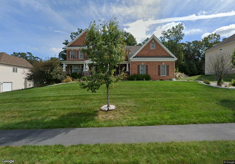
179 Mohawk Path Holliston, MA 01746
Holliston AreaEstimated Value: $1,588,000 - $1,874,000
About This Home
This home is located at 179 Mohawk Path, Holliston, MA 01746 and is currently estimated at $1,746,447, approximately $324 per square foot. 179 Mohawk Path is a home with nearby schools including Placentino Elementary School, Miller Elementary School, and Robert H. Adams Middle School.
Ownership History
We collect this data history from publicly available records. To have your information removed, we recommend requesting removal directly through your county’s website.
Purchase Details
Purchase Details
Home Financials for this Owner
Home Financials are based on the most recent Mortgage that was taken out on this home.Home Values in the Area
Average Home Value in this Area
Purchase History
We collect this data history from publicly available records. To have your information removed, we recommend requesting removal directly through your county’s website.
| Date | Buyer | Sale Price | Title Company |
|---|---|---|---|
| -- | -- | ||
| $1,073,125 | -- |
Mortgage History
We collect this data history from publicly available records. To have your information removed, we recommend requesting removal directly through your county’s website.
| Date | Status | Borrower | Loan Amount |
|---|---|---|---|
| Open | $550,000 | ||
| Previous Owner | $643,875 |
Tax History
We collect this data history from publicly available records. To have your information removed, we recommend requesting removal directly through your county’s website.
| Year | Tax Paid | Tax Assessment Tax Assessment Total Assessment is a certain percentage of the fair market value that is determined by local assessors to be the total taxable value of land and additions on the property. | Land | Improvement |
|---|---|---|---|---|
| 2025 | $22,319 | $1,523,500 | $274,600 | $1,248,900 |
| 2024 | $22,113 | $1,468,300 | $274,600 | $1,193,700 |
| 2023 | $20,999 | $1,363,600 | $274,600 | $1,089,000 |
| 2022 | $19,236 | $1,106,800 | $274,600 | $832,200 |
| 2021 | $21,136 | $1,184,100 | $259,600 | $924,500 |
| 2020 | $20,976 | $1,112,800 | $254,900 | $857,900 |
| 2019 | $20,811 | $1,105,200 | $247,300 | $857,900 |
| 2018 | $20,634 | $1,105,200 | $247,300 | $857,900 |
| 2017 | $19,952 | $1,077,300 | $260,000 | $817,300 |
| 2016 | $9,812 | $522,200 | $243,000 | $279,200 |
| 2015 | $1,545 | $79,700 | $79,700 | $0 |
Map
- 120 Mohawk Path
- 9 Adams Ln Unit 9
- 1 Adams Ln Unit 1
- 1 Adams Ln Unit 1
- 7 Adams Ln Unit 7
- 14 Millstone Dr
- 2 Whitney Dr
- 7 Sherborne Cir
- 3 Danforth Dr
- 251 Trailside Way
- 11 Curve St
- 177 Maple St
- 73 Trailside Way
- 147 Turner Rd Unit 73
- 152 Turner Rd Unit 38
- 135 Locust St
- 146 Mountain Gate Rd
- 89 Leland Farm Rd Unit 89
- 125 Leland Farm Rd Unit 125
- 245 Eliot St Unit 245
- 175 Mohawk Path
- 183 Mohawk Path Unit lot 87
- 183 Mohawk Path
- 187 Mohawk Path
- 180 Mohawk Path
- 176 Mohawk Path
- 169 Mohawk Path
- 172 Mohawk Path
- 172 Mohawk Path Unit 74
- 89 Mohawk Path Unit 89
- 88 Mohawk Path Unit 88
- 32 Hiawatha Trail
- 168 Mohawk Path
- Lot 56 Hiawatha Trail
- 195 Mohawk Path
- 195 Mohawk Path
- 195 Mohawk Path Unit 85
- 186 Mohawk Path Unit Lot 77
- 186 Mohawk Path Unit 186
- 29 Hiawatha Trail
Ask me questions while you tour the home.