Estimated Value: $325,621 - $377,000
4
Beds
3
Baths
1,803
Sq Ft
$194/Sq Ft
Est. Value
About This Home
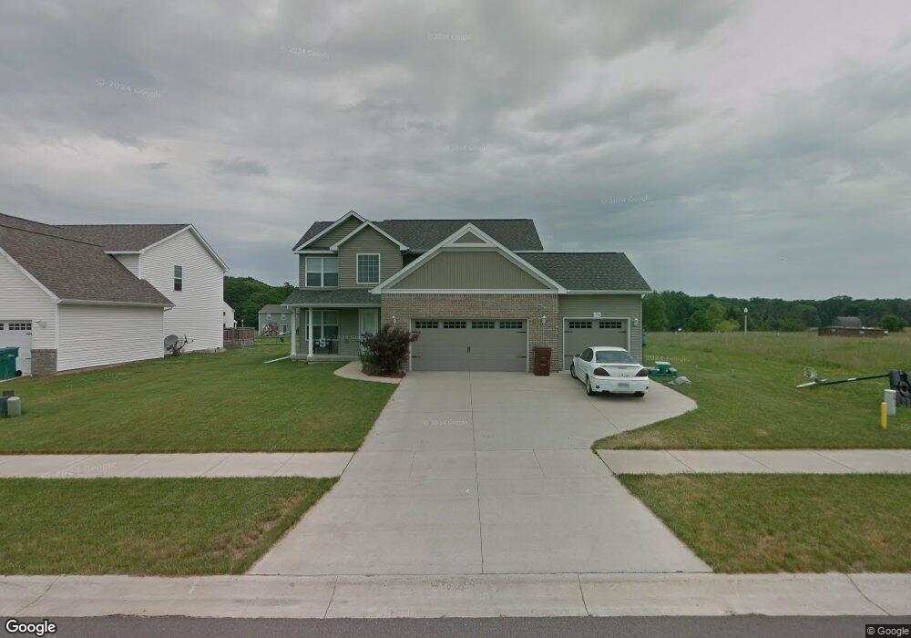
This home is located at 1796 Merganser Dr, Holt, MI 48842 and is currently estimated at $349,655, approximately $193 per square foot. 1796 Merganser Dr is a home located in Ingham County with nearby schools including Horizon Elementary School, Washington Woods Middle School, and Holt Junior High School.
Ownership History
Date
Name
Owned For
Owner Type
Purchase Details
Closed on
Sep 5, 2007
Sold by
Delhi Inc
Bought by
Betts Demond
Current Estimated Value
Home Financials for this Owner
Home Financials are based on the most recent Mortgage that was taken out on this home.
Original Mortgage
$207,500
Outstanding Balance
$131,778
Interest Rate
6.63%
Mortgage Type
Purchase Money Mortgage
Estimated Equity
$217,877
Create a Home Valuation Report for This Property
The Home Valuation Report is an in-depth analysis detailing your home's value as well as a comparison with similar homes in the area
Home Values in the Area
Average Home Value in this Area
Purchase History
We collect this data history from publicly available records. To have your information removed, we recommend requesting removal directly through your county’s website.
| Date | Buyer | Sale Price | Title Company |
|---|---|---|---|
| Betts Demond | $40,000 | Bell Title Company |
Source: Public Records
Mortgage History
We collect this data history from publicly available records. To have your information removed, we recommend requesting removal directly through your county’s website.
| Date | Status | Borrower | Loan Amount |
|---|---|---|---|
| Open | Betts Demond | $207,500 |
Source: Public Records
Tax History
| Year | Tax Paid | Tax Assessment Tax Assessment Total Assessment is a certain percentage of the fair market value that is determined by local assessors to be the total taxable value of land and additions on the property. | Land | Improvement |
|---|---|---|---|---|
| 2025 | $5,515 | $151,900 | $27,700 | $124,200 |
| 2024 | $13 | $146,400 | $25,000 | $121,400 |
| 2023 | $5,152 | $131,900 | $21,000 | $110,900 |
| 2022 | $4,859 | $118,000 | $22,700 | $95,300 |
| 2021 | $4,706 | $116,300 | $17,500 | $98,800 |
| 2020 | $4,793 | $111,700 | $17,500 | $94,200 |
| 2019 | $4,652 | $104,700 | $12,700 | $92,000 |
| 2018 | $4,625 | $98,400 | $12,700 | $85,700 |
| 2017 | $4,231 | $98,400 | $12,700 | $85,700 |
| 2016 | $4,195 | $97,000 | $16,800 | $80,200 |
| 2015 | $4,116 | $85,600 | $33,553 | $52,047 |
| 2014 | $4,116 | $83,400 | $33,553 | $49,847 |
Source: Public Records
Map
Nearby Homes
- 5633 Bittern
- 5636 Bittern
- 1796 Hollowbrook Dr
- 5671 Skylar Dr
- 1975 Hollowbrook Dr
- 5386 Auben Ln
- 1572 Gander Hill Dr
- 5360 Holt Rd
- 1598 Royal Crescent
- 1463 N Onondaga Rd
- V L 00 Holt Rd
- 2325 Bush Hill Dr
- 1485 Zuider Rd
- 1574 Haddon Hall Dr
- 5071 Haddon Hall Dr
- 4982 Wilcox Rd
- 2395 Washington Rd
- 1889 Tupelo Trail
- 4857 Sycamore St
- 5770 Horstmeyer Rd
- 1788 Merganser Dr
- 1780 Merganser Dr
- 1804 Merganser Dr
- 5640 Ladderback
- 1812 Merganser Dr
- 5630 Ladderback
- 1795 Merganser Dr
- 1803 Merganser Dr
- 1787 Merganser Dr
- 1811 Merganser Dr
- 5616 Ladderback Dr
- 5604 Ladderback
- 1806 Nightingale
- 1806 Nightingale Dr
- 5678 Ladderback
- 1828 Merganser Dr
- 5611 Bittern
- 5637 Ladderback
- 5684 Ladderback
- 1827 Merganser Dr
Your Personal Tour Guide
Ask me questions while you tour the home.