Estimated Value: $913,000 - $1,009,000
4
Beds
3
Baths
2,822
Sq Ft
$342/Sq Ft
Est. Value
About This Home
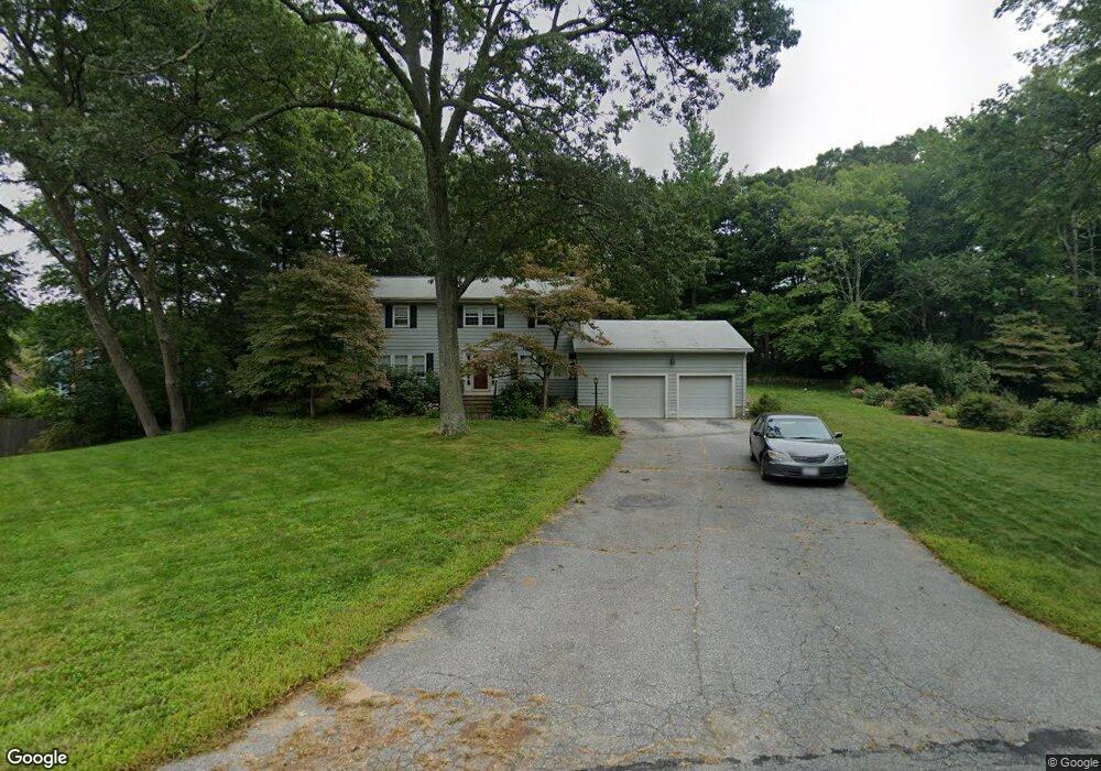
This home is located at 18 Bromfield Rd, Acton, MA 01720 and is currently estimated at $964,758, approximately $341 per square foot. 18 Bromfield Rd is a home located in Middlesex County with nearby schools including Acton-Boxborough Regional High School and Concord Academy.
Ownership History
Date
Name
Owned For
Owner Type
Purchase Details
Closed on
Jul 29, 2004
Sold by
Tabaczynski Glenda M and Tabaczynski John A
Bought by
Mccormick David Speir and Thacher Speers Elizabet
Current Estimated Value
Home Financials for this Owner
Home Financials are based on the most recent Mortgage that was taken out on this home.
Original Mortgage
$180,000
Outstanding Balance
$86,681
Interest Rate
6.33%
Mortgage Type
Purchase Money Mortgage
Estimated Equity
$878,077
Create a Home Valuation Report for This Property
The Home Valuation Report is an in-depth analysis detailing your home's value as well as a comparison with similar homes in the area
Home Values in the Area
Average Home Value in this Area
Purchase History
| Date | Buyer | Sale Price | Title Company |
|---|---|---|---|
| Mccormick David Speir | $650,000 | -- |
Source: Public Records
Mortgage History
| Date | Status | Borrower | Loan Amount |
|---|---|---|---|
| Open | Mccormick David Speir | $180,000 |
Source: Public Records
Tax History
| Year | Tax Paid | Tax Assessment Tax Assessment Total Assessment is a certain percentage of the fair market value that is determined by local assessors to be the total taxable value of land and additions on the property. | Land | Improvement |
|---|---|---|---|---|
| 2025 | $15,550 | $906,700 | $360,300 | $546,400 |
| 2024 | $14,535 | $871,900 | $360,300 | $511,600 |
| 2023 | $14,181 | $807,600 | $328,100 | $479,500 |
| 2022 | $13,407 | $689,300 | $284,800 | $404,500 |
| 2021 | $13,299 | $657,400 | $263,600 | $393,800 |
| 2020 | $12,543 | $651,900 | $263,600 | $388,300 |
| 2019 | $11,998 | $619,400 | $263,600 | $355,800 |
| 2018 | $11,787 | $608,200 | $263,600 | $344,600 |
| 2017 | $11,486 | $602,600 | $263,600 | $339,000 |
| 2016 | $11,434 | $594,600 | $263,600 | $331,000 |
| 2015 | $11,219 | $588,900 | $263,600 | $325,300 |
| 2014 | $10,838 | $557,200 | $263,600 | $293,600 |
Source: Public Records
Map
Nearby Homes
- 44 Wood Ln
- 491 Main St
- 190 School St
- 709 Main St
- 33 Meadowbrook Rd
- 205 Great Rd Unit C-6
- 524 Main St
- 2 Jackson Dr
- 70 River St
- 91 Drummer Rd Unit 91
- 12 Gabriel Ln
- 10 Long Ridge Rd
- 159 Prospect St Unit 4
- 182 Main St Unit 4
- 11 Longmeadow Way
- 15 Long Ridge Rd
- 42 Sunnyside Ln
- 15 Davis Rd Unit B-8
- 37 Water St
- 11 Davis Rd Unit B8
Your Personal Tour Guide
Ask me questions while you tour the home.