Estimated Value: $861,042 - $1,421,000
Studio
--
Bath
3,564
Sq Ft
$307/Sq Ft
Est. Value
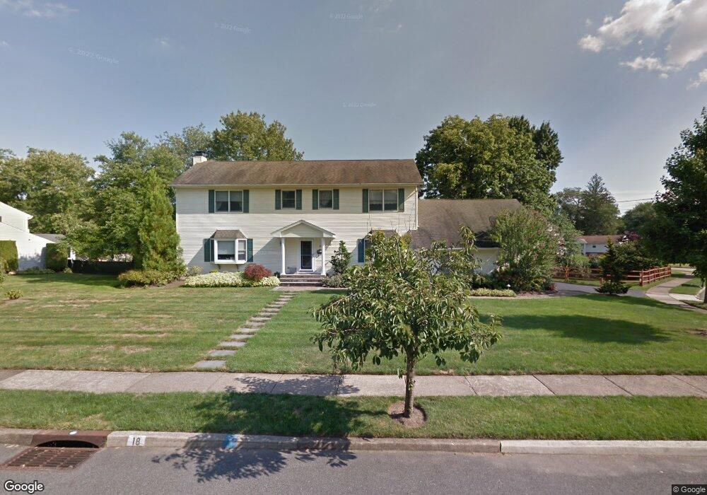
About This Home
This home is located at 18 Carlisle Rd, Wayne, NJ 07470 and is currently estimated at $1,095,261, approximately $307 per square foot. 18 Carlisle Rd is a home located in Passaic County with nearby schools including Lafayette Elementary School, Anthony Wayne Middle School, and Wayne Valley High School.
Ownership History
Date
Name
Owned For
Owner Type
Purchase Details
Closed on
Jan 26, 2004
Sold by
Lensak Michael
Bought by
Abrams Karen and Abrams Andrew
Current Estimated Value
Home Financials for this Owner
Home Financials are based on the most recent Mortgage that was taken out on this home.
Original Mortgage
$568,800
Outstanding Balance
$266,580
Interest Rate
5.82%
Estimated Equity
$828,681
Purchase Details
Closed on
Feb 5, 2001
Sold by
Kayser Hilde
Bought by
Lensak Micheal and Greebel Lisa
Home Financials for this Owner
Home Financials are based on the most recent Mortgage that was taken out on this home.
Original Mortgage
$240,000
Interest Rate
6.89%
Create a Home Valuation Report for This Property
The Home Valuation Report is an in-depth analysis detailing your home's value as well as a comparison with similar homes in the area
Home Values in the Area
Average Home Value in this Area
Purchase History
| Date | Buyer | Sale Price | Title Company |
|---|---|---|---|
| Abrams Karen | $711,000 | -- | |
| Lensak Micheal | $300,000 | -- |
Source: Public Records
Mortgage History
| Date | Status | Borrower | Loan Amount |
|---|---|---|---|
| Open | Abrams Karen | $568,800 | |
| Previous Owner | Lensak Micheal | $240,000 |
Source: Public Records
Tax History
| Year | Tax Paid | Tax Assessment Tax Assessment Total Assessment is a certain percentage of the fair market value that is determined by local assessors to be the total taxable value of land and additions on the property. | Land | Improvement |
|---|---|---|---|---|
| 2025 | $20,115 | $338,300 | $122,300 | $216,000 |
| 2024 | $19,344 | $338,300 | $122,300 | $216,000 |
| 2022 | $19,127 | $338,300 | $122,300 | $216,000 |
| 2021 | $19,107 | $338,300 | $122,300 | $216,000 |
| 2020 | $19,023 | $338,300 | $122,300 | $216,000 |
| 2019 | $18,654 | $338,300 | $122,300 | $216,000 |
| 2018 | $18,488 | $338,300 | $122,300 | $216,000 |
| 2017 | $18,319 | $338,300 | $122,300 | $216,000 |
| 2016 | $18,062 | $338,300 | $122,300 | $216,000 |
| 2015 | $17,845 | $338,300 | $122,300 | $216,000 |
| 2014 | $17,341 | $338,300 | $122,300 | $216,000 |
Source: Public Records
Map
Nearby Homes
- 24 Holmes Ln
- 14 Louisa Ct
- 61 Carlisle Rd
- 4 Highfield Ct
- 51 Harmer Terrace
- 35 Darlington Dr
- 14 Weinmanns Blvd
- 69 Colonial Rd
- 20 Maljim Ct
- 22 Woodlot Rd
- 8 Woodlot Rd
- 8 Danielle Dr
- 16 Lawrence Rd
- 59 Laauwe Ave
- 15 Littlewood Ct
- 18 Stonycroft Rd
- 4 Michele Ct
- 77 Garside Ave
- 2 White Oak Ln
- 28 Battle Ridge Trail
Your Personal Tour Guide
Ask me questions while you tour the home.