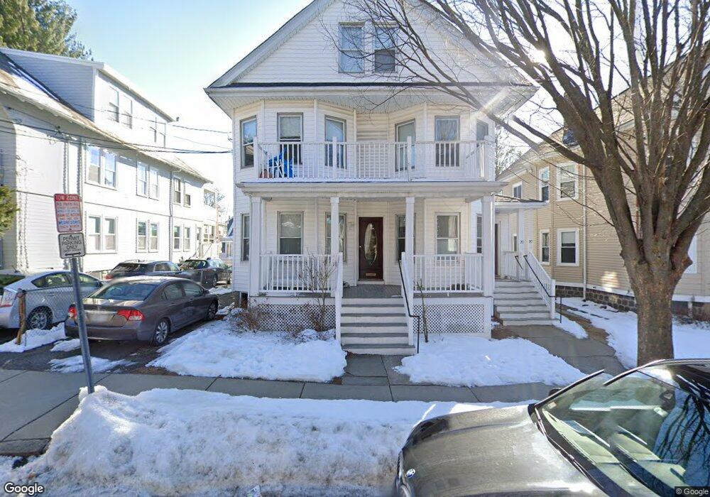
18 Curtis Ave Somerville, MA 02144
West Somerville NeighborhoodEstimated Value: $1,318,000 - $1,903,930
4
Beds
4
Baths
9,999
Sq Ft
$151/Sq Ft
Est. Value
About This Home
This home is located at 18 Curtis Ave, Somerville, MA 02144 and is currently estimated at $1,511,233, approximately $151 per square foot. 18 Curtis Ave is a home located in Middlesex County with nearby schools including Somerville High School, St. Clement Elementary School, and International School of Boston.
Ownership History
Date
Name
Owned For
Owner Type
Purchase Details
Closed on
Sep 5, 2024
Sold by
Mcdonagh Thomas M
Bought by
Sinead Properties Llc
Current Estimated Value
Purchase Details
Closed on
Aug 2, 2007
Sold by
Sheehy James F and Sheehy Judith J
Bought by
Mcdonagh Thomas M
Home Financials for this Owner
Home Financials are based on the most recent Mortgage that was taken out on this home.
Original Mortgage
$487,500
Interest Rate
6.73%
Mortgage Type
Purchase Money Mortgage
Purchase Details
Closed on
May 15, 2003
Sold by
Sheehy James F and Sheehy Judith J
Bought by
Sheehy James F and Sheehy Judith J
Create a Home Valuation Report for This Property
The Home Valuation Report is an in-depth analysis detailing your home's value as well as a comparison with similar homes in the area
Home Values in the Area
Average Home Value in this Area
Purchase History
| Date | Buyer | Sale Price | Title Company |
|---|---|---|---|
| Sinead Properties Llc | -- | None Available | |
| Sinead Properties Llc | -- | None Available | |
| Mcdonagh Thomas M | $650,000 | -- | |
| Mcdonagh Thomas M | $650,000 | -- | |
| Sheehy James F | -- | -- | |
| Sheehy James F | -- | -- |
Source: Public Records
Mortgage History
| Date | Status | Borrower | Loan Amount |
|---|---|---|---|
| Previous Owner | Sheehy James F | $484,000 | |
| Previous Owner | Sheehy James F | $480,000 | |
| Previous Owner | Mcdonagh Thomas M | $487,500 | |
| Previous Owner | Sheehy James F | $148,500 |
Source: Public Records
Property History
| Date | Event | Price | List to Sale | Price per Sq Ft |
|---|---|---|---|---|
| 06/01/2025 06/01/25 | For Rent | $5,200 | 0.0% | -- |
| 10/08/2024 10/08/24 | Off Market | $5,200 | -- | -- |
Tax History
| Year | Tax Paid | Tax Assessment Tax Assessment Total Assessment is a certain percentage of the fair market value that is determined by local assessors to be the total taxable value of land and additions on the property. | Land | Improvement |
|---|---|---|---|---|
| 2025 | $15,021 | $1,376,800 | $599,600 | $777,200 |
| 2024 | $14,339 | $1,363,000 | $599,600 | $763,400 |
| 2023 | $13,908 | $1,345,100 | $599,600 | $745,500 |
| 2022 | $13,110 | $1,287,800 | $571,100 | $716,700 |
| 2021 | $12,676 | $1,244,000 | $566,900 | $677,100 |
| 2020 | $12,157 | $1,204,900 | $567,300 | $637,600 |
| 2019 | $11,450 | $1,064,100 | $516,400 | $547,700 |
| 2018 | $10,401 | $919,600 | $469,500 | $450,100 |
| 2017 | $10,219 | $875,700 | $442,900 | $432,800 |
| 2016 | $9,895 | $789,700 | $395,500 | $394,200 |
| 2015 | $9,534 | $756,100 | $365,300 | $390,800 |
Source: Public Records
Map
Nearby Homes
- 12 Upland Rd
- 183 Powder House Blvd
- 25 Upland Rd
- 123 W Adams St Unit 1
- 83 Conwell Ave Unit 1
- 202 Powder House Blvd Unit 1
- 202 Powder House Blvd Unit 2
- 233 Powder House Blvd
- 34 Belknap St
- 138 North St
- 6 Hamilton Rd Unit 6
- 106 Electric Ave Unit 3
- 150 North St Unit 150
- 55 Packard Ave Unit 1
- 42 Packard Ave Unit 42
- 1252 Broadway Unit 4
- 1188 Broadway Unit 403
- 14 Farragut Ave Unit 1
- 59A High St Unit A
- 325A Alewife Brook Pkwy Unit A
- 18 Curtis Ave Unit 1
- 20 Curtis Ave Unit 1
- 20 Curtis Ave Unit 2
- 20 Curtis Ave
- 24 Curtis Ave Unit 2
- 24 Curtis Ave
- 22 Curtis Ave
- 22 Curtis Ave Unit 1
- 22 Curtis Ave Unit 2
- 14 Curtis Ave
- 14 Curtis Ave Unit 14
- 14 Curtis Ave Unit 1
- 14 Curtis Ave
- 14 Curtis Ave Unit 2
- 16 Curtis Ave Unit 2
- 26 Curtis Ave
- 19 Curtis Ave
- 19 Curtis Ave Unit 2
- 12 Curtis Ave
- 19 Conwell Ave
Your Personal Tour Guide
Ask me questions while you tour the home.