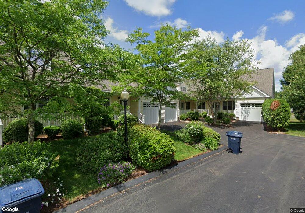
18 Explorers Way Holden, MA 01520
Estimated Value: $480,117 - $586,000
2
Beds
3
Baths
1,661
Sq Ft
$318/Sq Ft
Est. Value
About This Home
This home is located at 18 Explorers Way, Holden, MA 01520 and is currently estimated at $528,029, approximately $317 per square foot. 18 Explorers Way is a home located in Worcester County with nearby schools including Wachusett Regional High School, Bancroft School, and Notre Dame Academy.
Ownership History
Date
Name
Owned For
Owner Type
Purchase Details
Closed on
Jul 31, 2023
Sold by
Bonofiglio Albert F and Bonofiglio Marie E
Bought by
Martell Christina M and Lee Meaghan M
Current Estimated Value
Purchase Details
Closed on
Oct 2, 2012
Sold by
Bonofiglio Marie E
Bought by
Bonofiglio Albert F and Bonofiglio Marie E
Home Financials for this Owner
Home Financials are based on the most recent Mortgage that was taken out on this home.
Original Mortgage
$72,000
Interest Rate
3.62%
Mortgage Type
New Conventional
Purchase Details
Closed on
Jun 1, 2007
Sold by
Newell Road Realty Llc
Bought by
Lee Marie E
Home Financials for this Owner
Home Financials are based on the most recent Mortgage that was taken out on this home.
Original Mortgage
$105,000
Interest Rate
6.24%
Mortgage Type
Purchase Money Mortgage
Create a Home Valuation Report for This Property
The Home Valuation Report is an in-depth analysis detailing your home's value as well as a comparison with similar homes in the area
Home Values in the Area
Average Home Value in this Area
Purchase History
| Date | Buyer | Sale Price | Title Company |
|---|---|---|---|
| Martell Christina M | -- | None Available | |
| Bonofiglio Albert F | -- | -- | |
| Lee Marie E | $322,500 | -- |
Source: Public Records
Mortgage History
| Date | Status | Borrower | Loan Amount |
|---|---|---|---|
| Previous Owner | Bonofiglio Albert F | $72,000 | |
| Previous Owner | Lee Marie E | $105,000 |
Source: Public Records
Tax History
| Year | Tax Paid | Tax Assessment Tax Assessment Total Assessment is a certain percentage of the fair market value that is determined by local assessors to be the total taxable value of land and additions on the property. | Land | Improvement |
|---|---|---|---|---|
| 2025 | $5,692 | $410,700 | $0 | $410,700 |
| 2024 | $5,388 | $380,800 | $0 | $380,800 |
| 2023 | $4,960 | $330,900 | $0 | $330,900 |
| 2022 | $5,581 | $337,000 | $0 | $337,000 |
| 2021 | $5,664 | $325,500 | $0 | $325,500 |
| 2020 | $5,481 | $322,400 | $0 | $322,400 |
| 2019 | $7,043 | $403,600 | $0 | $403,600 |
| 2018 | $5,626 | $319,500 | $0 | $319,500 |
| 2017 | $5,388 | $306,300 | $0 | $306,300 |
| 2016 | $4,989 | $289,200 | $0 | $289,200 |
| 2015 | $5,066 | $279,600 | $0 | $279,600 |
| 2014 | $4,963 | $279,600 | $0 | $279,600 |
Source: Public Records
Map
Nearby Homes
- 53 Tea Party Cir
- 12 Newell Rd
- 202 Torrey Lane Extension Unit 202
- 3 Torrey Ln
- 527 Salisbury St
- 7 Wildwood Rd
- 42 N Worcester Ave
- 16 Sycamore Dr
- 5 Piehl Ave
- 146 Shrewsbury St
- 339 Salisbury St
- 23 Leslie Rd
- 250 Shrewsbury St
- 158 Chester St
- 270 Brattle St
- 90 Bjorklund Ave
- 3901 Knightsbridge Close Unit 3901
- 4004 Brompton Cir
- 84 Chester St
- 288 Fisher Rd
- 2 Explorers Way
- 4 Explorers Way
- 6 Explorers Way
- 8 Explorers Way
- 12 Explorers Way
- 14 Explorers Way
- 16 Explorers Way
- 6 Explorers Way Unit 623
- 2 Explorers Way Unit 625
- 8 Explorers Way Unit 8
- 619 Explorers Way Unit 619
- 613 Explorers Way Unit 613
- 618 Explorers Way Unit 618
- 621 Explorers Way Unit 621
- 620 Explorers Way Unit 620
- 622 Explorers Way Unit 622
- 17 Explorers Way
- 15 Explorers Way
- 11 Explorers Way
- 9 Explorers Way
Your Personal Tour Guide
Ask me questions while you tour the home.