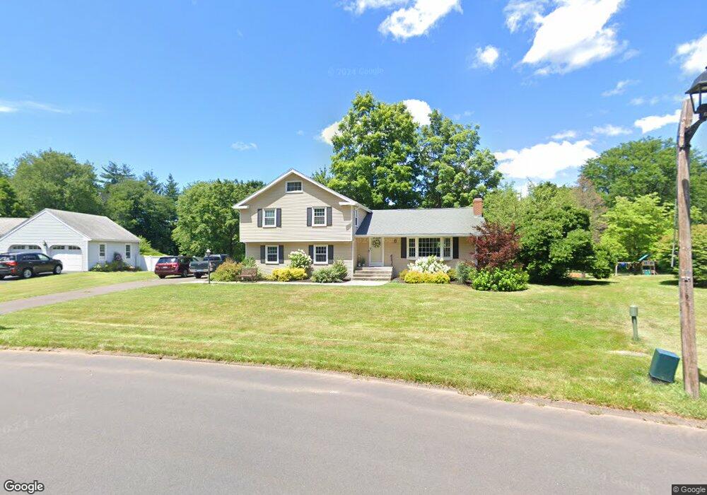
18 Holly Cir Windsor, CT 06095
West Windsor NeighborhoodEstimated Value: $424,000 - $490,000
4
Beds
3
Baths
2,064
Sq Ft
$220/Sq Ft
Est. Value
About This Home
This home is located at 18 Holly Cir, Windsor, CT 06095 and is currently estimated at $453,089, approximately $219 per square foot. 18 Holly Cir is a home located in Hartford County with nearby schools including Oliver Ellsworth School, John F. Kennedy School, and Sage Park Middle School.
Ownership History
Date
Name
Owned For
Owner Type
Purchase Details
Closed on
Aug 16, 2017
Sold by
Martin Sean K
Bought by
Martin Sean K and Martin Laura L
Current Estimated Value
Purchase Details
Closed on
Nov 9, 2009
Sold by
Butenas Josephine Est and Butenas
Bought by
Martin Sean
Home Financials for this Owner
Home Financials are based on the most recent Mortgage that was taken out on this home.
Original Mortgage
$204,000
Interest Rate
5.25%
Mortgage Type
Purchase Money Mortgage
Create a Home Valuation Report for This Property
The Home Valuation Report is an in-depth analysis detailing your home's value as well as a comparison with similar homes in the area
Home Values in the Area
Average Home Value in this Area
Purchase History
| Date | Buyer | Sale Price | Title Company |
|---|---|---|---|
| Martin Sean K | -- | -- | |
| Martin Sean | $255,000 | -- |
Source: Public Records
Mortgage History
| Date | Status | Borrower | Loan Amount |
|---|---|---|---|
| Previous Owner | Martin Sean | $195,500 | |
| Previous Owner | Martin Sean | $204,000 |
Source: Public Records
Tax History
| Year | Tax Paid | Tax Assessment Tax Assessment Total Assessment is a certain percentage of the fair market value that is determined by local assessors to be the total taxable value of land and additions on the property. | Land | Improvement |
|---|---|---|---|---|
| 2025 | $7,739 | $272,020 | $71,330 | $200,690 |
| 2024 | $8,248 | $272,020 | $71,330 | $200,690 |
| 2023 | $6,061 | $180,390 | $55,440 | $124,950 |
| 2022 | $6,002 | $180,390 | $55,440 | $124,950 |
| 2021 | $6,002 | $180,390 | $55,440 | $124,950 |
| 2020 | $5,973 | $180,390 | $55,440 | $124,950 |
| 2019 | $5,841 | $180,390 | $55,440 | $124,950 |
| 2018 | $5,390 | $163,520 | $55,440 | $108,080 |
| 2017 | $5,306 | $163,520 | $55,440 | $108,080 |
| 2016 | $5,154 | $163,520 | $55,440 | $108,080 |
| 2015 | $5,056 | $163,520 | $55,440 | $108,080 |
| 2014 | $4,944 | $162,260 | $55,440 | $106,820 |
Source: Public Records
Map
Nearby Homes
- 1 Deanne Lynn Cir
- 490 Old Day Hill Rd
- 10 Faldu Rd
- 268 High Path Rd Unit 268
- 136 High Path Rd
- 24 Mary Catherine Cir
- 943 High Path Rd Unit 943
- 98 High Path Rd
- 5 Haskins Rd Unit 5
- 18 Last Leaf Cir
- 105 Sunrise Cir
- 153 Brighton Cir
- 10 Cleary Ln
- 246 Kenswick Ln Unit 246
- 31 Woodduck Farms Rd
- 96 Fieldstone Dr
- 36 Pilgrim Dr
- 22 Settler Cir
- 135 East St
- 1 Morello Cir
- 14 Holly Cir
- 22 Holly Cir
- 10 Holly Cir
- 26 Holly Cir
- 1075 Poquonock Ave
- 1053 Poquonock Ave
- 31 Holly Cir
- 10 Farmstead Ln
- 41 Eastview Dr
- 1091 Poquonock Ave
- 1091 Poquonock Ave
- 1091 Poquonock Ave Unit 1091
- 16 Farmstead Ln
- 1045 Poquonock Ave
- 35 Eastview Dr
- 1101 Poquonock Ave
- 34 Holly Cir
- 45 Eastview Dr
- 1043 Poquonock Ave
- 35 Holly Cir
Your Personal Tour Guide
Ask me questions while you tour the home.