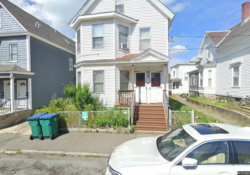
18 Phillips St Lowell, MA 01854
Acre NeighborhoodEstimated Value: $581,019 - $690,000
4
Beds
2
Baths
3,293
Sq Ft
$199/Sq Ft
Est. Value
About This Home
This home is located at 18 Phillips St, Lowell, MA 01854 and is currently estimated at $656,255, approximately $199 per square foot. 18 Phillips St is a home located in Middlesex County with nearby schools including Charlotte M. Murkland Elementary School, Joseph McAvinnue Elementary School, and Charles W. Morey Elementary School.
Ownership History
Date
Name
Owned For
Owner Type
Purchase Details
Closed on
Apr 5, 2011
Sold by
Sorn Sokha
Bought by
Lowell City Of
Current Estimated Value
Purchase Details
Closed on
Feb 18, 2005
Sold by
Leap Whitney Ros
Bought by
Sorn Kakrunna and Sorn Sokha
Purchase Details
Closed on
May 28, 2003
Sold by
Leap Titdara and Leap Titthdra
Bought by
Leap Titdara and Leap Whitney Ros
Purchase Details
Closed on
Feb 19, 1993
Sold by
Apex Heritage Property
Bought by
Kassin John H and Ociepka William
Create a Home Valuation Report for This Property
The Home Valuation Report is an in-depth analysis detailing your home's value as well as a comparison with similar homes in the area
Home Values in the Area
Average Home Value in this Area
Purchase History
| Date | Buyer | Sale Price | Title Company |
|---|---|---|---|
| Lowell City Of | $2,527 | -- | |
| Lowell City Of | $2,527 | -- | |
| Sorn Kakrunna | -- | -- | |
| Sorn Kakrunna | -- | -- | |
| Leap Titdara | -- | -- | |
| Leap Titdara | -- | -- | |
| Kassin John H | $41,000 | -- | |
| Kassin John H | $41,000 | -- |
Source: Public Records
Tax History
| Year | Tax Paid | Tax Assessment Tax Assessment Total Assessment is a certain percentage of the fair market value that is determined by local assessors to be the total taxable value of land and additions on the property. | Land | Improvement |
|---|---|---|---|---|
| 2025 | $6,563 | $571,700 | $97,100 | $474,600 |
| 2024 | $6,073 | $509,900 | $90,700 | $419,200 |
| 2023 | $5,657 | $455,500 | $78,900 | $376,600 |
| 2022 | $5,230 | $412,100 | $71,700 | $340,400 |
| 2021 | $4,848 | $360,200 | $62,400 | $297,800 |
| 2020 | $4,377 | $327,600 | $53,200 | $274,400 |
| 2019 | $3,920 | $279,200 | $47,000 | $232,200 |
| 2018 | $3,632 | $252,400 | $44,700 | $207,700 |
| 2017 | $3,433 | $230,100 | $40,700 | $189,400 |
| 2016 | $3,488 | $230,100 | $40,600 | $189,500 |
| 2015 | $3,203 | $206,900 | $41,900 | $165,000 |
| 2013 | $2,925 | $194,900 | $55,700 | $139,200 |
Source: Public Records
Map
Nearby Homes
- 19 Oliver St
- 116 Walker St
- 113 School St Unit 12
- 1017 Middlesex St Unit 5
- 3 Butman Place
- 169 Salem St
- 312 Wilder St
- 491 Dutton St Unit 305
- 491 Dutton St Unit 409
- 491 Dutton St Unit 504
- 143 Westford St
- 45 Marshall St
- 187 Varnum Ave
- 38 Starbird St
- 68 Smith St
- 70 Austin St Unit 15
- 129 Cabot St
- 104 Woodward Ave
- 45 Harvard St Unit 5 3rd fl
- 89 Mammoth Rd
- 14 Phillips St
- 22 Phillips St
- 26 Phillips St
- 12 Phillips St
- 669 Broadway St
- 17 Clare St
- 17 Clare St Unit 2
- 17 Clare St Unit 1
- 17 Clare St Unit 3
- 15 Clare St
- 15 Clare St Unit 2
- 665 Broadway St
- 30 Phillips St
- 21 Clare St
- 25 Clare St Unit 1
- 657 Broadway St
- 15 Phillips St
- 673 Broadway St
- 23 Phillips St
- 32 Phillips St
Your Personal Tour Guide
Ask me questions while you tour the home.