Estimated Value: $113,482 - $154,000
About This Home
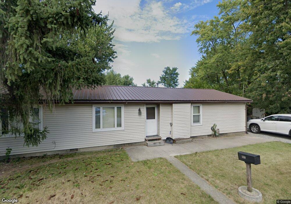
This home is located at 180 Watt Ave, Lima, OH 45801 and is currently estimated at $128,371, approximately $95 per square foot. 180 Watt Ave is a home located in Allen County with nearby schools including Bath Elementary School, Bath Middle School, and Bath High School.
Ownership History
We collect this data history from publicly available records. To have your information removed, we recommend requesting removal directly through your county’s website.
Purchase Details
Home Financials for this Owner
Home Financials are based on the most recent Mortgage that was taken out on this home.Purchase Details
Purchase History
We collect this data history from publicly available records. To have your information removed, we recommend requesting removal directly through your county’s website.
| Date | Buyer | Sale Price | Title Company |
|---|---|---|---|
| $43,000 | -- | ||
| $30,000 | -- |
Mortgage History
We collect this data history from publicly available records. To have your information removed, we recommend requesting removal directly through your county’s website.
| Date | Status | Borrower | Loan Amount |
|---|---|---|---|
| Closed | $40,850 |
Tax History
We collect this data history from publicly available records. To have your information removed, we recommend requesting removal directly through your county’s website.
| Year | Tax Paid | Tax Assessment Tax Assessment Total Assessment is a certain percentage of the fair market value that is determined by local assessors to be the total taxable value of land and additions on the property. | Land | Improvement |
|---|---|---|---|---|
| 2025 | $986 | $22,580 | $1,860 | $20,720 |
| 2024 | $989 | $22,580 | $1,860 | $20,720 |
| 2023 | $1,048 | $18,800 | $1,540 | $17,260 |
| 2022 | $857 | $18,800 | $1,540 | $17,260 |
| 2021 | $862 | $18,800 | $1,540 | $17,260 |
| 2020 | $844 | $16,840 | $1,440 | $15,400 |
| 2019 | $844 | $16,840 | $1,440 | $15,400 |
| 2018 | $828 | $16,840 | $1,440 | $15,400 |
| 2017 | $828 | $16,840 | $1,440 | $15,400 |
| 2016 | $818 | $16,840 | $1,440 | $15,400 |
| 2015 | $842 | $16,840 | $1,440 | $15,400 |
| 2014 | $842 | $16,770 | $1,440 | $15,330 |
| 2013 | $867 | $16,770 | $1,440 | $15,330 |
Map
- 1907 N Elizabeth St
- 1708 Karen St
- 1705 Karen St
- 1609 Karen St
- 429 Lewis Blvd
- 207 W Lane Ave
- 417 W Northern Ave
- 1913 Burch Ave
- 215 W Michigan Ave
- 524 Sandpiper St
- 2104 Virginia Ave
- 613 Meadowbrook Dr
- 1416 N Central Ave
- 1200 N Main St
- 1809 N Metcalf St
- 716 Ruth Ave
- 475 Kenmore St
- 611 Saint Clair Ave
- 712 Taylor Ave
- 520 Kenmore St
- 1802 N Elizabeth St
- 112 Watt Ave
- 1806 N Elizabeth St
- 197 Watt Ave
- 113 Watt Ave
- 110 Watt Ave
- 200 Watt Ave
- 111 Watt Ave
- 201 Watt Ave
- 1810 N Elizabeth St
- 1807 N Elizabeth St
- 106 Watt Ave
- 109 Stanton Ave
- 109 Watt Ave
- 1811 N Elizabeth St
- 186 Plaza Way
- 192 Plaza Way
- 180 Plaza Way
- 206 Watt Ave
- 107 Stanton Ave
Ask me questions while you tour the home.