Estimated Value: $448,609 - $488,000
About This Home
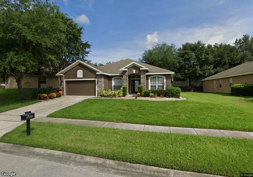
This home is located at 1801 Palmerston Cir, Ocoee, FL 34761 and is currently estimated at $464,902, approximately $156 per square foot. 1801 Palmerston Cir is a home located in Orange County with nearby schools including Prairie Lake Elementary School, Ocoee Middle School, and Wekiva High School.
Ownership History
We collect this data history from publicly available records. To have your information removed, we recommend requesting removal directly through your county’s website.
Purchase Details
Home Financials for this Owner
Home Financials are based on the most recent Mortgage that was taken out on this home.Purchase Details
Purchase Details
Home Financials for this Owner
Home Financials are based on the most recent Mortgage that was taken out on this home.Home Values in the Area
Average Home Value in this Area
Purchase History
We collect this data history from publicly available records. To have your information removed, we recommend requesting removal directly through your county’s website.
| Date | Buyer | Sale Price | Title Company |
|---|---|---|---|
| $155,000 | Stewart Title Co | ||
| -- | None Available | ||
| $357,300 | Universal Land Title Inc |
Mortgage History
We collect this data history from publicly available records. To have your information removed, we recommend requesting removal directly through your county’s website.
| Date | Status | Borrower | Loan Amount |
|---|---|---|---|
| Open | $151,070 | ||
| Previous Owner | $285,750 |
Tax History
We collect this data history from publicly available records. To have your information removed, we recommend requesting removal directly through your county’s website.
| Year | Tax Paid | Tax Assessment Tax Assessment Total Assessment is a certain percentage of the fair market value that is determined by local assessors to be the total taxable value of land and additions on the property. | Land | Improvement |
|---|---|---|---|---|
| 2026 | $2,956 | $181,793 | -- | -- |
| 2025 | $2,956 | $181,793 | -- | -- |
| 2024 | $2,606 | $177,014 | -- | -- |
| 2023 | $2,606 | $167,015 | $0 | $0 |
| 2022 | $2,515 | $162,150 | $0 | $0 |
| 2021 | $2,483 | $157,427 | $0 | $0 |
| 2020 | $2,371 | $155,253 | $0 | $0 |
| 2019 | $2,451 | $151,762 | $0 | $0 |
| 2018 | $2,439 | $148,932 | $0 | $0 |
| 2017 | $2,421 | $199,134 | $22,000 | $177,134 |
| 2016 | $2,425 | $193,736 | $22,000 | $171,736 |
| 2015 | $2,462 | $173,920 | $15,000 | $158,920 |
| 2014 | $2,447 | $170,570 | $20,000 | $150,570 |
Map
- 2079 Ashwood Bluff Dr
- 2091 Ashwood Bluff Dr
- 2103 Ashwood Bluff Dr
- 3090 Timber Hawk Cir
- 2932 Muller Oak Loop
- 2315 Ashwood Bluff Dr
- 2335 Ashwood Bluff Dr
- 2190 Laurel Blossom Cir
- 2196 Laurel Blossom Cir
- 3404 Spineywood Dr
- 2336 Bay St
- 2347 Ashwood Bluff Dr
- 3282 Spineywood Dr
- 2348 Bay St
- 3289 Spineywood Ct
- 3285 Spineywood Ct
- 3277 Spineywood Ct
- 3278 Spineywood Dr
- 3274 Spineywood Dr
- 3259 Spineywood Ct
- 1802 Palmerston Cir
- 1806 Palmerston Cir
- 1798 Palmerston Cir
- 1794 Palmerston Cir
- 1818 Palmerston Cir
- 1809 Palmerston Cir
- 1795 Palmerston Cir
- 1790 Palmerston Cir
- 1822 Palmerston Cir
- 1821 Palmerston Cir
- 1785 Palmerston Cir
- 1733 Palmerston Cir
- 1786 Palmerston Cir
- 1737 Palmerston Cir
- 1826 Palmerston Cir
- 1825 Palmerston Cir
- 1781 Palmerston Cir
- 1729 Palmerston Cir
- 1741 Palmerston Cir
- 1782 Palmerston Cir
Ask me questions while you tour the home.