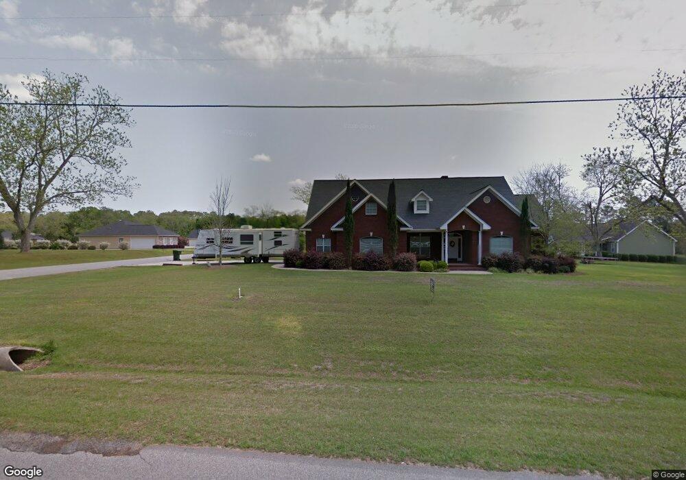
1801 S Broad St Cairo, GA 39828
Cairo AreaEstimated Value: $415,771 - $514,000
About This Home
This home is located at 1801 S Broad St, Cairo, GA 39828 and is currently estimated at $471,693, approximately $151 per square foot. 1801 S Broad St is a home located in Grady County with nearby schools including Cairo High School.
Ownership History
We collect this data history from publicly available records. To have your information removed, we recommend requesting removal directly through your county’s website.
Purchase Details
Home Financials for this Owner
Home Financials are based on the most recent Mortgage that was taken out on this home.Purchase Details
Purchase Details
Purchase Details
Purchase Details
Purchase Details
Purchase History
We collect this data history from publicly available records. To have your information removed, we recommend requesting removal directly through your county’s website.
| Date | Buyer | Sale Price | Title Company |
|---|---|---|---|
| $277,500 | -- | ||
| $19,579 | -- | ||
| $12,500 | -- | ||
| -- | -- | ||
| $100,000 | -- | ||
| -- | -- |
Mortgage History
We collect this data history from publicly available records. To have your information removed, we recommend requesting removal directly through your county’s website.
| Date | Status | Borrower | Loan Amount |
|---|---|---|---|
| Open | $190,000 | ||
| Closed | $222,000 | ||
| Previous Owner | $249,982 | ||
| Previous Owner | $254,050 | ||
| Previous Owner | $231,750 |
Tax History
We collect this data history from publicly available records. To have your information removed, we recommend requesting removal directly through your county’s website.
| Year | Tax Paid | Tax Assessment Tax Assessment Total Assessment is a certain percentage of the fair market value that is determined by local assessors to be the total taxable value of land and additions on the property. | Land | Improvement |
|---|---|---|---|---|
| 2025 | $4,110 | $180,893 | $8,000 | $172,893 |
| 2024 | $4,110 | $162,502 | $8,000 | $154,502 |
| 2023 | $3,015 | $83,110 | $4,800 | $78,310 |
| 2022 | $3,138 | $83,110 | $4,800 | $78,310 |
| 2021 | $3,147 | $83,110 | $4,800 | $78,310 |
| 2020 | $3,155 | $83,110 | $4,800 | $78,310 |
| 2019 | $3,154 | $83,110 | $4,800 | $78,310 |
| 2018 | $2,999 | $83,110 | $4,800 | $78,310 |
| 2017 | $2,885 | $83,110 | $4,800 | $78,310 |
| 2016 | $2,364 | $66,893 | $4,800 | $62,093 |
| 2015 | $2,570 | $73,293 | $11,200 | $62,093 |
| 2014 | $2,571 | $73,293 | $11,200 | $62,093 |
| 2013 | -- | $90,580 | $11,200 | $79,380 |
Map
- 112 Cakebread Dr
- 198 Oakdale Rd SE
- 1590 Lullwater Cir SE
- 109 15th Ave SE
- 1891 Lakewood Dr SE
- 1870 Oakdale Rd SE
- 1406 Platt Ave
- 1275 Platt Ave
- 1291 Stone Ave
- 220 13th Ave SW
- 1236 Brookwood Dr SE
- 138 Joyner Rd
- 506 Culpepper Dr
- 30 8th Ave SW
- 140 Elderberry Ln
- 31 SW 7th Ave
- 1751 Ga Highway 93 S
- 624 7th St SW
- 000 S Broad St
- 481 4th St SE
- 1809 S Broad St
- 103 Mimosa Dr
- 1717 S Broad St
- 103 Cakebread Dr
- 107 Cakebread Dr
- 102 Mimosa Dr
- 1713 S Broad St
- Lot # 7 Oak Bend Subdivision
- 15.7ACR 13th Ave Sw (Parcel 0053 0041)
- 104 Mimosa Dr
- 0 Sterling Cir
- 0069C006 Sterling Cir
- 1728 Sterling Cir
- 1733 Sterling Cir
- 00 Mimosa Dr
- 1714 Sterling Cir
- 108 Mimosa Dr
- 1709 S Broad St
- 1721 Sterling Cir
- 1725 Sterling Cir
Ask me questions while you tour the home.