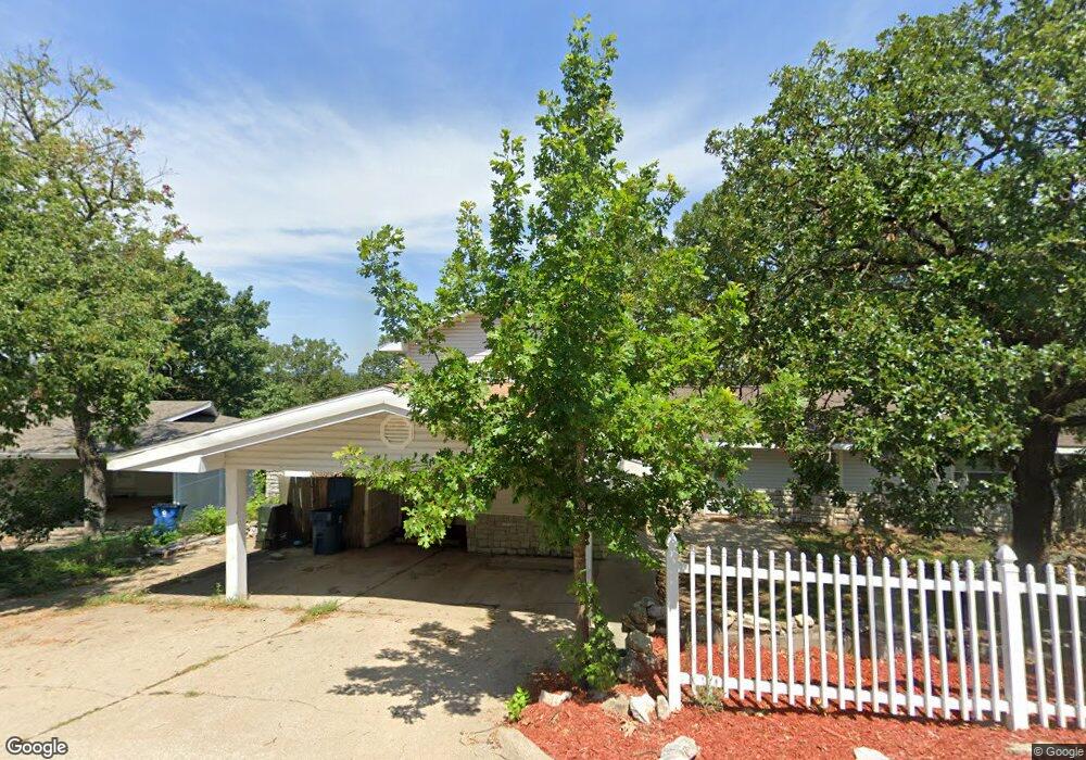
1805 Boswell Ave Branson, MO 65616
North Branson NeighborhoodEstimated Value: $215,490 - $404,000
3
Beds
--
Bath
1,440
Sq Ft
$190/Sq Ft
Est. Value
About This Home
This home is located at 1805 Boswell Ave, Branson, MO 65616 and is currently estimated at $274,123, approximately $190 per square foot. 1805 Boswell Ave is a home located in Taney County with nearby schools including Cedar Ridge Primary, Cedar Ridge Intermediate School, and Cedar Ridge Elementary School.
Ownership History
Date
Name
Owned For
Owner Type
Purchase Details
Closed on
Jan 13, 2022
Sold by
Martin Jay W
Bought by
Martin Jay W and Robinson Lindsay
Current Estimated Value
Home Financials for this Owner
Home Financials are based on the most recent Mortgage that was taken out on this home.
Original Mortgage
$156,750
Outstanding Balance
$144,169
Interest Rate
3.11%
Mortgage Type
New Conventional
Estimated Equity
$129,954
Purchase Details
Closed on
Mar 20, 2020
Sold by
Martin Jay W
Bought by
The Jay Martin Family Trust
Purchase Details
Closed on
Dec 11, 2019
Sold by
Revocable Living Trust Agmt Of Jay Marti
Bought by
Martin Jay
Home Financials for this Owner
Home Financials are based on the most recent Mortgage that was taken out on this home.
Original Mortgage
$105,000
Interest Rate
3.7%
Mortgage Type
New Conventional
Create a Home Valuation Report for This Property
The Home Valuation Report is an in-depth analysis detailing your home's value as well as a comparison with similar homes in the area
Home Values in the Area
Average Home Value in this Area
Purchase History
| Date | Buyer | Sale Price | Title Company |
|---|---|---|---|
| Martin Jay W | -- | Waco Title | |
| Martin Jay W | -- | Waco Title | |
| The Jay Martin Family Trust | -- | None Available | |
| Martin Jay | -- | None Available |
Source: Public Records
Mortgage History
| Date | Status | Borrower | Loan Amount |
|---|---|---|---|
| Open | Martin Jay W | $156,750 | |
| Previous Owner | Martin Jay | $105,000 |
Source: Public Records
Tax History
| Year | Tax Paid | Tax Assessment Tax Assessment Total Assessment is a certain percentage of the fair market value that is determined by local assessors to be the total taxable value of land and additions on the property. | Land | Improvement |
|---|---|---|---|---|
| 2025 | $991 | $16,980 | -- | -- |
| 2023 | $991 | $18,540 | $0 | $0 |
| 2022 | $964 | $18,540 | $0 | $0 |
| 2021 | $958 | $18,540 | $0 | $0 |
| 2019 | $893 | $16,560 | $0 | $0 |
| 2018 | $893 | $16,560 | $0 | $0 |
| 2017 | $631 | $11,820 | $0 | $0 |
| 2016 | $630 | $11,820 | $0 | $0 |
| 2015 | $624 | $11,820 | $0 | $0 |
| 2014 | $570 | $11,320 | $0 | $0 |
Source: Public Records
Map
Nearby Homes
- 000 Truman Dr
- 1650 Miller Dr
- 508 Truman Dr
- Tbd Roark Valley Rd
- Tbd 0 Roark Valley Rd
- 000 W St
- 250 Berry Dr Unit A7
- 109 Cottonwood Cir
- 1211 W 76 Country Blvd
- 103 Della St
- 0 Gretna Rd Unit 60317933
- Tbd Gretna Rd
- 000 Gretna Rd
- Lot 4c Gretna Rd
- 5100 Gretna Rd
- Lot 4b Gretna Rd
- Lot 4a Gretna Rd
- 126 Cottonwood Cir
- TBD W 76 Country Blvd
- 1125/1127 W 76 Country Blvd
- 1803 Boswell Ave
- 1807 Boswell Ave
- 1804 Boswell Ave
- 1809 Boswell Ave
- 1808 Boswell Ave
- 1608 Miller Dr
- 1818 Boswell Ave
- 1810 Miller Dr
- 1802 Boswell Ave
- 1715 Boswell Ave
- 1807 Miller Dr
- 1811 Boswell Ave
- 1714 Miller Dr
- 1808 Miller Dr
- 1806 Miller Dr
- 1812 Miller Dr
- 1805 Neihardt St
- 1804 Miller Dr
- 1716 Miller Dr
- 1803 Neihardt St
Your Personal Tour Guide
Ask me questions while you tour the home.