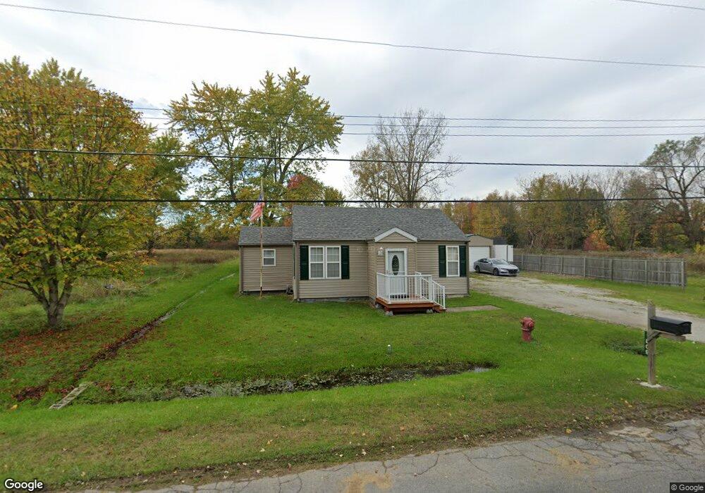
1809 Omar Rd Kimball, MI 48074
Kimball AreaEstimated Value: $146,000 - $195,000
2
Beds
1
Bath
744
Sq Ft
$222/Sq Ft
Est. Value
About This Home
This home is located at 1809 Omar Rd, Kimball, MI 48074 and is currently estimated at $165,013, approximately $221 per square foot. 1809 Omar Rd is a home located in St. Clair County with nearby schools including Kimball Elementary School, Central Middle School, and Port Huron High School.
Create a Home Valuation Report for This Property
The Home Valuation Report is an in-depth analysis detailing your home's value as well as a comparison with similar homes in the area
Home Values in the Area
Average Home Value in this Area
Tax History
We collect this data history from publicly available records. To have your information removed, we recommend requesting removal directly through your county’s website.
| Year | Tax Paid | Tax Assessment Tax Assessment Total Assessment is a certain percentage of the fair market value that is determined by local assessors to be the total taxable value of land and additions on the property. | Land | Improvement |
|---|---|---|---|---|
| 2025 | $1,152 | $60,800 | $0 | $0 |
| 2024 | $596 | $56,700 | $0 | $0 |
| 2023 | $546 | $54,800 | $0 | $0 |
| 2022 | $1,003 | $45,900 | $0 | $0 |
| 2020 | $943 | $42,800 | $42,800 | $0 |
| 2019 | $930 | $35,700 | $0 | $0 |
| 2018 | $886 | $34,800 | $0 | $0 |
| 2017 | $870 | $35,900 | $0 | $0 |
| 2016 | $430 | $35,900 | $0 | $0 |
| 2015 | -- | $34,800 | $34,800 | $0 |
| 2014 | -- | $30,200 | $30,200 | $0 |
| 2013 | -- | $36,800 | $0 | $0 |
Source: Public Records
Map
Nearby Homes
- 5080 Dove Rd
- V/L Allen Rd
- 1434 Allen Rd
- 1908 Range Rd
- 1405 Range Rd
- 1383 Allen Rd
- 00 Range Rd
- 0000 Range Rd
- 0 Allen Rd Unit 50213817
- 5418 Dove Rd
- 4382 Wall Rd
- 1863 Wadhams Rd
- 0 Wall Rd Unit 50185999
- 0 Wall Rd Unit 50213922
- 1038 Broad ax Ln
- 0 Range Vl Rd
- 2396 Wadhams Rd
- 4118 Griswold Rd
- 4761 Lapeer Rd
- 0 Lapeer Rd Unit 50137357
Your Personal Tour Guide
Ask me questions while you tour the home.