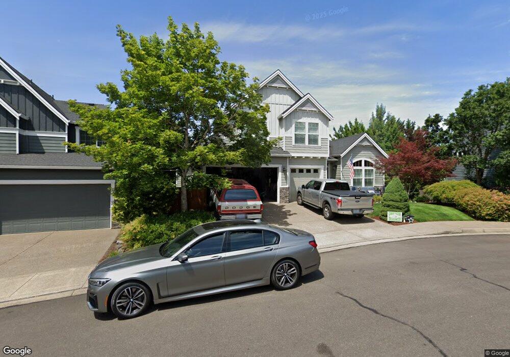
181 Link Ct Newberg, OR 97132
Estimated Value: $872,000 - $1,148,000
8
Beds
4
Baths
2,974
Sq Ft
$331/Sq Ft
Est. Value
About This Home
This home is located at 181 Link Ct, Newberg, OR 97132 and is currently estimated at $985,014, approximately $331 per square foot. 181 Link Ct is a home located in Yamhill County with nearby schools including Mabel Rush Elementary School, Mountain View Middle School, and Newberg Senior High School.
Ownership History
Date
Name
Owned For
Owner Type
Purchase Details
Closed on
Mar 16, 2023
Sold by
Kubin Brian Loyd
Bought by
Kubin Family Living Trust
Current Estimated Value
Purchase Details
Closed on
Jul 9, 2007
Sold by
D R Horton Inc Portland
Bought by
Kubin Brian Loyd and Kubin Lindsay Layne
Home Financials for this Owner
Home Financials are based on the most recent Mortgage that was taken out on this home.
Original Mortgage
$417,000
Interest Rate
6.51%
Mortgage Type
Unknown
Create a Home Valuation Report for This Property
The Home Valuation Report is an in-depth analysis detailing your home's value as well as a comparison with similar homes in the area
Purchase History
| Date | Buyer | Sale Price | Title Company |
|---|---|---|---|
| Kubin Family Living Trust | -- | -- | |
| Kubin Brian Loyd | $565,063 | First American Title |
Source: Public Records
Mortgage History
| Date | Status | Borrower | Loan Amount |
|---|---|---|---|
| Previous Owner | Kubin Brian Loyd | $417,000 |
Source: Public Records
Tax History
| Year | Tax Paid | Tax Assessment Tax Assessment Total Assessment is a certain percentage of the fair market value that is determined by local assessors to be the total taxable value of land and additions on the property. | Land | Improvement |
|---|---|---|---|---|
| 2025 | $7,943 | $492,205 | -- | -- |
| 2024 | $7,639 | $477,869 | -- | -- |
| 2023 | $7,377 | $463,950 | $0 | $0 |
| 2022 | $7,179 | $450,437 | $0 | $0 |
| 2021 | $6,984 | $437,317 | $0 | $0 |
| 2020 | $6,289 | $424,580 | $0 | $0 |
| 2019 | $6,205 | $412,214 | $0 | $0 |
| 2018 | $5,293 | $339,575 | $0 | $0 |
| 2017 | $5,627 | $329,684 | $0 | $0 |
| 2016 | $5,511 | $320,082 | $0 | $0 |
| 2015 | $5,413 | $310,761 | $0 | $0 |
| 2014 | $5,049 | $301,712 | $0 | $0 |
Source: Public Records
Map
Nearby Homes
- 180 the Greens Ave
- 212 Greenlink Way
- 134 Argyle Ct
- 5208 Fairway St
- 368 Fairway St
- 30575 NE Fernwood Rd
- 5123 Longest Dr
- 3866 Oak Meadows Loop
- 31339 NE Corral Creek Rd
- 211 White Oak St
- 31795 NE Wilsonville Rd
- 713 Oak Hollow Dr
- 3226 E Province Ct
- 3233 E Province Ct
- 3312 E Fernwood Rd
- 3208 E Province Ct
- 1108 Hadley Rd
- 29250 NE Wilsonville Rd
- 4236 E Willakenzie St
- 11925 NE Lauren Ln
- 173 Link Ct
- 203 Link Ct
- 180 N the Greens Ave
- 186 the Greens Ave
- 165 Link Ct
- 202 the Greens Ave
- 164 the Greens Ave
- 157 Link Ct
- 174 Link Ct
- 206 N the Greens Ave
- 206 the Greens Ave
- 166 Link Ct
- 156 the Greens Ave
- 211 Link Ct
- 5234 Wedgewood Loop
- 210 the Greens Ave
- 158 Link Ct
- 149 Link Ct
- 5238 Wedgewood Loop
- 148 the Greens Ave
Your Personal Tour Guide
Ask me questions while you tour the home.