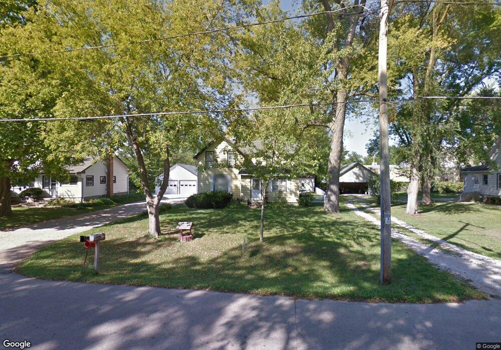
181 S Main St Dousman, WI 53118
Estimated Value: $242,000 - $330,000
3
Beds
1
Bath
1,370
Sq Ft
$218/Sq Ft
Est. Value
About This Home
This home is located at 181 S Main St, Dousman, WI 53118 and is currently estimated at $298,486, approximately $217 per square foot. 181 S Main St is a home located in Waukesha County with nearby schools including Dousman Elementary School, Kettle Moraine Middle School, and Kettle Moraine High School.
Ownership History
Date
Name
Owned For
Owner Type
Purchase Details
Closed on
Jun 6, 2006
Sold by
Finn Mary E
Bought by
Babcock James F and Babcock Jean R
Current Estimated Value
Home Financials for this Owner
Home Financials are based on the most recent Mortgage that was taken out on this home.
Original Mortgage
$125,343
Outstanding Balance
$71,091
Interest Rate
6.72%
Mortgage Type
VA
Estimated Equity
$227,395
Create a Home Valuation Report for This Property
The Home Valuation Report is an in-depth analysis detailing your home's value as well as a comparison with similar homes in the area
Home Values in the Area
Average Home Value in this Area
Purchase History
We collect this data history from publicly available records. To have your information removed, we recommend requesting removal directly through your county’s website.
| Date | Buyer | Sale Price | Title Company |
|---|---|---|---|
| Babcock James F | $126,500 | None Available |
Source: Public Records
Mortgage History
We collect this data history from publicly available records. To have your information removed, we recommend requesting removal directly through your county’s website.
| Date | Status | Borrower | Loan Amount |
|---|---|---|---|
| Open | Babcock James F | $125,343 |
Source: Public Records
Tax History
| Year | Tax Paid | Tax Assessment Tax Assessment Total Assessment is a certain percentage of the fair market value that is determined by local assessors to be the total taxable value of land and additions on the property. | Land | Improvement |
|---|---|---|---|---|
| 2024 | $2,641 | $215,000 | $85,000 | $130,000 |
| 2023 | $2,257 | $173,000 | $67,000 | $106,000 |
| 2022 | $2,248 | $155,000 | $49,000 | $106,000 |
| 2021 | $2,051 | $155,000 | $49,000 | $106,000 |
| 2020 | $2,206 | $155,000 | $49,000 | $106,000 |
| 2019 | $2,124 | $126,000 | $35,000 | $91,000 |
| 2018 | $2,061 | $126,000 | $35,000 | $91,000 |
| 2017 | $2,077 | $126,000 | $35,000 | $91,000 |
| 2016 | $2,013 | $126,000 | $35,000 | $91,000 |
| 2015 | $2,059 | $126,000 | $35,000 | $91,000 |
| 2014 | $1,968 | $126,000 | $35,000 | $91,000 |
| 2013 | $1,968 | $126,000 | $35,000 | $91,000 |
Source: Public Records
Map
Nearby Homes
- 251 S Main St
- 120 N Main St
- 234 Wolf Dr Unit 6B
- 228 Wolf Dr Unit 3
- Lt4 Wolf Dr
- 412 E Red Pine Cir
- 407 Ingleside Ct
- 137 Twin Creeks Ct Dr
- 148 Twin Creeks Ct
- 149 Twin Creeks Ct
- 413 Ingleside Ct
- 490 Talbots Woods Dr
- 448 W Talbot's Woods Dr
- 143 Twin Creeks Court Dr
- 437 Ingleside Ct
- 478 W Talbot's Woods Dr
- 430 Ingleside Ct
- 401 Ingleside Ct
- 394 Ingleside Ct
- 395 Ingleside Ct
- 180 S Main St
- 187 S Main St
- 167 S Main St Unit 171
- 188 S Main St
- 170 S Main St
- 194 S Main St
- 161 S Main St
- 104 W Ottawa Ave
- 198 S Main St
- 120 W Ottawa Ave
- 206 S Main St
- 207 S Main St
- 124 E Ottawa Ave
- 113 E Ottawa Ave
- 119 W Ottawa Ave
- 130 E Ottawa Ave
- 121 E Ottawa Ave
- 214 S Main St
- 136 E Ottawa Ave
- 211 Edwards St
Your Personal Tour Guide
Ask me questions while you tour the home.