Estimated Value: $185,000 - $207,000
3
Beds
2
Baths
1,221
Sq Ft
$162/Sq Ft
Est. Value
About This Home
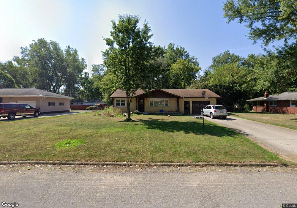
This home is located at 1810 Cedar St, Niles, MI 49120 and is currently estimated at $197,780, approximately $161 per square foot. 1810 Cedar St is a home located in Berrien County with nearby schools including Ballard Elementary School, Oak Manor Sixth Grade Center, and Ring Lardner Middle School.
Ownership History
Date
Name
Owned For
Owner Type
Purchase Details
Closed on
May 21, 2004
Sold by
Huttenstine Gary D and Estate Of Harold Huttenstine
Bought by
Vernon James Norman
Current Estimated Value
Home Financials for this Owner
Home Financials are based on the most recent Mortgage that was taken out on this home.
Original Mortgage
$112,000
Outstanding Balance
$54,791
Interest Rate
6.12%
Mortgage Type
Purchase Money Mortgage
Estimated Equity
$142,989
Purchase Details
Closed on
Jun 28, 1989
Create a Home Valuation Report for This Property
The Home Valuation Report is an in-depth analysis detailing your home's value as well as a comparison with similar homes in the area
Home Values in the Area
Average Home Value in this Area
Purchase History
We collect this data history from publicly available records. To have your information removed, we recommend requesting removal directly through your county’s website.
| Date | Buyer | Sale Price | Title Company |
|---|---|---|---|
| Vernon James Norman | $112,000 | Metropolitan Title Company | |
| -- | $41,000 | -- |
Source: Public Records
Mortgage History
We collect this data history from publicly available records. To have your information removed, we recommend requesting removal directly through your county’s website.
| Date | Status | Borrower | Loan Amount |
|---|---|---|---|
| Open | Vernon James Norman | $112,000 |
Source: Public Records
Tax History
| Year | Tax Paid | Tax Assessment Tax Assessment Total Assessment is a certain percentage of the fair market value that is determined by local assessors to be the total taxable value of land and additions on the property. | Land | Improvement |
|---|---|---|---|---|
| 2025 | $1,841 | $96,600 | $0 | $0 |
| 2024 | $674 | $86,800 | $0 | $0 |
| 2023 | $642 | $86,000 | $0 | $0 |
| 2022 | $611 | $73,300 | $0 | $0 |
| 2021 | $1,548 | $62,800 | $9,000 | $53,800 |
| 2020 | $1,523 | $58,900 | $0 | $0 |
| 2019 | $1,500 | $55,500 | $9,000 | $46,500 |
| 2018 | $1,426 | $55,500 | $0 | $0 |
| 2017 | $1,415 | $52,600 | $0 | $0 |
| 2016 | $1,378 | $50,800 | $0 | $0 |
| 2015 | $1,373 | $51,500 | $0 | $0 |
| 2014 | $533 | $49,700 | $0 | $0 |
Source: Public Records
Map
Nearby Homes
- 1733 Sycamore St
- 1621 Maple St
- 1643 Ferry St
- 2451 Spansail Dr
- 36 N 16th St
- 1893 Lewis Dr
- V/L Kathryn St Unit Tract 3
- 1440 Hickory St
- 1638 Superior St
- 324 S 15th St
- 0 Kathryn St Unit Tract 1
- 1338 Regent St
- 1515 Inner Dr
- 1648 Oak St
- 1301 Regent St
- 218 N 13th St
- 1314 Ferry St
- 1917 E Main St
- 1022 Howard St
- 1021 Sycamore St
- 1808 Cedar St
- 21 N 18th St
- 1805 Broadway St
- 1830 Cedar St
- 1807 Cedar St
- 1803 Cedar St
- 1823 Cedar St
- 1801 Broadway St
- 1821 Broadway St
- 1738 Cedar St
- 1827 Cedar St
- 16 N 19th St
- 1734 Cedar St
- 1737 Cedar St
- 1739 Broadway St Unit F
- 1806 Broadway St
- 1806 Regent St
- 1812 Broadway St
- 1804 Regent St
- 1730 Cedar St
Your Personal Tour Guide
Ask me questions while you tour the home.