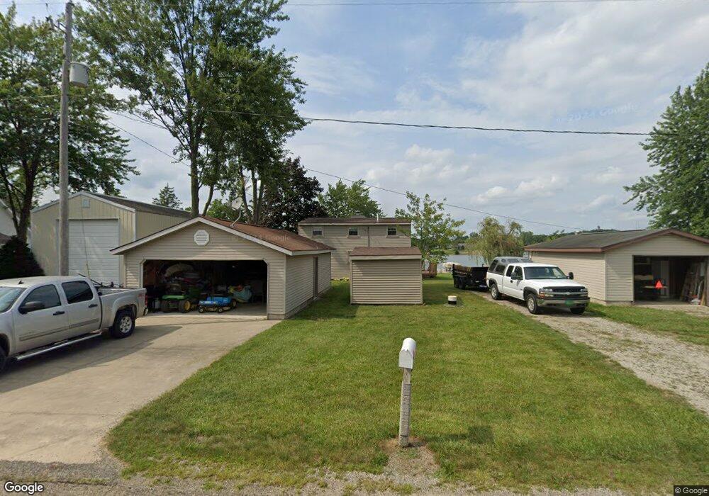
1810 Point Dr Camden, MI 49232
Estimated Value: $269,000 - $414,000
Studio
1
Bath
720
Sq Ft
$461/Sq Ft
Est. Value
About This Home
This home is located at 1810 Point Dr, Camden, MI 49232 and is currently estimated at $332,277, approximately $461 per square foot. 1810 Point Dr is a home located in Hillsdale County with nearby schools including Camden-Frontier K-8 School and Camden-Frontier High School.
Ownership History
Date
Name
Owned For
Owner Type
Purchase Details
Closed on
Nov 6, 2020
Sold by
Ronald N Miller And Sue A Miller Liv Tr
Bought by
Steyer Benjamin and Steyer Whitney
Current Estimated Value
Home Financials for this Owner
Home Financials are based on the most recent Mortgage that was taken out on this home.
Original Mortgage
$112,000
Outstanding Balance
$99,664
Interest Rate
2.8%
Mortgage Type
New Conventional
Estimated Equity
$232,613
Purchase Details
Closed on
Feb 18, 2008
Sold by
Miller Ronald N and Miller Sue A
Bought by
Miller Ronald N and Miller Sue A
Purchase Details
Closed on
Mar 1, 1983
Bought by
Miller
Create a Home Valuation Report for This Property
The Home Valuation Report is an in-depth analysis detailing your home's value as well as a comparison with similar homes in the area
Purchase History
| Date | Buyer | Sale Price | Title Company |
|---|---|---|---|
| Steyer Benjamin | $140,000 | None Available | |
| Miller Ronald N | -- | None Available | |
| Miller | -- | -- |
Source: Public Records
Mortgage History
| Date | Status | Borrower | Loan Amount |
|---|---|---|---|
| Open | Steyer Benjamin | $112,000 |
Source: Public Records
Tax History
| Year | Tax Paid | Tax Assessment Tax Assessment Total Assessment is a certain percentage of the fair market value that is determined by local assessors to be the total taxable value of land and additions on the property. | Land | Improvement |
|---|---|---|---|---|
| 2025 | $947 | $120,100 | $0 | $0 |
| 2024 | $9 | $112,300 | $0 | $0 |
| 2023 | $879 | $96,000 | $0 | $0 |
| 2022 | $3,698 | $82,900 | $0 | $0 |
| 2021 | $3,603 | $73,900 | $0 | $0 |
| 2020 | $2,479 | $72,800 | $0 | $0 |
| 2019 | $2,374 | $69,500 | $0 | $0 |
| 2018 | $2,304 | $67,200 | $0 | $0 |
| 2017 | $2,202 | $67,120 | $0 | $0 |
| 2016 | $2,187 | $65,160 | $0 | $0 |
| 2015 | $471 | $65,160 | $0 | $0 |
| 2013 | $457 | $63,640 | $0 | $0 |
| 2012 | $446 | $61,550 | $0 | $0 |
Source: Public Records
Map
Nearby Homes
- 14364 Horn Dr
- 14600 W Diane Dr
- 14705 Woodbridge Rd
- 14934 Heather Ct
- 13551 Hillsdale Rd
- 13091 S Bird Lake Rd
- 623-624 Yuma Trail
- 460 Seneca Dr
- 0 Pontiac Trail Unit 335, 336, 337, 338,
- 988-989 Seneca Dr
- 555 Molala Trail
- 207 Modoc Trail
- 155 Navajo Trail
- 169 Seneca Dr
- 0 Seneca Dr Unit Lot 864
- 0 Seneca Dr
- 234 Seneca Dr
- 600 Seneca Dr
- 0 W Territorial Rd Unit 11603977
- 638 Seneca Dr
Your Personal Tour Guide
Ask me questions while you tour the home.